geo.wikisort.org - Mountains
Piz Buin (German pronunciation: [ˌpits buˈiːn] (![]() listen)) is a mountain in the Silvretta range of the Alps on the border between Austria and Switzerland. It forms the border between the Swiss canton of Graubünden and the Austrian state of Vorarlberg and is the highest peak in Vorarlberg.
listen)) is a mountain in the Silvretta range of the Alps on the border between Austria and Switzerland. It forms the border between the Swiss canton of Graubünden and the Austrian state of Vorarlberg and is the highest peak in Vorarlberg.
| Piz Buin | |
|---|---|
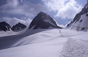
 View from the Ochsentaler Glacier, July 2001 | |
| Highest point | |
| Elevation | 3,312 m (10,866 ft) |
| Prominence | 544 m (1,785 ft)[1] |
| Parent peak | Fluchthorn |
| Isolation | 6.1 km (3.8 mi)[2] |
| Listing | Alpine mountains above 3000 m |
| Coordinates | 46°50′44″N 10°07′11″E |
| Geography | |
| Location | Vorarlberg, Austria Graubünden, Switzerland |
| Parent range | Silvretta Alps |
| Climbing | |
| First ascent | 14 July 1865 by Joseph Anton Specht und Johann Jakob Weilenmann, guided by Jakob Pfitscher und Franz Pöll. |
| Easiest route | glacier/snow climb |
Its original name in the Romansh language is Piz Buin Grond. A similar but smaller summit nearby is called Piz Buin Pitschen at 3,255 m (10,680 ft). Piz Buin was first climbed on 14 July 1865 by Joseph Anton Specht and Johann Jakob Weilenmann, guided by Jakob Pfitscher and Franz Pöll. Piz Buin Pitschen was climbed three years later.
Piz Buin can be reached from the Wiesbadener hut, crossing the Vermunt glacier, climbing up the Wiesbadener ridge and hiking over the Ochsentaler Glacier to the Buin gap. From the gap there is a zigzag walk to the top, with only a 20 m (65 ft) steep step to surmount before reaching the relatively flat summit space, which has an old wooden cross on the very top. The border between Switzerland and Austria crosses the summit from East to West.
See also
- List of mountains of Switzerland
References
- Retrieved from the Swisstopo topographic maps. The key col is the Pass Futschöl (2,768 m)
- Retrieved from Google Earth. The nearest point of higher elevation is northeast of Piz Vadret.
External links
На других языках
[de] Piz Buin
Der Piz Buin ( [pits buˈiːn]?/i), genauer: Großer Piz Buin (Bündnerromanisch: Piz Buin Grond), auf der Grenze zwischen Österreich und der Schweiz ist mit 3312 m ü. A. der dritthöchste Berg der Silvretta und der höchste des österreichischen Bundeslandes Vorarlberg.- [en] Piz Buin
[fr] Piz Buin
Le Piz Buin (en français : « Pic du bœuf ») est un sommet des Alpes, à 3 312 m d'altitude, dans le massif de Silvretta, à cheval entre l'Autriche (land de Vorarlberg) et la Suisse (canton des Grisons). Il est le plus haut sommet du land de Vorarlberg.[it] Piz Buin
Il Piz Buin (.mw-parser-output .audiolink a{background:url("//upload.wikimedia.org/wikipedia/commons/thumb/8/8a/Loudspeaker.svg/11px-Loudspeaker.svg.png")center left no-repeat!important;padding-left:16px!important;padding-right:0!important}[ˌpits buˈiːn][?·info]; 3.312 m s.l.m.) anche chiamato Piz Buin Grond[1] in lingua romancia è una montagna delle Alpi Retiche occidentali (sottosezione Alpi del Silvretta, del Samnaun e del Verwall). Forma il confine tra il cantone svizzero dei Grigioni e lo stato austriaco del Vorarlberg ed è la vetta più alta del Vorarlberg.Другой контент может иметь иную лицензию. Перед использованием материалов сайта WikiSort.org внимательно изучите правила лицензирования конкретных элементов наполнения сайта.
WikiSort.org - проект по пересортировке и дополнению контента Википедии


