geo.wikisort.org - Mountains
The Glockner Group[1] (German: Glocknergruppe) is a sub-group of the Austrian Central Alps in the Eastern Alps, and is located in the centre section of the High Tauern on the main chain of the Alps.
| Glockner Group | |
|---|---|
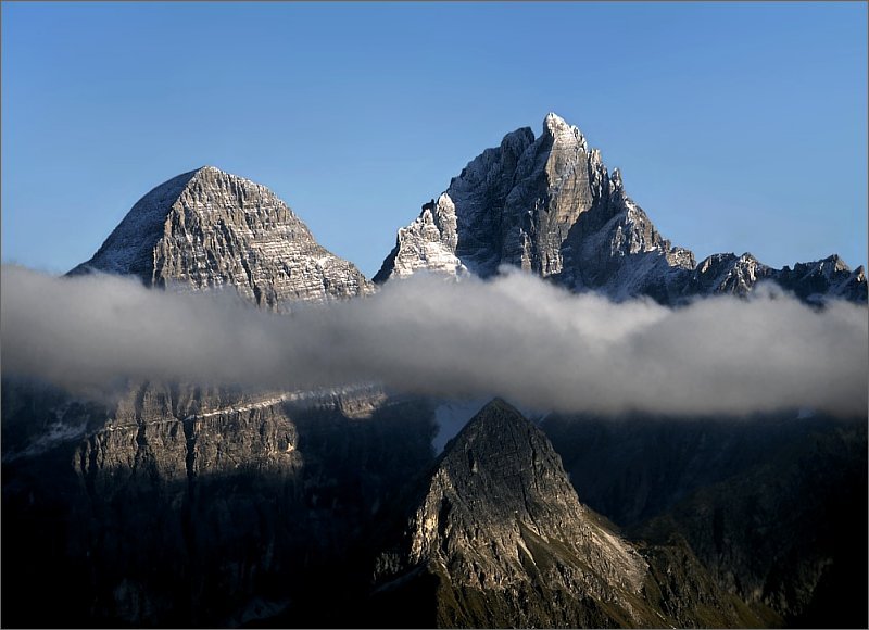
 Glockner Group from the north | |
| Highest point | |
| Peak | Großglockner |
| Elevation | 3,798 m above sea level (AA) |
| Geography | |
 Location of the Glockner Group within the Eastern Alps | |
| Country | Austria |
| States | East Tyrol, Salzburg and Carinthia |
| Range coordinates | 47°04′30″N 12°41′40″E |
| Parent range | High Tauern |


The Glockner Group lies in Austria in the federal states of Salzburg, Tyrol and Carinthia. The three states meet at a tripoint on the summit of the Eiskögele (3,436 m (AA)).
The highest summit of the Glockner Group and also the highest peak in Austria is the Großglockner (3,798 m above sea level (AA)), which gives the mountain group its name. Considerable portions of the Glockner Group belong to the core zone of the High Tauern National Park. Also found in the Glockner Group is the Pasterze, the largest glacier in Austria.
Boundaries
The boundaries of the Glockner Group are defined as follows: the River Salzach from Uttendorf to Taxenbach; the Rauriser Tal to Wörth; Seidlwinkltal; Hochtor (Großglockner High Alpine Road); Tauernbach; Möll to its confluence with the Moosbach; Moosbach; Peischlachtörl; Peischlachbach; Kals am Großglockner; Kalser Bach; Dorfertal; Dorfersee; Kalser Tauern; Weißsee; Weißenbach; Grünsee; Enzingerboden; Stubachtal; Uttendorf.
Together with the Ankogel Group, the Goldberg Group, the Schober Group, the Kreuzeck Group, the Granatspitz Group, the Venediger Group, the Villgraten Mountains and the Rieserferner Group the Glockner Group forms the mountain range of the High Tauern.
Neighbouring ranges
The Glockner Group borders on the following ranges in the Alps:
- Kitzbühel Alps (to the northwest)
- Salzburg Slate Alps (to the northeast)
- Goldberg Group (to the east)
- Schober Group (to the south)
- Granatspitze Group (to the west)
Peaks
The named three-thousanders in the Glockner Group:[2]
- Großglockner, 3,798 m above sea level (AA)
- Kleinglockner, 3,770 m above sea level (AA)
- Glocknerwand, 3,721 m above sea level (AA)
- Teufelshorn, 3,680 m above sea level (AA)
- Großes Wiesbachhorn, 3,564 m above sea level (AA)
- Romariswandköpfe, 3,511 m above sea level (AA)
- Teufelskamp, 3,511 m above sea level (AA)
- Schneewinkelkopf, 3,476 m above sea level (AA)
- Johannisberg, 3,453 m above sea level (AA)
- Eiskögele, 3,426 m above sea level (AA)
- Klockerin, 3,425 m above sea level (AA)
- Hinterer Bratschenkopf, 3,413 m above sea level (AA)
- Vorderer Bratschenkopf, 3,401 m above sea level (AA)
- Großer Bärenkopf, 3,396 m above sea level (AA)
- Hoher Tenn, 3,360 m above sea level (AA)
- Mittlerer Bärenkopf, 3,358 m above sea level (AA)
- Hohe Dock, 3,348 m above sea level (AA)
- Hohe Riffl, 3,338 m above sea level (AA)
- Fuscherkarkopf, 3,331 m above sea level (AA)
- Schneespitze, 3,317 m above sea level (AA)
- Hohenwartkopf, 3,308 m above sea level (AA)
- Kleines Wiesbachhorn, 3,283 m above sea level (AA)
- Sinwelleck, 3,281 m above sea level (AA)
- Gramul, 3,276 m above sea level (AA)
- Vorderer Bärenkopf, 3,249 m above sea level (AA)
- Schwerteck, 3,247 m above sea level (AA)
- Kellerskopf, 3,239 m above sea level (AA)
- Luisenkopf, 3,207 m above sea level (AA)
- Hocheiser, 3,206 m above sea level (AA)
- Kitzsteinhorn, 3,203 m above sea level (AA)
- Hoher Kasten, 3,189 m above sea level (AA)
- Schattseitköpfl, 3,182 m above sea level (AA)
- Oberer Fochezkopf, 3,159 m above sea level (AA)
- Kleiner Tenn, 3,158 m above sea level (AA)
- Gamsspitze, 3,157 m above sea level (AA)
- Breitkopf, 3,154 m above sea level (AA)
- Totenkopf, 3,151 m above sea level (AA)
- Bauernbrachkopf, 3,125 m above sea level (AA)
- Schwarzköpfl, 3,124 m above sea level (AA)
- Zwingkopf, 3,117 m above sea level (AA)
- Freiwandkasten, 3,114 m above sea level (AA)
- Schwertkopf, 3,099 m above sea level (AA)
- Racherin, 3,092 m above sea level (AA)
- Lange Wand, 3,087 m above sea level (AA)
- Grieskogel, 3,066 m above sea level (AA)
- Blaue Köpfe, 3,061 m above sea level (AA)
- Freiwandspitz, 3,034 m above sea level (AA)
- Wasserradkopf, 3,032 m above sea level (AA)
- Kreuzwandspitze, 3,031 m above sea level (AA)
- Spielmann, 3,027 m above sea level (AA)
- Zollspitze, 3,024 m above sea level (AA)
- Brennkogel, 3,018 m above sea level (AA)
- Rifflkarkopf, 3,016 m above sea level (AA)
- Kellerswand, 3,010 m above sea level (AA)
- Kristallspitzl, 3,005 m above sea level (AA)
Tourism
The region is well developed for tourism: The Großglockner High Alpine Road (and its branch to Franz Josefs Höhe), the road from Uttendorf to the Enzingerboden, the bus transfers to the reservoirs near Kaprun and the toll road from Kals am Großglockner to the Lucknerhaus enable cars and public transport to travel well into the mountains. A large number of Alpine huts offer accommodation for walkers and climbers:
- Glocknerhaus, 2,132 m above sea level (AA)
- Hofmanns Hut, 2,444 m above sea level (AA)
- Oberwalder Hut, 2,973 m above sea level (AA)
- Salm Hut, 2,644 m above sea level (AA)
- Schwarzenberg Hut, 2,267 m above sea level (AA)
- Ebmatten-Fürthermoaralm, 1,803 m above sea level (AA)
- Erzherzog Johann Hut, 3,454 m above sea level (AA)
- Gleiwitzer Hut, 2,172 m above sea level (AA)
- Glorer Hut, 2,642 m above sea level (AA)
- Heinrich Schwaiger Haus, 2,802 m above sea level (AA)
- Krefeld Hut, 2,295 m above sea level (AA)
- Stüdl Hut, 2,801 m above sea level (AA)
- Franz Josefs Haus, 2,363 m above sea level (AA)
- Fuschertörlhaus, 2,445 m above sea level (AA)
- Luckner Hut, 2,241 m above sea level (AA)
Power generation
The power industry in Austrian and the Austrian Federal Railways use the water from the Glockner Group to generate electricity at the following locations Kaprun, Franz Josefs Höhe (Margaritze Reservoir) and Enzingerboden (Weißsee, Tauernmoossee).
Maps
- German Alpine Club: Alpine Club Map No. 40 Glocknergruppe. 9th ed., Munich, 2006, ISBN 3-928777-87-4.
References
- Reynolds, Kev (2005). Walking in the Alps, 2nd ed., Cicerone, Singapore, p.409, ISBN 1-85284-261-X.
- ÖK50 www.austrianmap.at
Sources
- Wolfgang Pusch: "Stau unterm Gipfelkreuz und Einsamkeit über den Wolken - alpine Möglichkeiten in der Glocknergruppe" in: Berg 2007 (Alpine Club Yearbook, Vol. 131) with Alpine Club map 40 of the Glocknergruppe, ISBN 3-937530-15-0, pp. 280–285.
External links
| Wikimedia Commons has media related to Glockner Group. |
Subgroups of the High Tauern according to the AVE (from west to east) | ||
|---|---|---|
| Main ridge |  | |
| Southern groups | ||
Mountain ranges of the Central Eastern Alps according to the AVE | ||
|---|---|---|
|  | |
| Authority control |
|
|---|
На других языках
[de] Glocknergruppe
Die Glocknergruppe ist eine Gebirgsgruppe der zentralen Ostalpen und befindet sich im mittleren Teil der Hohen Tauern im Verlauf des Alpenhauptkamms.- [en] Glockner Group
[it] Gruppo del Glockner
Il Gruppo del Glockner (in tedesco Glocknergruppe) è un massiccio montuoso delle Alpi dei Tauri occidentali. Si trova in Austria (Tirolo, Salisburghese e Carinzia). Buona parte del gruppo è inserita nel Parco nazionale Alti Tauri.Другой контент может иметь иную лицензию. Перед использованием материалов сайта WikiSort.org внимательно изучите правила лицензирования конкретных элементов наполнения сайта.
WikiSort.org - проект по пересортировке и дополнению контента Википедии