geo.wikisort.org - Mountains
The Schober group (German: Schobergruppe) is a sub-range of the Hohe Tauern mountains in the Central Eastern Alps, on the border between the Austrian states of Tyrol (East Tyrol) and Carinthia. Most of the range is located inside Hohe Tauern national park. It is named after Mt. Hochschober, 3,242 metres (10,636 ft), though its highest peak is Mt. Petzeck at 3,283 metres (10,771 ft).
| Schober group | |
|---|---|
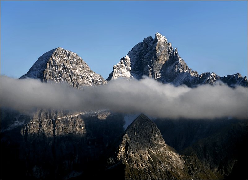
 Northeastern part of the Schober group, view from Grossglockner High Alpine Road with the Alwitzsch, Bretterköpfen, Hoher Seekamp and Karlkamp (from the left) | |
| Highest point | |
| Peak | Petzeck |
| Elevation | 3,283 m (10,771 ft) |
| Coordinates | 46°56′54″N 12°48′15″E |
| Naming | |
| Native name | Schobergruppe (German) |
| Geography | |
 Schober group (in red) within the Alps.
The borders of the range according to Alpine Club classification of the Eastern Alps | |
| Country | Austria |
| States | Tyrol and Carinthia |
| Parent range | Hohe Tauern |
Geography
The range comprises central parts of the Hohe Tauern south of the neighbouring Glockner Group and the Alpine divide. In the south it stretches down to the East Tyrolean capital Lienz and the Drava Valley. In the east, the Grossglockner High Alpine Road leads up to Hochtor Pass via Großkirchheim.
Neighbouring ranges

The Schober group is bordered by the following other ranges in the Alps:
- Glockner Group (to the north)
- Goldberg Group (to the east)
- Kreuzeck group (to the SE)
- Gailtal Alps (to the S)
- Villgraten Mountains (to the SW)
- Granatspitze Group (to the NW)
Peaks
All the named three-thousanders in the Schober group:[1]

|
|
Alpine huts
- Adolf-Noßberger Hut
- Elberfelder Hut
- Gernot-Röhr Bothy
- Gößnitzkopf Bothy
- Hochschober Hut
- Lienzer Hut
- Wangenitzsee Hut
- Winklerner Hut
Accident
On 8 September 2016 shortly after takeoff on the return leg of a supply flight to the Elberfelder Hut, a helicopter crashed, and the pilot, Hannes Arch, was killed. The hut manager, who had spontaneously decided to accompany Arch, was injured but was able to be rescued.[2]
References
- ÖK50 www.austrianmap.at
- Hannes Arch: Suche nach Absturzursache. In: ORF, 9 September 2016.
Maps
- Alpine Club map 41 Schobergruppe. Deutscher Alpenverein: Munich, 2005, ISBN 3-928777-12-2.
Literature
- Gerhard Karl, Michael Krobath: "Die Schobergruppe, ein stilles Kleinod der Hohen Tauern" in: Berg 2006 (Alpine Club Yearbook, Vol. 130) with Alpine Club map 41 of the Schober group, ISBN 3-937530-10-X, pp. 270–283.
- Walter Mair: Alpenvereinsführer Schobergruppe. Bergverlag Rudolf Rother: Munich, 1979, ISBN 3-7633-1222-6.
External links
Subgroups of the High Tauern according to the AVE (from west to east) | ||
|---|---|---|
| Main ridge |  | |
| Southern groups | ||
Mountain ranges of the Central Eastern Alps according to the AVE | ||
|---|---|---|
|  | |
| Authority control |
|
|---|
На других языках
[de] Schobergruppe
Die Schobergruppe ist eine Gebirgsgruppe der Zentralen Ostalpen. Sie befindet sich in österreichischen Bundesländern Kärnten und Tirol und südlich des Alpenhauptkamms. Namensgebender Gipfel ist der markante Hochschober, höchster Gipfel ist das Petzeck mit einer Höhe von 3283 m ü. A.. Sie umschließt hufeisenförmig das Debanttal und ist durch das Peischlachtörl von der nördlich gelegenen Glocknergruppe getrennt. Größere Teile der Schobergruppe sind Teil des Nationalparks Hohe Tauern.- [en] Schober group
[it] Gruppo del Schober
Il Gruppo del Schober (in tedesco Schobergruppe) è un gruppo montuoso degli Alti Tauri. Si trova in Austria (Tirolo e Carinzia).Другой контент может иметь иную лицензию. Перед использованием материалов сайта WikiSort.org внимательно изучите правила лицензирования конкретных элементов наполнения сайта.
WikiSort.org - проект по пересортировке и дополнению контента Википедии