geo.wikisort.org - Mountains
The Gurktal Alps (German: Gurktaler Alpen, Slovene: Krške Alpe) is a mountain range located in the Central Eastern Alps in Austria, named after the valley of the Gurk river. The range stretches west to Lake Millstatt and east to Neumarkter Sattel (north-northwest of Neumarkt in der Steiermark). The highest peak is the Styrian Eisenhut (2441m).
This article may be expanded with text translated from the corresponding article in German. (August 2012) Click [show] for important translation instructions.
|
| Gurktal Alps | |
|---|---|
 Wöllaner Nock, 2,145 m (7,037 ft) | |
| Highest point | |
| Peak | Eisenhut |
| Elevation | 2,441 m (8,009 ft) |
| Coordinates | 46°57′11″N 13°55′45″E |
| Geography | |
| Country | Austria |
| States | Carinthia, Styria and Salzburg |
| Range coordinates | 46°57′N 13°56′E |
| Parent range | Central Eastern Alps Carinthian-Styrian Alps (Noric Alps) |
Geography
Location
The range is located between the Mur Valley in the north, separating it from the Niedere Tauern, and the Drava in the south, where it borders on the Gailtal Alps and Karavanke ranges of the Southern Limestone Alps. In the west, the Gurktal Alps reach up to the Katschberg Pass and the Ankogel Group of the Hohe Tauern range. In the east, the Neumarkt Pass in Upper Styria separates it from the adjacent Lavanttal Alps.
Subdivisions
The Gurktal Alps may be divided into five subgroups:
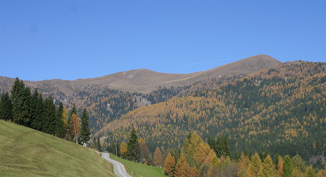
- The Nock Mountains lie between the Liesertal and Flattnitzer Höhe. Their highest peak is the Eisenhut (2,441 m).
- The Metnitz Mountains lie between the Mur and Metnitz valleys. Their highest point is the Goldachnock (2,171 m).
- The Mödring Chain lies between the Metnitz and Gurktal valleys. Its highest point is the Dorferecken (1,726 m)
- The Wimitz Mountains lie between the Gurk and Glan valleys through which flows the Wimitz river. Their highest peaks are the Schneebauerberg and the Hocheck (both 1,338 m)
At the southern end of the Gurktal Alps is the Klagenfurt Basin. Here there are seven more smaller mountain chains:
- Magdalensberg (Lippekogel, 1,079 m)
- Ossiach Tauern (Taubenbühel 1,069 m)
- Glantal Highlands (Ulrichsberg, 1,022 m)
- Sattnitz (Tanzboden, 929 m)
- Feldkirchen-Moosburg Upland (Freudenberg, 817 m)
- St. Veit Upland (Buchberg, 808 m)
- Maria Saal Upland (Maria Saaler Berg, 746 m)
The Gurktal Alps are, along with the Lavanttal Alps to the east, are occasionally classified as part of the Noric Alps. However, it is not geologically justified.[1]
Peaks
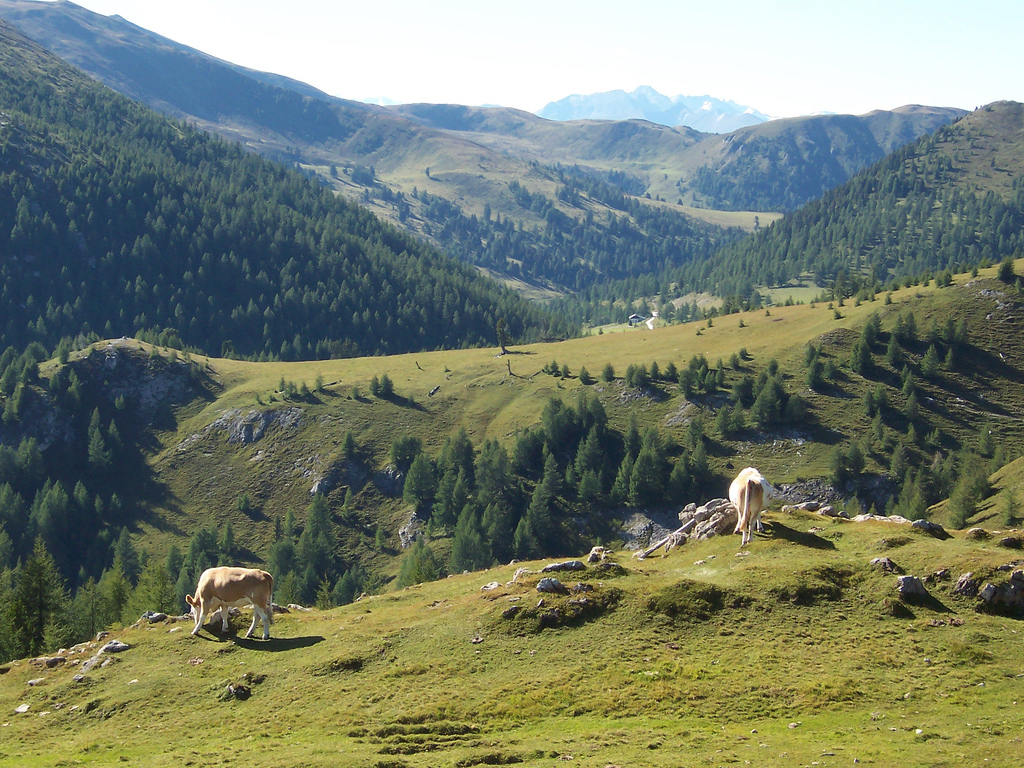
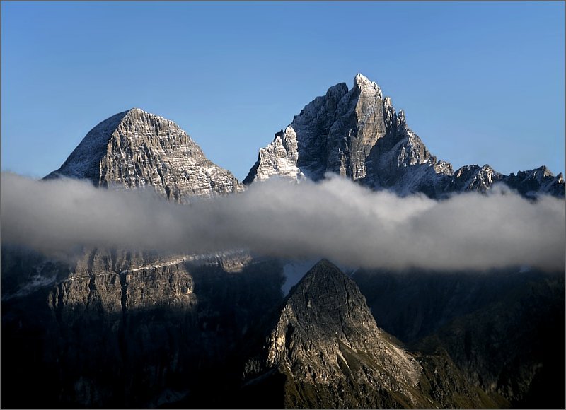
The highest peaks are located within the Nock Mountains (Nockberge, from Nock meaning "rounded hilltop", cf. Nockerl) subgroup west of Flattnitz Pass, including Mt. Eisenhut, 2,441 m (8,009 ft), in Styria. The Nationalpark Nockberge along the scenic Nockalm Road in Carinthia since 1987 is a protected landscape area (IUCN V). The Nock Mountains also stretch down to major Carinthian lakes like Millstätter See and Ossiacher See.
Other peaks include:
- Großer Rosennock, 2,440 m (8,010 ft)
- Hohe Pressing, 2,370 m (7,780 ft)
- Rinsennock, 2,334 m (7,657 ft)
Economy and tourism
This section contains content that is written like an advertisement. (January 2019) |

The landscape has numerous mountain pastures and had been the site of transhumance agriculture. The Gurktal Alps were also a mining area for iron and silver. Magnesite deposits are continued to be exploited near Radenthein.
Today, tourism is the most important economic sector. The valleys of the Gurktal Alps cater for tourists in summer and for the winter season. The leading tourist area is Bad Kleinkirchheim, then Turracher Höhe (Predlitz-Turrach and Reichenau), Falkert (Reichenau) and Innerkrems (Krems in Kärnten), Flattnitz, Afritz and Katschberg (Rennweg am Katschberg). The largest ski areas are Katschberg-Aineck, Innerkrems-Schönfeld-Karneralm, Turracher Höhe and Gerlitzen in the Nock Mountains and Kreischberg in the Metnitz Mountains.
The Nock Mountain region is well known for its spas. The Karlbad along the Nockalmstraße is the oldest farmers' healing spring in Austria. The method of creating the baths (with spring water and hot rocks), has remained unchanged since the 17th century. Their location means there is no electricity. The name of the spa is derived from the little cirque (Karl from Kar, cirque).
References
This article needs additional citations for verification. (August 2012) |
- Norische Alpen in Austria-Forum (in German) (at AEIOU)
Mountain ranges of the Central Eastern Alps according to the AVE | ||
|---|---|---|
|  | |
Authority control | |
|---|---|
| General |
|
| National libraries | |
На других языках
[de] Gurktaler Alpen
Die Gurktaler Alpen sind eine Gebirgsgruppe der zentralen Ostalpen in Österreich zwischen der Mur im Norden und der Gurk im Süden. Sie reichen im Westen bis etwa zum Millstätter See und im Osten bis zum Neumarkter Sattel (nordnordwestlich von Neumarkt in der Steiermark). Höchster Gipfel ist der steirische Eisenhut (2441 m).- [en] Gurktal Alps
[fr] Alpes de Gurktal
Les Alpes de Gurktal (en allemand : Gurktaler Alpen) sont un massif des Alpes orientales centrales. Elles s'élèvent en Autriche (principalement le land de Carinthie, mais également land de Salzbourg et land de Styrie). La rivière Gurk prend sa source au sein du massif et le traverse vers l'est, et ainsi, la vallée (Tal) lui donne son nom.[it] Alpi della Gurktal
Le Alpi della Gurktal (in tedesco Gurktaler Alpen oppure Nockberge) sono una sottosezione[1] delle Alpi di Stiria e Carinzia. La vetta più alta è l'Eisenhut che raggiunge i 2.441 m s.l.m.Другой контент может иметь иную лицензию. Перед использованием материалов сайта WikiSort.org внимательно изучите правила лицензирования конкретных элементов наполнения сайта.
WikiSort.org - проект по пересортировке и дополнению контента Википедии