geo.wikisort.org - Mountains
The Ötztal Alps (Italian: Alpi Venoste, German: Ötztaler Alpen) are a mountain range in the Central Eastern Alps, in the State of Tyrol in western Austria and the Province of South Tyrol in northern Italy.
This article does not cite any sources. (February 2022) |
| Ötztal Alps | |
|---|---|
 | |
| Highest point | |
| Peak | Wildspitze |
| Elevation | 3,774 m (12,382 ft) |
| Coordinates | 46°53′49″N 10°52′31″E |
| Geography | |

| |
| Countries | Austria and Italy |
| Range coordinates | 46°45′N 10°55′E |
| Parent range | Central Eastern Alps |
| Borders on | Stubai Alps |
Geography
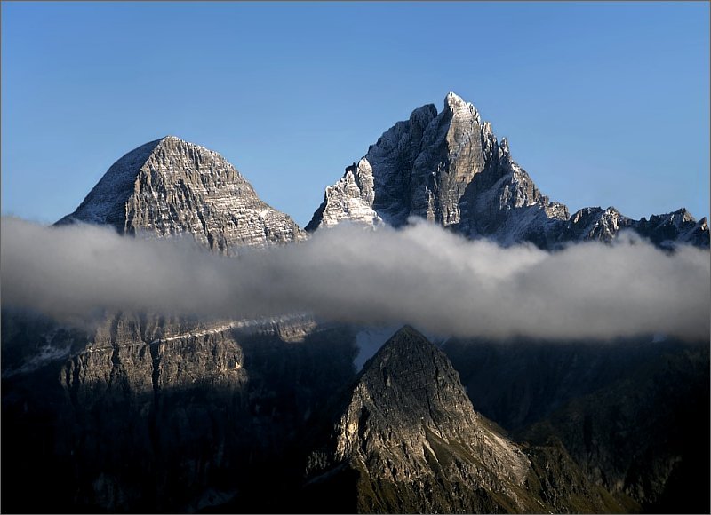
The Ötztal Alps are arrayed at the head of the Ötztal valley, a side valley of the Inn river southwest of Innsbruck, Austria. One line of summits forms part of the border between Austria and Italy.
The Ötztal Alps are bordered by the Reschen Pass (1504 m) in the west and the Inn river in the northwest and north. In the east the range is separated from the Stubai Alps by the Ötztaler Ache in the Ötztal, the Timmelsjoch (2474 m) and the Passer river in the Passeier Valley. On the south and southwest, the range is limited by the deep valley of the Etsch river, here known as the Vinschgau.
The Ötztal Alps are surrounded by the following ranges:
On September 1991, Ötzi the so-called "Iceman" was found on the Hauslabjoch between the peaks Fineilspitze and Similaun.
Peaks

The highest point of the Ötztal Alps is Wildspitze 3,774 metres (12,382 ft), which is also the second highest mountain in Austria (after Großglockner). Wildspitze is on one of several arms that extend north and northeast from the main ridge.
Some of the main peaks of the Ötztal Alps are:
| Peak | Elevation | |
|---|---|---|
| m | ft | |
| Wildspitze | 3,774 | 12,382 |
| Weißkugel | 3,739 | 12,267 |
| Hintere Schwärze | 3,628 | 11,903 |
| Similaun | 3,603 | 11,821 |
| Ramolkogel | 3,551 | 11,651 |
| Schalfkogel | 3,540 | 11,614 |
| Hochvernagtspitze | 3,535 | 11,598 |
| Watzespitze | 3,533 | 11,591 |
| Weißseespitze | 3,518 | 11,542 |
| Fineilspitze | 3,514 | 11,529 |
| Hochwilde | 3,480 | 11,417 |
| Hinterer Seelenkogel | 3,472 | 11,391 |
| Bliggspitze | 3,454 | 11,332 |
| Lagaunspitze | 3,439 | 11,283 |
| Hochfirst | 3,403 | 11,237 |
| Verpeilspitze | 3,425 | 11,165 |
| Ehrichspitze | 3,420 | 11,220 |
| Hohe Geige | 3,395 | 11,138 |
| Valvelspitze | 3,360 | 11,020 |
| Glockturm | 3,355 | 11,007 |
| Rofelewand | 3,353 | 11,001 |
| Hochalt | 3,285 | 10,778 |
| Grawand | 3,251 | 10,666 |
| Remsspitze | 3,205 | 10,515 |
| Nederkogel | 3,163 | 10,377 |
| Hundstalkogel | 3,080 | 10,100 |
| Nauderer Hennesiglspitze | 3,042 | 9,980 |
| Wildnörderer | 3,015 | 9,982 |
| Endkopf | 2,652 | 8,701 |


Passes
The main mountain passes of the Ötztal Alps are:
| Mountain pass | location | type | elevation (m/ft) | |
|---|---|---|---|---|
| Gepatschjoch | Vent to the Kaunertal | snow | 3243 | 10,640 |
| Ramoljoch | Vent to Gurgl | snow | 3194 | 10,479 |
| Langtaufererjoch | Vent to the Reschen Pass | snow | 3167 | 10,391 |
| Gurgler Eisjoch | Gurgl to Schnals | snow | 3137 | 10,292 |
| Langthalerjoch | Gurgl to Pfelders-Plan | snow | 3058 | 10,033 |
| Niederjoch | Vent to Schnals | snow | 3017 | 9899 |
| Pitztalerjöchl | Mittelberg (Pitztal) to Sölden | snow | 2995 | 9826 |
| Eisjöchl am Bild | Pfelders to Schnals | snow | 2908 | 9541 |
| Venter Hochjoch | Vent to Kurzras | snow | 2885 | 9465 |
| Timmelsjoch (Passo del Rombo) | Sölden to Meran | road | 2509 | 8232 |
| Reschen Pass (Passo di Resia) | Landeck to Meran | road | 1494 | 4902 |
See also
| Wikimedia Commons has media related to Ötztal Alps. |
- Banker Kirchenkogel
- Geography of the Alps
Mountain ranges of the Central Eastern Alps according to the AVE | ||
|---|---|---|
|  | |
Authority control | |
|---|---|
| General |
|
| National libraries | |
На других языках
[de] Ötztaler Alpen
Die Ötztaler Alpen (italienisch Alpi Venoste) sind Teil der zentralen Ostalpen und eine der größten Gebirgsgruppen der gesamten Ostalpen. Anteile haben Österreich mit dem Bundesland Tirol und Italien mit der Provinz Südtirol. Der höchste Gipfel der Ötztaler Alpen ist die Wildspitze (3768 m ü. A.[1]). Der Alpenhauptkamm durchzieht die Gruppe jedoch weiter südlich über den Schnalskamm, dessen Hauptgipfel die mit 3738 m nur wenig niedrigere Weißkugel an der Grenze zwischen Nord- und Südtirol ist.- [en] Ötztal Alps
[es] Alpes de Ötztal
Los Alpes de Ötztal (en alemán, Ötztaler Alpen; en italiano, Alpi Venoste) son una cordillera en los Alpes centrales en Europa, parte de los Alpes orientales centrales. Se encuentran a la cabecera del Ötztal, un valle lateral del Eno al suroeste de Innsbruck, Austria; el cordal de cumbres forma parte de la frontera austro-italiana. El límite occidental lo marca el paso de Resia, mientras que en el este la sierra está separada de los Alpes de Stubai por el Timmelsjoch. En el lado sur, la sierra limita por el profundo valle del Adigio (Vinschgau).[fr] Alpes de l'Ötztal
Les Alpes de l'Ötztal (en allemand : Ötztaler Alpen) ou Alpes vénostes (en italien : Alpi Venoste) sont un massif des Alpes orientales centrales. Elles s'élèvent entre l'Autriche (Tyrol) et l'Italie (province autonome de Bolzano), sur la rive gauche de l'Ötztal, une vallée latérale de l'Inn au sud-ouest d'Innsbruck. La ligne de crêtes formée par le massif délimite les bassins hydrographiques allant vers la mer Noire (Inn et Danube) et vers l'Adriatique (Adige : val vénoste), et aussi la frontière entre Tyrol et Italie. Le versant nord est d'ailleurs riche en importants glaciers.[ru] Эцтальские Альпы
Эцта́льские Альпы[2] (нем. Ötztaler Alpen) — горная цепь в Центральных Восточных Альпах. Высшая точка — гора Вильдшпитце (3768 м), вторая по высоте в Австрии.Другой контент может иметь иную лицензию. Перед использованием материалов сайта WikiSort.org внимательно изучите правила лицензирования конкретных элементов наполнения сайта.
WikiSort.org - проект по пересортировке и дополнению контента Википедии