geo.wikisort.org - Mountains
The Kreuzeck Group is a mountain range of the Central Eastern Alps. It may be considered either a separate range or part of the larger High Tauern chain. Administratively, the range belongs to the Austrian states of Carinthia and, in the westernmost part, Tyrol (i.e. East Tyrol).
| Kreuzeck group | |
|---|---|
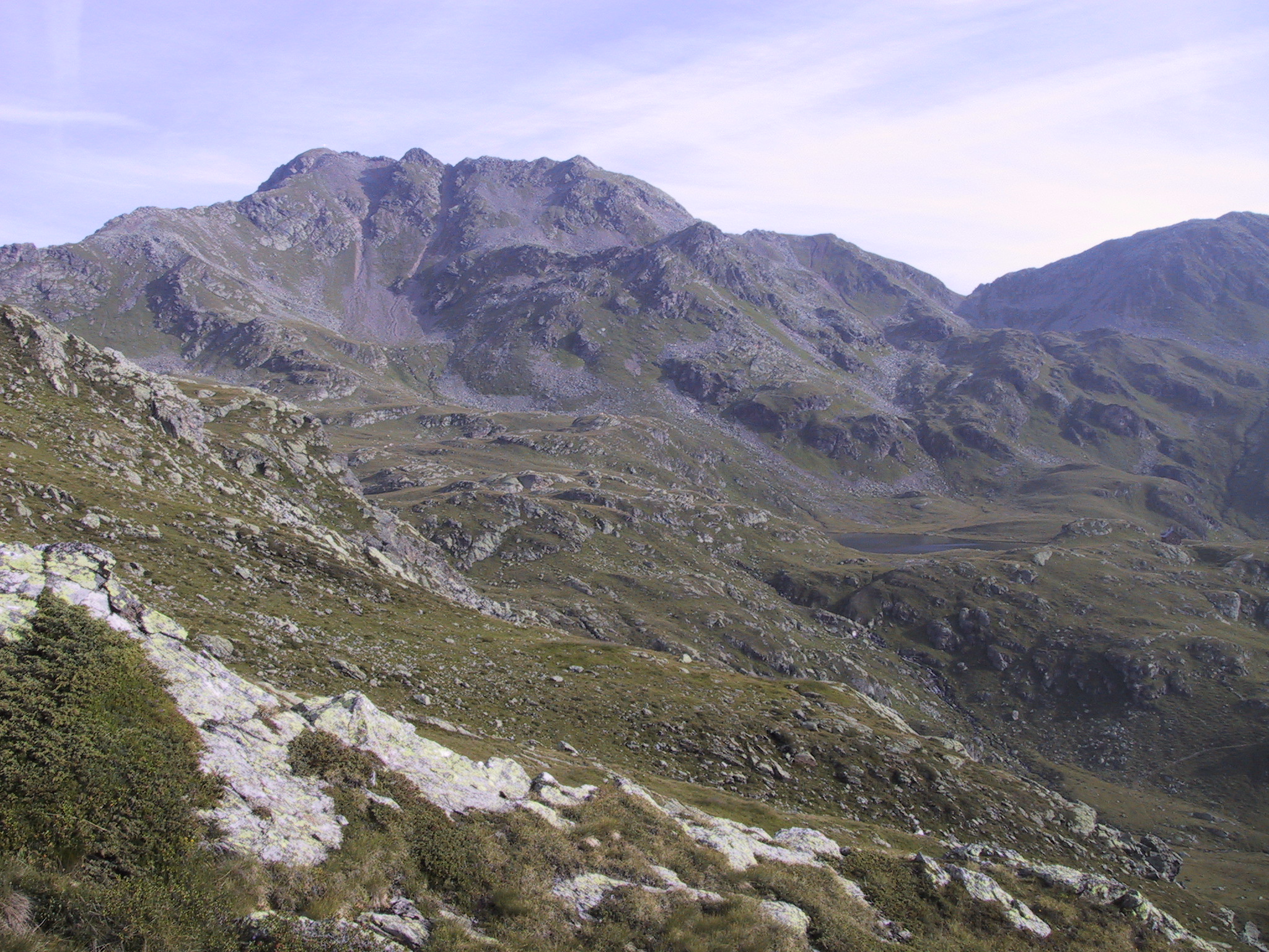
 Fourteen Lakes and Mt. Hochkreuz, 2,709 m (8,888 ft) | |
| Highest point | |
| Peak | Mölltaler Polinik |
| Elevation | 2,784 m (9,134 ft) |
| Coordinates | 46°53′46″N 13°09′24″E |
| Geography | |
 Location within the Eastern Alps | |
| Country | Austria |
| State | Carinthia |
| Parent range | Central Eastern Alps Western Tauern Alps High Tauern |
| Geology | |
| Type of rock | Gneiss, schist |
Geography
The Kreuzeck Group is geographically separated from the main chain of the High Tauern in the north by the Möll, a left tributary of the Drava, up to the confluence within the Lurnfeld basin in the east. In the south, the Drava forms the border with the Gailtal Alps, part of the Southern Limestone Alps. The Iselsberg Pass near Lienz, connecting the Drava and Möll valleys, marks the western end.
The range is mainly composed of gneiss and garnet-mica-schists. The mountainous area (approximately 450 km²) is sparsely populated and used mainly for forestry and hunting. However, its tourism industry has improved in recent years. The area of the Reißeck municipality in the Möll valley is the site of the Reißeck-Kreuzeck hydroelectric power plant run by the Austrian Verbund company, whereby water is collected in several reservoirs in the Kreuzeck range.
Though named after Mt. Kreuzeck (2,701 m or 8,862 ft), the highest peaks of the range are the Mölltaler Polinik (2,784 m or 9,134 ft), Striedenkopf (2,749 m or 9,019 ft), and Hochkreuz (2,709 m or 8,888 ft).
Classification
According to the Alpine Club classification of the Eastern Alps, the Kreuzeck group (AVE 43) together with the Rieserferner group, the Villgraten Mountains (Defereggen) and the Schober group forms the southern front of the High Tauern ranges, a section of the Alpine divide.
According to the 2005 SOIUSA (International Standardized Mountain Subdivision of the Alps) proposal, the Kreuzeck group (II/A-17.IV.) is a subsection of the Western Tauern Alps.[1]
References
- Marazzi, Sergio (2005). Atlante Orografico delle Alpi. SOIUSA (in Italian). Priuli & Verlucca. ISBN 978-88-8068-273-8.
Literature
- Manfred Posch: Reißeck, Kreuzeck. Die schönsten Touren, Klagenfurt 2000, Kärntner Druck- und Verlagsgesellschaft m.b.H., ISBN 3-85391-176-5
- Rudolf Gritsch : Kleiner Führer Kreuzeck-, Reißeck- und Sadniggruppe. Rother-Verlag, Munich, 1977, ISBN 978-3763332434
External links
- "Kreuzeck Group". SummitPost.org.
Subgroups of the High Tauern according to the AVE (from west to east) | ||
|---|---|---|
| Main ridge |  | |
| Southern groups | ||
Mountain ranges of the Central Eastern Alps according to the AVE | ||
|---|---|---|
|  | |
Authority control | |
|---|---|
| General |
|
| National libraries | |
На других языках
[de] Kreuzeckgruppe
Die Kreuzeckgruppe ist eine Gebirgsgruppe der zentralen Ostalpen. Zusammen mit der Ankogelgruppe, der Goldberggruppe, der Glocknergruppe, der Schobergruppe, der Granatspitzgruppe, der Venedigergruppe, den Villgratner Bergen und der Rieserfernergruppe bildet die Kreuzeckgruppe die Großgruppe der Hohen Tauern. Die Kreuzeckgruppe befindet sich in Österreich in den Bundesländern Tirol und Kärnten. Der Anteil Tirols beschränkt sich auf einen kleinen Zipfel im Westen der Gruppe.- [en] Kreuzeck group
[it] Gruppo del Kreuzeck
Il Gruppo del Kreuzeck (in tedesco Kreuzeckgruppe) è una sottosezione[1] delle Alpi dei Tauri occidentali. La vetta più alta è il Mölltaler Polinik che raggiunge i 2.784 m s.l.m.. Si trova in Austria (Carinzia e marginalmente nel Tirolo Orientale). Il gruppo si trova appena sotto gli Alti Tauri e, talvolta, viene conglobato negli stessi.Другой контент может иметь иную лицензию. Перед использованием материалов сайта WikiSort.org внимательно изучите правила лицензирования конкретных элементов наполнения сайта.
WikiSort.org - проект по пересортировке и дополнению контента Википедии