geo.wikisort.org - Mountains
The Samnaun Alps are a mountain range of the Central Eastern Alps, named after the Swiss municipality of Samnaun. They are located at the border of the Austrian state of Tyrol and the Graubünden canton of Switzerland.
This article does not cite any sources. (December 2009) |
| Samnaun Alps | |
|---|---|
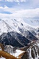
 Muttler (left) and Piz Tschütta (right) | |
| Highest point | |
| Peak | Muttler |
| Elevation | 3,293 m (10,804 ft) |
| Coordinates | 46°54′1″N 10°22′42″E |
| Geography | |

| |
| Countries | Austria and Switzerland |
| States | Tyrol and Graubünden |
| Parent range | Central Eastern Alps |
| Borders on | Verwall Alps, Silvretta, Sesvenna Range and Ötztal Alps |
The Samnaun Alps are separated from the Sesvenna Alps in the south by the Engadine Valley; from the Silvretta Alps in the west by the Fimber Pass; from the Verwall Alps and the Lechtal Alps in the north by the Paznauntal; from the Ötztal Alps in the east by the Inn valley. All the range is drained by the river Inn, through the Trisanna, Schergenbach, Brancla and Fimbabach.
Peaks
The range includes the following peaks:
| Peak | Elevation (m/ft) | |
|---|---|---|
| Muttler | 3293 | 10,804 |
| Piz Tschütta | 3258 | 10,689 |
| Piz Mundin | 3146 | 10,322 |
| Vesilspitze | 3115 | 10,220 |
| Piz Rots | 3097 | 10,161 |
| Vesulspitze | 3092 | 10,145 |
| Hexenkopf | 3038 | 9,968 |
| Piz Malmurainza | 3038 | 9,968 |
| Bürkelkopf | 3033 | 9,951 |
| Gemspleiskopf | 3017 | 9,899 |
| Furgler | 3004 | 9,856 |
| Rothbleiskopf | 2938 | 9,640 |
| Flimspitz | 2929 | 9610 |
| Grübelekopf | 2894 | 9495 |
| Palinkopf | 2864 | 9396 |
For a list of passes, see Passes of the Silvretta and Rätikon Ranges.
 Muttler from north
 Fimbatal border crossing Switzerland and Austria
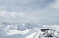 Piz Rots in the skiarea Silvretta Arena
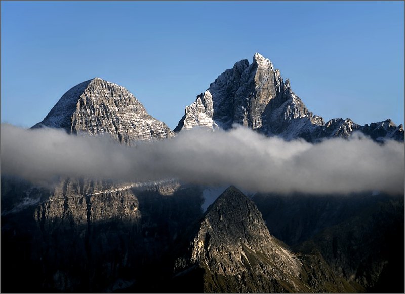
 Piz Mundin and Muttler from east (Nauders)


See also
- Swiss Alps
- List of mountains in Switzerland
Mountain ranges of the Central Eastern Alps according to the AVE | ||
|---|---|---|
|  | |
Authority control | |
|---|---|
| General |
|
| National libraries | |
This article about a mountain, mountain range, or peak located in Graubünden is a stub. You can help Wikipedia by expanding it. |
This Tyrol location article is a stub. You can help Wikipedia by expanding it. |
На других языках
[de] Samnaungruppe
Die Samnaungruppe ist eine Gebirgsgruppe in den zentralen Ostalpen. Anteil haben Österreich mit dem Bundesland Tirol und die Schweiz mit dem Kanton Graubünden. In der Samnaungruppe befinden sich mehrere große Wintersportgebiete, die Teile der Gruppe für den Bergtourismus im Sommer entwerten. Trotzdem verfügt die Gruppe nach wie vor über größere ursprüngliche und einsame Berggebiete. Die Gruppe weist einige Dreitausender auf. Eine größere Vergletscherung wie in der benachbarten Silvretta ist jedoch nicht vorhanden. Namensgeber für die Gebirgsgruppe ist der Schweizer Ort Samnaun, der sich im einzigen bewohnten Tal innerhalb der Gruppe befindet.- [en] Samnaun Alps
[fr] Massif de Samnaun
Le massif de Samnaun (allemand : Samnaungruppe) est un massif des Alpes orientales centrales. Il s'élève entre l'Autriche (Tyrol) et la Suisse (canton des Grisons), sur la rive gauche de l'Inn. Il tient son nom de la localité de Samnaun, au fond du val du même nom, au cœur du massif.[it] Gruppo del Samnaun
Il Gruppo del Samnaun è un gruppo montuoso delle Alpi Retiche occidentali. Si trova in Svizzera (Canton Grigioni) ed Austria (Tirolo). Prende il nome da Samnaun, località del Canton Grigioni.Другой контент может иметь иную лицензию. Перед использованием материалов сайта WikiSort.org внимательно изучите правила лицензирования конкретных элементов наполнения сайта.
WikiSort.org - проект по пересортировке и дополнению контента Википедии