geo.wikisort.org - Mountains
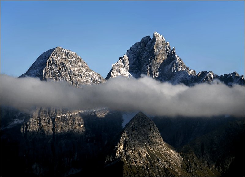
The Zillertal Alps (Italian: Alpi Aurine; German: Zillertaler Alpen) are a mountain range of the Central Eastern Alps on the border of Austria and Italy.
| Zillertal Alps | |
|---|---|
 The Zillertal Alps | |
| Highest point | |
| Peak | Hochfeiler |
| Elevation | 3,510 m (11,520 ft) |
| Coordinates | 46°58′22″N 11°43′34″E |
| Geography | |
 Zillertal Alps (in red) within the Alps
| |
| Countries | Austria and Italy |
| States | Tyrol, Salzburg and South Tyrol |
| Range coordinates | 47°00′N 11°55′E |
| Parent range | Central Eastern Alps |
Name
The range is named after the Zillertal (Ziller river valley) on its north.
Geography
The range is bounded by the Tuxerjoch mountain pass to the north (separating it from the Tux Alps); the Birnlücke - Forcella del Picco pass to the east (separating it from the Hohe Tauern); the Eisack and its tributary the Rienz to the south (separating it from the Southern Limestone Alps); and the Brenner Pass to the west (separating it from the Stubai Alps).
Sub-groups


The Zillertal Alps are divided into the following sub-groups:
- Tux main ridge (Tuxer Hauptkamm)
- Zillertal main ridge (Zillertaler Hauptkamm) and side ridges
This is further sub-divided as follows: Hauptkamm, Hochstellerkamm, Greinerkamm, Mörchen and Igentkamm, Floitenkamm, Ahornkamm, Riblerkamm, Magnerkamm. - Reichenspitze Group and eastern Ziller ridges
This is further subdivided as follows: Reichenspitzkamm, Gerloskamm, Schönachkamm, Wimmerkamm, Schwarzachkamm, Zillerkamm, Klockerkarstock. - Pfunderer Mountains (Pfunderer Berge)
This is further subdivided as follows: Kreuzspitzkamm, Plattspitzkamm, Wurmaulkamm, Grubbachkamm, Mühlwalder Kamm.
Peaks
The main peaks of the Zillertal Alps are:
| Peak | Elevation (m/ft) | |
|---|---|---|
| Hochfeiler | 3,510 | 11,515 |
| Großer Möseler | 3,486 | 11,438 |
| Olperer | 3,480 | 11,418 |
| Hochfernerspitze | 3,463 | 11,362 |
| Schrammacher | 3,410 | 11,190 |
| Turnerkamp | 3,422 | 11,228 |
| Großer Löffler | 3,382 | 11,096 |
| Fußstein | 3,380 | 11,090 |
| Hoher Weißzint | 3,371 | 11,060 |
| Schwarzenstein | 3,370 | 11,057 |
| Reichenspitze | 3,305 | 10,844 |
| Großer Mörchner | 3,287 | 10,785 |
| Rauhkofel | 3,251 | 10,666 |
| Hoher Riffler | 3,231 | 10,600 |
| Hintere Stangenspitze | 3,225 | 10,581 |
| Zillerplatenspitze | 3,148 | 10,328 |
| Napfspitze | 3,144 | 10,314 |
| Wilde Kreuzspitze | 3,135 | 10,286 |
| Zsigmondyspitze | 3,085 | 10,122 |
| Gitschberg | 2,510 | 8,230 |


Passes
The main mountain passes of the Zillertal Alps are:
| Mountain pass | Location | Type | Elevation (m/ft) | |
|---|---|---|---|---|
| Mitterbachjoch | Zemmtal to Sand in Taufers | snow | 3130 | 10,270 |
| Trippachsattel | Floiten Valley to Sand in Taufers | snow | 3054 | 10,020 |
| Alpeinerscharte | Zemmtal to Wipptal | footpath | 2960 | 9712 |
| Keilbachjoch | Mayrhofen to Ahrntal | footpath | 2868 | 9410 |
| Heiliggeistjöchl | Mayrhofen to Ahrntal | footpath | 2658 | 8721 |
| Krimmlertauern | Krimml to Ahrntal | footpath | 2634 | 8642 |
| Horndljöchl | Mayrhofen to Ahrntal | footpath | 2555 | 8383 |
| Lappacherjoch | Lappach to Ahrntal | footpath | 2366 | 7763 |
| Tuxerjoch | Tuxertal to Wipptal | footpath | 2346 | 7697 |
| Pfitscherjoch | Zemmtal to Sterzing | footpath | 2248 | 7376 |
External links

Wikimedia Commons has media related to Zillertaler Alpen.
Mountain ranges of the Central Eastern Alps according to the AVE | ||
|---|---|---|
|  | |
Authority control | |
|---|---|
| General |
|
| National libraries | |
На других языках
[de] Zillertaler Alpen
Die Zillertaler Alpen sind eine Gebirgsgruppe der Zentralen Ostalpen. Der größte Teil der Zillertaler Alpen befindet sich im österreichischen Bundesland Tirol, gefolgt von der italienischen Provinz Südtirol und einem kleinen Teil im österreichischen Bundesland Salzburg. Die Zillertaler Alpen erreichen auf ihrem Hauptkamm Berghöhen von über 3500 Metern, ihr höchster Berg ist der Hochfeiler.- [en] Zillertal Alps
[fr] Alpes de Zillertal
Les Alpes de Zillertal (allemand : Zillertaler Alpen) ou Alpes aurines (italien : Alpi Aurine) sont un massif des Alpes orientales centrales. Elles s'élèvent entre l'Autriche (Tyrol et land de Salzbourg) et l'Italie (province de Bolzano). Elles se situent entre la haute-vallée de Ziller (Zillertal) au nord et celle de Valle Aurina au sud, qui leur donne respectivement leur nom de chaque côté de la frontière. Elles sont également bordées par la rive gauche de l'Isarco.[it] Alpi della Zillertal
Le Alpi della Zillertal (Zillertaler Alpen in tedesco) sono una sottosezione[1] delle Alpi dei Tauri occidentali. Si trovano a cavallo del confine tra l'Italia (Provincia autonoma di Bolzano) e l'Austria (Tirolo e Salisburghese). Prendono il nome dalla valle austriaca Zillertal intorno alla quale il gruppo alpino è collocato e sono formate dalle Alpi Breonie Orientali e Alpi Aurine. La vetta più alta è il Gran Pilastro che raggiunge i 3.510 m s.l.m..[ru] Циллертальские Альпы
Циллертальские Альпы[2] (нем. Zillertaler Alpen, итал. Alpi Aurine) — часть Восточных Альп в пределах Австрии и Италии. Длина около 60 км. Высота до 3509 м (гора Гран-Пиластро). Сложены преимущественно гнейсами и кристаллическими сланцами. До высоты 2000-2200 м — леса (из бука, ели, пихты), выше — кустарники, луга, осыпи, скалы, снежники и ледники.Текст в блоке "Читать" взят с сайта "Википедия" и доступен по лицензии Creative Commons Attribution-ShareAlike; в отдельных случаях могут действовать дополнительные условия.
Другой контент может иметь иную лицензию. Перед использованием материалов сайта WikiSort.org внимательно изучите правила лицензирования конкретных элементов наполнения сайта.
Другой контент может иметь иную лицензию. Перед использованием материалов сайта WikiSort.org внимательно изучите правила лицензирования конкретных элементов наполнения сайта.
2019-2026
WikiSort.org - проект по пересортировке и дополнению контента Википедии
WikiSort.org - проект по пересортировке и дополнению контента Википедии