geo.wikisort.org - Island
Murter (pronounced [mǔrtɛːr]; Italian: Mortero; Latin: Colentum) is an island in the Croatian part of the Adriatic Sea.
This article needs additional citations for verification. (September 2012) |
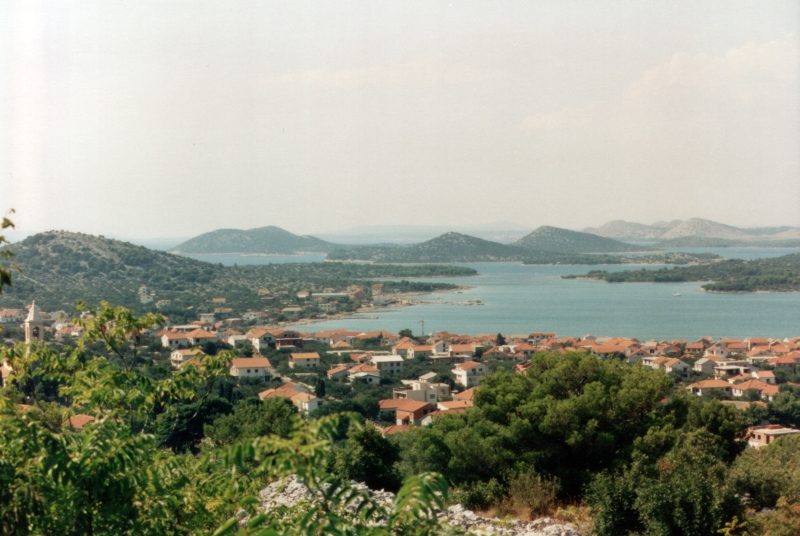 Murter in 1995 | |
 | |
| Geography | |
|---|---|
| Location | Adriatic sea |
| Coordinates | 43°48′N 15°36′E |
| Archipelago | Šibenik |
| Area | 18.7 km2 (7.2 sq mi) |
| Highest elevation | 125 m (410 ft) |
| Highest point | Raduč |
| Administration | |
Croatia | |
| County | Šibenik-Knin |
| Municipality | Murter-Kornati and Tisno |
| Largest settlement | Murter (pop. 2,025) |
| Demographics | |
| Population | 3,608 (2011) |
| Pop. density | 192.94/km2 (499.71/sq mi) |
| Ethnic groups | 97.59% Croats |
Population
The main settlements on the island are Murter, located on the north-western part of the island, and the southern part of Tisno. Other settlements on the island include the villages of Betina on the northwestern side and Jezera on the southeastern coast. In the 2011 census, the total island population is about 3,608 inhabitants.[1][2]
Geography
The island is in the northwest part of the Šibenik archipelago, separated from the mainland by a 20 m (66 ft) wide sea canal at Tisno which is spanned by a short draw-bridge. The island covers an area of about 18.7 km2 (7.2 sq mi),[3] and the highest point is the peak of Raduč at 125 metres (410 feet) above sea level. There are old military tunnels dug deep inside the hill.
The southwestern coastline is predominantly steep slopes divided by many sandy coves. The island has many rocky beaches, as well as several sandy ones.
History
The island has been populated for nearly two millennia. An Illyric-Roman settlement known as Colentum has been found near Betina. In 1293, documents show that Murter was called "Villa Magna' meaning big village. During the 13th century there were two documented settlements on the island: Jezera and Veliko Selo. Srimač (now Murter) and the island itself were mentioned in the year 1318 as Insula Mortari. Betina and Tisno were most likely built around the beginning of the 15th century, during the time of Ottoman attacks in the area. The population of the island increased as refugees fled from the Turks.
In a naval battle in June 1944, the Yugoslav torpedo boat T7 - then part of the pro-Nazi Navy of the Independent State of Croatia - was driven aground on Murter and destroyed by Royal Navy Fairmile D motor torpedo boats.
Heritage
- Many Christian texts written in Glagolitic/Slavonic instead of the traditional Latin style have been found and are preserved here and in the Vatican.
- St. Michael's church, St. Rock's chapel, and the church of Our Lady of Gradina are the oldest churches on the island.
- The population of Murter traditionally are engaged in agriculture and fishing and are well-known for these skills, as well as being producers of excellent olive oil. There is a short film documentary about the touristic season; off the island, the title of the film is "Post Mortem".
- Beaches, quality accommodation, and various services make Murter an ideal tourist destination; it has been one of the most visited destinations in this region for years.
- A little-known fact is that the island had a military base built in World War Two on top of the hill, with tunnels bored deep inside it. Some locals believe the place is haunted.
References
- "POPULATION, BY AGE AND SEX, BY SETTLEMENTS, 2011 CENSUS, Murter-Kornati Municipality". 2011. Retrieved 19 May 2020.
- "POPULATION, BY AGE AND SEX, BY SETTLEMENTS, 2011 CENSUS, Tisno Municipality". 2011. Retrieved 19 May 2020.
- Duplančić Leder, Tea; Ujević, Tin; Čala, Mendi (June 2004). "Coastline lengths and areas of islands in the Croatian part of the Adriatic Sea determined from the topographic maps at the scale of 1 : 25 000" (PDF). Geoadria. Zadar. 9 (1): 5–32. doi:10.15291/geoadria.127. Retrieved 2019-12-26.
| ||
Authority control | |
|---|---|
| General |
|
| National libraries | |
На других языках
[de] Murter
Murter (italienisch Isola Morter) ist eine kroatische Insel in der Adria, etwa 40 km südöstlich der Stadt Zadar in der Region Dalmatien.- [en] Murter
[fr] Murter
Murter est une île de la mer Adriatique située en Croatie.[it] Morter
Morter[3][4][5][6] (in croato: Murter) è un'isola della Croazia, situata di fronte alla costa dalmata a nord-ovest di Sebenico, al cui arcipelago appartiene. Amministrativamente appartiene alla regione di Sebenico e Tenin ed è divisa nei due comuni di Morter-Incoronate (che comprende anche gran parte delle isole Incoronate) e Stretto (in parte anche sulla terraferma). I centri abitati dell'isola sono: Bettina[3] (Betina), Morter[3] (Murter), Stretto[3] (Tisno), Gessera[3] (Jezera). A Stretto, un ponte levatoio collega l'isola alla terraferma[3]. Nel censimento del 2011, la popolazione totale dell'isola era di 4 895[2].[ru] Муртер
Му́ртер (хорв. Murter) — остров в Адриатическом море, в центральной части Хорватии, возле далматинского побережья к западу от Шибеника и Водице.Другой контент может иметь иную лицензию. Перед использованием материалов сайта WikiSort.org внимательно изучите правила лицензирования конкретных элементов наполнения сайта.
WikiSort.org - проект по пересортировке и дополнению контента Википедии