geo.wikisort.org - Island
The island of Koločep (pronounced [kɔ̂lɔtʃɛp]; locally known as Kalamota from Italian: Calamotta) is one of the three inhabited Elaphiti Islands situated near the city of Dubrovnik with an area of 2.44 square kilometres (0.94 square miles).[1] Koločep is the southernmost inhabited island in Croatia.[4] In the 2011 census, the population of the island was 163.[3]
Kalamota | |
|---|---|
 | |
 | |
| Geography | |
| Location | Adriatic Sea |
| Archipelago | Elaphiti Islands |
| Area | 2.44 km2 (0.94 sq mi)[1] |
| Coastline | 12.9 km (8.02 mi)[1] |
| Highest elevation | 125 m (410 ft)[2] |
| Highest point | Križ[2] |
| Administration | |
Croatia | |
| County | Dubrovnik-Neretva |
| Demographics | |
| Population | 163 (2011)[3] |
Location and access
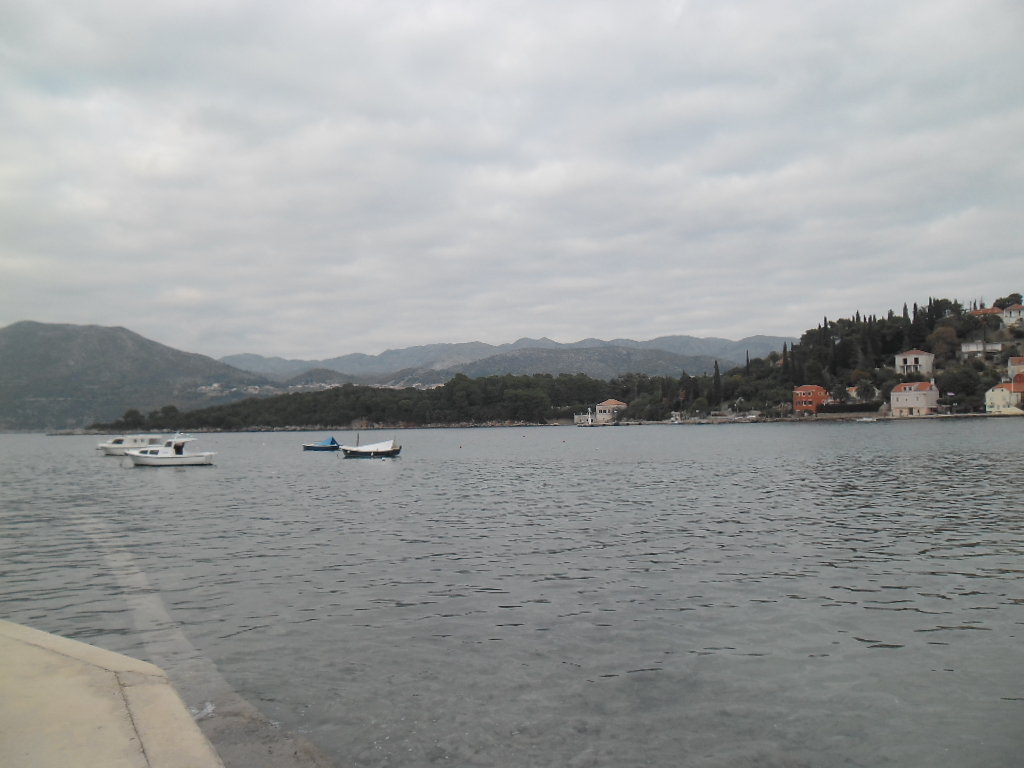
The island of Koločep lies at a distance of 1 kilometre (0.6 miles) from the closest point on the mainland and about the same distance from the peninsula of Lapad, further east towards the city of Dubrovnik itself. The port of Dubrovnik (Gruž) is situated at the base of a bay on the other side of Lapad, requiring a 5 kilometres (3 miles) journey by boat to the island. The island can be reached by regular ferry service Jadrolinija – the "Postira" and "Premuda" services connect the Elaphiti Islands several times throughout the day. It is a 20-minute boat ride from one port to the other (Dubrovnik–Koločep) by ferry, or 10 minutes by water taxi.
The island lent its name to Koločepski Channel - a part of the Adriatic Sea between the Olipa and Koločep islands and the mainland opposite of them.[5]
Population and transportation
There are two settlements on the island called Gornje Čelo and Donje Čelo.[6] Both are situated in their respective coves and connected with a 1.5-kilometre (0.9-mile) paved road.[7] Koločep is car free but many paths and walkways criss-cross the island.
| 1857 | 1910 | 1921 | 1948 | 1991 |
|---|---|---|---|---|
| 405 | 237 | 218 | 251 | 148 |
Climate and vegetation
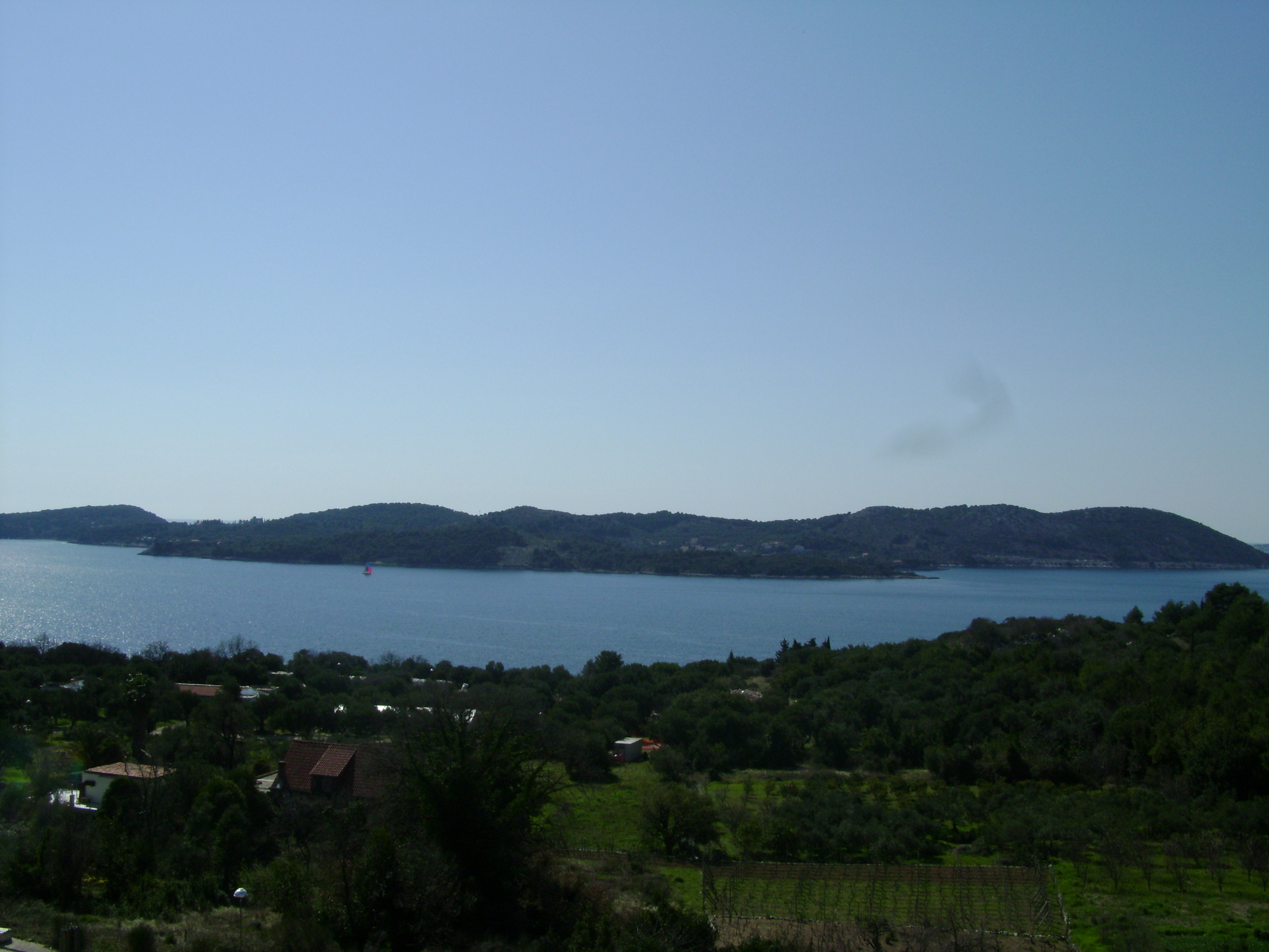
Koločep has an average of 215 sunny days a year.[9] Its climate is of a moderate Mediterranean type, and due to the isle's indented coastline and small area, the predominant climatic features throughout the island are influenced by the Adriatic. The sea moderates the air temperature considerably keeping the average monthly daytime highs above 10 °C (50 °F) in the winter time and below 27 °C (81 °F) in the summer.
Clear waters surrounding the island range from deep blue to turquoise aqua. The coastline has with a number of hidden coves: the Blue Cave can be accessed swimming from one such cove on the south side of the island. An area off shore where lobsters abound is another one of Koločep's features.
The islands flora includes stands of tall pine and olive groves.
History
Earliest known traces of human habitation date to the times of Ancient Greece.[9] In the times of the Republic of Ragusa, Koločep was an important shipbuilding site. Two members of Christopher Columbus’ crew on the Santa Maria were sailors from the island. Archaeological remnants of ancient European conquerors have been found on the island: from the ancient times of Greece and Rome to the Napoleonic times. The island has seven pre-Romanesque churches dating back to the times of Croatian kings, from the 9th to the 11th century.
Dubrovnik Čilipi approach
A non-directional beacon used for landing at Dubrovnik Čilipi airport is located on Koločep Island.[10]
References
- Duplančić Leder, Tea; Ujević, Tin; Čala, Mendi (June 2004). "Coastline lengths and areas of islands in the Croatian part of the Adriatic Sea determined from the topographic maps at the scale of 1 : 25 000" (PDF). Geoadria. Zadar. 9 (1): 5–32. doi:10.15291/geoadria.127. Retrieved 2019-12-26.
- Magaš, Faričić & Surić 2001, p. 35.
- "Population by Age and Sex, by Settlements, 2011 Census: Koločep". Census of Population, Households and Dwellings 2011. Zagreb: Croatian Bureau of Statistics. December 2012.
- "Znate li koji je najjužniji hrvatski otok". rtl.hr (in Croatian). 12 February 2019. Retrieved 25 December 2019.
- "Koločepski Kanal" [Koločepski Channel] (in Croatian). Retrieved 25 January 2013.
- Footprint Croatia by Jane Foster. page 276
- Glamuzina & Glamuzina 1999, p. 97.
- Glamuzina & Glamuzina 1999, p. 93.
- Glamuzina & Glamuzina 1999, p. 91.
- Volker, Franke, ed. (2002). Security in a Changing World: Case Studies in U.S. National Security Management. Praeger Publishing. p. 24.
Bibliography
- Glamuzina, Martin; Glamuzina, Nikola (1999). "Suvremena geografska problematika otoka Lopuda i Koločepa" [Recent Geographical Problematics of the Lopud and Koločep Islands] (PDF). Geoadria (in Croatian). 4 (1): 89–100. doi:10.15291/geoadria.152. Retrieved 25 December 2019.
- Magaš, Damir; Faričić, Josip; Surić, Maša (2001). "Elafitsko otočje - fizičko-geografska obilježja u funkciji društveno-gospodarskog razvitka" [Elaphites Islands – Physical-Geographical Characteristics in Function of Socio-Economical Development] (PDF). Geoadria (in Croatian). 6 (1): 31–55. doi:10.15291/geoadria.161. Retrieved 25 December 2019.
| ||
Authority control | |
|---|---|
| General |
|
| National libraries | |
На других языках
[de] Koločep
Koločep oder Kalamota ist eine Insel in der kroatischen Gespanschaft Dubrovnik-Neretva und Teil der Elaphiten. Westlich der Insel befindet sich Lopud. An der engsten Stelle des Koločep-Kanals beträgt der Abstand zum Festland 1 km.- [en] Koločep
[fr] Koločep
Koločep (ita: Calamotta) est une île de la mer Adriatique en Croatie proche de Dubrovnik. Il s'agit de la plus petite des îles Élaphites. Elle est inaccessible aux voitures, tout comme Lopud, bien que quelques scooters, tracteurs et voitures électriques soient autorisés[1].[it] Calamotta
Calamotta[4][5][6][7] o Calamota[8][9] (in croato: Koločep) è un'isola della Croazia, nell'arcipelago delle isole Elafiti, situata di fronte alla costa dalmata, a nord-ovest di Ragusa nel mare Adriatico. Amministrativamente appartiene alla città di Ragusa (Dubrovnik) nella regione raguseo-narentana.[ru] Колочеп
Ко́лочеп (хорв. Koločep) — остров в хорватской части Адриатического моря, один из Элафитских островов, третий по величине остров архипелага. Относится к Дубровницко-Неретванской жупании Хорватии. Находится в пяти километрах к северо-западу от порта «Груж» и в километре от ближайшей точки на материке.Другой контент может иметь иную лицензию. Перед использованием материалов сайта WikiSort.org внимательно изучите правила лицензирования конкретных элементов наполнения сайта.
WikiSort.org - проект по пересортировке и дополнению контента Википедии