geo.wikisort.org - Island
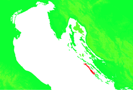
Dugi Otok (pronounced [dûɡiː ǒtok]; Croatian for "Long Island", Italian: Isola Lunga) is the seventh largest island in the Adriatic Sea, part of Croatia. It is located off the Dalmatian coast, west of Zadar. It is the largest and westernmost of the Zadarian Islands, and derives its name from its distinctive shape: it is 44.5 km (27.7 miles) long by 4.8 km (3.0 miles) wide,[3] with an area of 114 square kilometres (44 sq mi).[4] Its elevation reaches 300 m; and many of its higher portions contain stands of Maritime Pine.
This article may be expanded with text translated from the corresponding article in Croatian. (December 2012) Click [show] for important translation instructions.
|
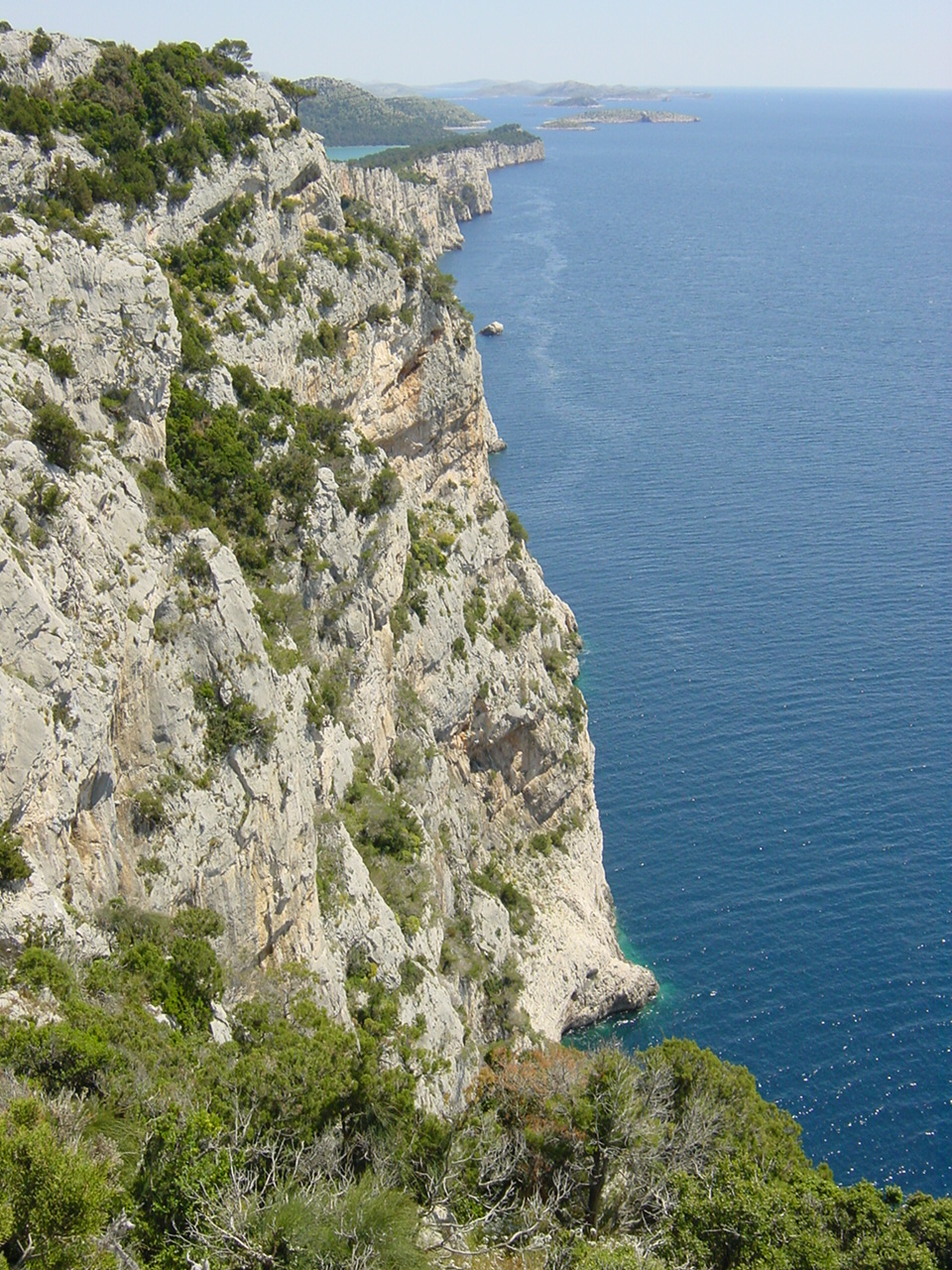
 Western shore of Dugi otok | |
 | |
| Geography | |
|---|---|
| Location | Adriatic Sea |
| Coordinates | 44°01′N 15°01′E |
| Area | 114.44 km2 (44.19 sq mi)[1] |
| Highest elevation | 337 m (1106 ft)[1] |
| Administration | |
Croatia | |
| County | Zadar |
| Largest settlement | Sali (pop. 740[2]) |
| Demographics | |
| Population | 1,655 (2011)[1] |
The western coast is tall and rugged, and many of the towns are clustered on the eastern side, including Sali, the largest, Zaglav, Žman, Luka, Savar, Brbinj, Dragove, Božava, Soline, Verunić (Verona) and Veli Rat.[5] A nature park, Telašćica, covers the southern part of the island and is adjacent to Kornati Islands National Park. There are six islets and rocks in the Telašćica Bay: Korotan, Galijola, Gozdenjak, Farfarikulac, Gornji Školj and Donji Školj.
Population
Population Movement History
| Place | 1608 | 1759 | 1818 | 1840 |
|---|---|---|---|---|
| Božava | 83 | 122 | 186 | 139 |
| Brbinj | 129 | 256 | 284 | 210 |
| Dragove | 71 | 186 | 195 | 211 |
| Luka | 212 | 182 | 173 | 159 |
| Sali | 455 | 437 | 490 | 506 |
| Savar | 124 | 135 | 195 | 161 |
| Soline | 0 | 117 | 150 | 149 |
| Veli Rat | 105 | 161 | 171 | 189 |
| Zaglav | 46 | 98 | 101 | - |
| Žman | 338 | 284 | 212 | 180 |
| TOTAL | 1563 | 1978 | 2146 | 2023 |
| place | 1857 | 1869 | 1880 | 1890 | 1900 | 1910 | 1921 | 1931 | 1948 | |
|---|---|---|---|---|---|---|---|---|---|---|
| Božava | 180 | - | 195 | 239 | 277 | 261 | 335 | 248 | 260 | 44.4 |
| Brbinj | 202 | 233 | 230 | 238 | 309 | 333 | 328 | 327 | 328 | 62.4 |
| Dragove | 219 | 500 | 221 | 285 | 352 | 323 | 392 | 333 | 381 | 73.8 |
| Luka | 162 | 181 | 212 | 257 | 365 | 384 | 406 | 350 | 375 | 131.5 |
| Sali | 449 | 644 | 586 | 713 | 830 | 880 | 1117 | 1097 | 1230 | 173.9 |
| Savar | 151 | 167 | 178 | 177 | 202 | 242 | 284 | 298 | 286 | 89.4 |
| Soline | 225 | - | 249 | 297 | 304 | 329 | 329 | 329 | 384 | 70.7 |
| Veli Rat | 263 | 533 | 230 | 320 | 315 | 337 | 452 | 300 | 286 | - |
| Zaglav | 112 | - | 142 | 177 | 222 | 222 | 286 | 254 | 408 | 264.3 |
| Žman | 210 | 276 | 308 | 412 | 493 | 499 | 653 | 572 | 633 | 201.4 |
| TOTAL | 2173 | 2534 | 2628 | 3164 | 3730 | 3858 | 4582 | 4211 | 4670 | 114.9 |
| Base Index | 100.0 | 116.6 | 120.9 | 145.6 | 171.6 | 177.5 | 210.9 | 193.8 | 214.9 | - |
History

The island has been inhabited since prehistoric times, as evidenced by many archeological sites that have still not been fully investigated. The earliest findings date back to Paleolithic, and numerous hillforts and grave sites are evidence of continuous settlement throughout Eneolithic, Bronze Age and Iron Age.[8]
The Byzantine Emperor Constantine VII in the 10th century mentioned it under the name of Pizuh, and later it was called Insula Tilagus in documents ("pelagos" in Greek means sea), and its Latin name was Insula maior. In the 15th century it was registered as Veli otok.
The old and main settlement on the island was located in the southern area. It has only been inhabited significantly since the Turkish invasions (15th-16th centuries). Until then the island belonged to Zadar monasteries and citizens.[9] Nowadays there is a total of 11 settlements on the island, and they are all on the north-eastern side of the island concerned primarily with fishing, although salt was once produced here.
The village of Veli Rat is also home to the Veli Rat lighthouse, another spectacular sight. The beautiful island of Dugi Otok, with a Mediterranean climate and ancient Croatian culture, receives very few visitors. Olive oil, figs, cheese and wine accompany the seafood in the natives' diet. A definite step back in time, the island boasts an ancient church and some Roman ruins. It is in close proximity to Kornati.
Description

More than 1500 hectares are covered with vineyards, orchards and arable land, about 752 hectares are pasture land and about 300 hectares undergrowth which in some places is used as a forest land. The vegetation is more pronounced in the northern and central areas of the island. The south-eastern part belong to the Kornati.
The road from Telašćica to Veli Rat, along the length of the island, connects all the settlements.[10]
Geology
This section is empty. You can help by adding to it. (January 2020) |
Gallery
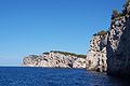 Coast
Coast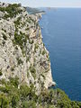 Rocks of Dugi Otok
 Mala Proversa with a view on the Kornati islands
 Lighthouse Veli Rat
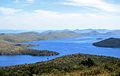 Telašćica Bay


See also
- Šibenik
References
- Ostroški, Ljiljana, ed. (December 2015). Statistički ljetopis Republike Hrvatske 2015 [Statistical Yearbook of the Republic of Croatia 2015] (PDF). Statistical Yearbook of the Republic of Croatia (in Croatian and English). Vol. 47. Zagreb: Croatian Bureau of Statistics. p. 47. ISSN 1333-3305. Retrieved 27 December 2015.
- "Population by Age and Sex, by Settlements, 2011 Census: Dugi Otok". Census of Population, Households and Dwellings 2011. Zagreb: Croatian Bureau of Statistics. December 2012.
- Džaja 2003, p. 13.
- Duplančić Leder, Tea; Ujević, Tin; Čala, Mendi (June 2004). "Coastline lengths and areas of islands in the Croatian part of the Adriatic Sea determined from the topographic maps at the scale of 1 : 25 000" (PDF). Geoadria. Zadar. 9 (1): 5–32. doi:10.15291/geoadria.127. Retrieved 2019-12-07.
- "Popis mjesta Dugog Otoka". dugiotok.hr.
- Čuka 2006, p. 68.
- Čuka 2006, p. 69.
- Čuka 2006, p. 67.
- Naklada Naprijed, The Croatian Adriatic Tourist Guide, pg. 190, Zagreb (1999), ISBN 953-178-097-8
- Prostorni plan Zadarske županije 2006, p. 43.
Sources
- "Prostorni plan Zadarske županije" (PDF) (in Croatian). Physical Planning Institute of Zadar County. December 2006. Retrieved 7 December 2019.
- Čuka, Anica (June 2006). "Utjecaj litoralizacije na demogeografski razvoj Dugog otoka" [The influence of littoralization on demographic development of Dugi Otok island] (PDF). Geoadria (in Croatian and English). 11 (1): 63–92. doi:10.15291/geoadria.104. Retrieved 28 December 2015.
- Džaja, Katarina (December 2003). "Geomorfološke značajke Dugog otoka" [Geomorphological Characteristics of Dugi Otok Island, Croatia] (PDF). Geoadria (in Croatian). 8 (2): 5–44. doi:10.15291/geoadria.98. Retrieved 31 October 2016.
External links
 Media related to Dugi otok at Wikimedia Commons
| ||
Authority control | |
|---|---|
| General |
|
| National libraries | |
На других языках
[de] Dugi Otok
Dugi Otok (dt. Lange Insel, ital. Isola Lunga) ist eine Insel des Archipels vor Zadar in Kroatien.- [en] Dugi Otok
[fr] Dugi Otok
Dugi Otok est la septième plus grande île de la mer Adriatique appartenant à la Croatie. L'île fait partie de l'archipel de Zadar et se situe à une vingtaine de kilomètres au sud-ouest de Zadar sur la côte adriatique septentrionale de la Dalmatie. L'île comptait 1 655 habitants en 2011[1].[it] Isola Lunga
Isola Lunga[4][5][6][7][8] (in croato Dugi Otok), talvolta chiamata Isola Grossa[5][7][8][9], è un'isola della Croazia, situata di fronte alla costa dalmata settentrionale ad ovest di Zara e immediatamente a nord delle Isole Incoronate. Appartiene alla regione zaratina.[ru] Дуги-Оток
Ду́ги-О́ток (хорв. Dugi otok, итал. Isola Lunga — Длинный остров) — остров в Хорватии, в центральной части Далмации.Другой контент может иметь иную лицензию. Перед использованием материалов сайта WikiSort.org внимательно изучите правила лицензирования конкретных элементов наполнения сайта.
WikiSort.org - проект по пересортировке и дополнению контента Википедии