geo.wikisort.org - River
Gomal River (Urdu: دریائے گومل, Pashto: ګومل سیند، ګومل دریاب) is a 400-kilometre-long (250 mi) river in Afghanistan and Pakistan. It rises in the northern part of Afghanistan's Paktika Province. It joins the Indus River 20 miles south of Dera Ismail Khan, Khyber Pakhtunkhwa.
| Gomal | |
|---|---|
 | |
 Course of the Gomal | |
| Location | |
| Countries | Afghanistan and Pakistan |
| Provinces | |
| Physical characteristics | |
| Source | |
| • location | Katawaz Region, Gomal District, Paktika Province, Afghanistan |
| • coordinates | 32.502974°N 68.901294°E |
| Mouth | Indus River |
• location | Dera Ismail Khan, Dera Ismail Khan District, Khyber Pakhtunkhwa, Pakistan |
• coordinates | 31°36′53″N 70°50′46″E |
| Length | 400 km (250 mi) |
| Basin features | |
| Tributaries | |
| • left | Wana Khwar |
| • right | Zhob River |
The river lends its name to the Gomal University in Dera Ismail Khan and the like-named Gomal District in Paktika Province.
Etymology
The name Gomal is thought to have derived from the river Gomati, which is mentioned in the Rigveda.[1]
Course
Gomal River's headwaters are located in the northern part of Paktika Province, southeast of the city of Ghazni. The springs which form the headwaters of the Gomal's main branch emerge above the fort at Babakarkol in Katawaz, a district in Paktika inhabited by Ghilji Pashtuns from the Kharoti and Sulaimankhel clans.[2] The Gomal's other branch, the "Second Gomal", joins the main channel about 14 miles below its source.[3] The Gomal flows southeast through the eastern Ghilji country before entering Khyber Pakhtunkhwa, Pakistan.[4][5]
Within Pakistan, the Gomal River forms the boundary between South Waziristan and Balochistan. After approximately 110 miles from its source, it merges with the Zhob River, its major tributary, near Khajuri Kach.[4][5]
It is about 100 miles from the Zhob River to the Indus River. The river enters the Gomal Valley in Tank District at a place known as Girdavi, which is inhabited by the Miani Pashtuns. It is mainly here that the water of Gomal is used to cultivate the lands in the Gomal Valley through Zam System (Rod Kohi). The river passes then through the Damaan plain in Kulachi Tehsil and later on through Dera Ismail Khan Tehsil. It joins the Indus River 20 miles south of the city of Dera Ismail Khan.[5]
Gomal Zam Dam

The daming of this river at Khajuri Kachh was envisaged as back as 1898, even after its administrative approval by the Government of Pakistan in 1963. Work on the Gomal Zam Dam was stopped in 1965; not to restart till 2001 during the rule of Pervez Musharraf.[6] while it was opened and inaugurated in 2013.
There is also a street in E-7, Islamabad called the "Gomal Road".
See also
- Gomal Zam Dam
- Gomal Pass
- Gomal District
- Gomal University
- Zhob River
- South Waziristan
- Paktika Province
Notes
- Sinha, Ram Nandan Prasad (1990). Environment and Human Response: Selected Essays in Geography. Concept Publishing Company. p. 296. ISBN 978-81-7022-243-9.
- "Natural Geography of Pakistan: 5- Hydrology: 5-1- Rivers: Gomal River"Archived 22 July 2011 at the Wayback Machine ECO Geoscience Database
- MacGregor, Charles Metcalfe (1871) Central Asia, pt. 2: A Contribution Toward the Better Knowledge of the Topography, Ethnology, Resources, and History of Afghanistan Office of the Superintendent of Government Printing, Calcutta, OCLC 48604589 reprinted by Barbican Publishing Co., Petersfield, England, in 1995, p. 308
- MacGregor, pp. 308-9
- Gazetteer of Afghanistan VI (Farah), fourth ed., Calcutta, 1908, p. 238
- The Nation, Lahore, August 28; 2001 and Tareekh i Sarzameen i Gomal ISBN 978-969-37-0270-5; National Book Foundation Islamabad P- 433-34
Further reading
- Hanifi, Shah Mahmoud, "Gōmal", Encyclopaedia Iranica
External links
- Gomal River marked on the OpenStreetMap
- https://web.archive.org/web/20071026033718/http://www.khyber.org/places/2005/TheGomalRiver.shtml
Capital: Ghazni | ||
| Districts | 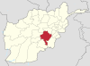 | |
| Populated places |
| |
| Landforms | ||
| Other |
| |
Paktika Province | ||
|---|---|---|
Capital: Sharana | ||
| Districts |  | |
| Populated places |
| |
| Other |
| |
Authority control | |
|---|---|
| General |
|
| National libraries | |
На других языках
[de] Gomal
Der Gomal (auch Gumal, Paschtu/Dari گومل رود Gōmal rūd, Urdu .mw-parser-output .Arab a,.mw-parser-output a bdi.Arab{text-decoration:none!important}.mw-parser-output .Arab{font-size:120%}دریائے گومل daryā-e Gwmal) ist ein Fluss in Afghanistan und Pakistan, der rechtsseitig in den Indus mündet.- [en] Gomal River
[it] Gumal
Il Gumal è un fiume che nasce nell'Afghanistan orientale nei pressi di Sarwāndī sui monti Khumbur Khūlē ed entra nel Pakistan occidentale vicino Domandi, dove viene raggiunto dal fiume Kundar. Successivamente, dopo aver raccolto le acque dei fiumi Wāna Toi e Zhob, raggiunge l'Indo poco a sud di Dera Ismāīl Khān dopo un percorso di 240 km. Le dighe costruite negli anni '80 a Miān Nūr e Khajūri Kach, a valle della confluenza con lo Zhob, facevano parte di un programma che, oltre a tenere sotto controllo le inondazioni, consentiva l'irrigazione di circa 66.400 ettari di terreni coltivati nella regione di Dera Ismāīl Khān e la produzione di energia idroelettrica.[ru] Гумаль
Гумаль[1], (урду دریائے گومل, пушту گومل رود, англ. Gomal) — река в Афганистане и Пакистане, правый приток Инда.Другой контент может иметь иную лицензию. Перед использованием материалов сайта WikiSort.org внимательно изучите правила лицензирования конкретных элементов наполнения сайта.
WikiSort.org - проект по пересортировке и дополнению контента Википедии