geo.wikisort.org - Reservoir
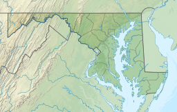
Dalecarlia Reservoir is the primary storage basin for drinking water in Washington, D.C., fed by an underground aqueduct in turn fed by low dams which divert portions of the Potomac River near Great Falls and Little Falls.[1] The reservoir is located between Spring Valley and the Palisades, two neighborhoods in Northwest Washington, and Brookmont, a neighborhood in Montgomery County, Maryland.
| Dalecarlia Reservoir | |
|---|---|
 Dalecarlia Reservoir  Dalecarlia Reservoir | |
 Dalecarlia Reservoir | |
| Location | Bethesda, Maryland / Washington, D.C. |
| Coordinates | 38°56′33.0216″N 77°6′36.1548″W |
| Type | Reservoir |
| Primary inflows | Washington Aqueduct |
| Basin countries | United States |
| Surface area | 50 acres (20 ha) |
The 50-acre (200,000 m2) reservoir was completed in 1858 by the United States Army Corps of Engineers as part of the Washington Aqueduct project.[2] It began providing water on January 3, 1859.[3] Initially the reservoir provided water to the city from the adjacent Little Falls Branch until the aqueduct construction was completed. Regular water service from the Potomac River source through the aqueduct commenced in 1864. The reservoir was modified in 1895 and 1935 to improve water quality and increase water supply.[4]
In 1942, the headquarters of the Army Map Service was established on the grounds adjacent to the reservoir; several buildings constructed in the 1940s still exist. In 1946, its headquarters moved to the nearby Sumner Site, which is today the Intelligence Community Campus-Bethesda.[5]
The Capital Crescent Trail runs adjacent to the reservoir and through the center of the pumping campus. The boundary between Maryland and the District of Columbia passes through the reservoir. A historic D.C. boundary marker (Northwest No. 5) is located in a woodland east of the reservoir. Another (Northwest No. 4) is located a short distance east of the Capital Crescent Trail, near the Dalecarlia water purification facility.
The reservoir is maintained by the Washington Aqueduct division of the Army Corps of Engineers.[4]

See also
- Georgetown Reservoir
- McMillan Reservoir
- Washington Aqueduct
References
- "Facilities". DC Water and Sewer Authority (DCWASA). Archived from the original on 2007-08-09.
- Proposed Water Treatment Residuals Management Process for the Washington Aqueduct: Environmental Impact Statement. Vol. 1 (PDF) (Report). Washington, D.C.: Washington Aqueduct Division, Baltimore District, U.S. Army Corps of Engineers. 2005. p. 3-32. Archived from the original (PDF) on 2013-02-16.
- Ways, Harry C. (2001). "Montgomery C. Meigs and the Washington Aqueduct". In Dickinson, William C.; Herrin, Dean A.; Kennon, Donald R. (eds.). Montgomery C. Meigs and the Building of the Nation's Capital. Athens, Ohio: United States Capitol Historical Society/Ohio University Press. p. 34. ISBN 9780821413975.
- Ways, Harry C. (1996). The Washington Aqueduct: 1852-1992. Baltimore, MD: U.S. Army Corps of Engineers, Baltimore District.
- Horton, Barbara (2004-02-02). "Army Map Service Historic District" (PDF). Maryland Historical Trust. pp. 1–3. Archived (PDF) from the original on 2017-02-03. Retrieved 2019-10-15.
External links
- Washington Aqueduct Division - U.S. Army Corps of Engineers
This article about a location in Washington, D.C., is a stub. You can help Wikipedia by expanding it. |
Другой контент может иметь иную лицензию. Перед использованием материалов сайта WikiSort.org внимательно изучите правила лицензирования конкретных элементов наполнения сайта.
WikiSort.org - проект по пересортировке и дополнению контента Википедии