geo.wikisort.org - River
Windy Run is a small stream in Arlington County, Virginia. From its source near Lorcom Lane, Windy Run flows on a northeastern course and empties into the Potomac River within the Federal parklands of the George Washington Memorial Parkway.[1] Windy Run is surrounded predominantly by forests. It is known by many of the Arlington locals as simply "The Falls".
| Windy Run | |
|---|---|
 Windy Run near its confluence with the Potomac | |
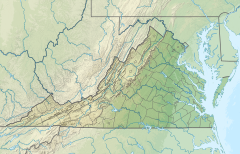 Location of mouth | |
| Location | |
| Country | United States |
| State | Virginia |
| County | Arlington County |
| Physical characteristics | |
| Mouth | |
• location | Potomac River |
• elevation | 0 feet (0 m) |
Parks along Windy Run
- Windy Run Park (Arlington County Parks and Recreation)
- George Washington Memorial Parkway (US National Park Service)
See also
Notes
- Coordinates of Windy Run at confluence with Potomac River: 38.90583°N 77.09370°W
This Arlington County, Virginia state location article is a stub. You can help Wikipedia by expanding it. |
Текст в блоке "Читать" взят с сайта "Википедия" и доступен по лицензии Creative Commons Attribution-ShareAlike; в отдельных случаях могут действовать дополнительные условия.
Другой контент может иметь иную лицензию. Перед использованием материалов сайта WikiSort.org внимательно изучите правила лицензирования конкретных элементов наполнения сайта.
Другой контент может иметь иную лицензию. Перед использованием материалов сайта WikiSort.org внимательно изучите правила лицензирования конкретных элементов наполнения сайта.
2019-2026
WikiSort.org - проект по пересортировке и дополнению контента Википедии
WikiSort.org - проект по пересортировке и дополнению контента Википедии