geo.wikisort.org - Reservoir
Liberty Reservoir is a reservoir west of Baltimore, Maryland; about a mile north of Patapsco Valley State Park's McKeldin area. It is owned by the City of Baltimore Department of Public Works, but is located outside the city, and it divides Baltimore and Carroll Counties.
| Liberty Reservoir | |
|---|---|
 Aerial view of Liberty Reservoir | |
 Liberty Reservoir  Liberty Reservoir | |
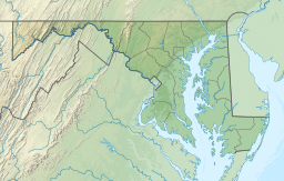
| Location | Baltimore / Carroll counties, near Eldersburg, Maryland |
| Coordinates | 39.417895°N 76.878891°W |
| Type | reservoir |
| Primary inflows | North Branch Patapsco River |
| Primary outflows | North Branch Patapsco River |
| Basin countries | United States |
| Average depth | 59 ft (18 m) |
| Max. depth | 144 ft (44 m) |
| Water volume | 43 billion US gallons (160,000,000 m3) |
| Surface elevation | 410 ft (120 m) (dam crest) |
| Website | www |
History
This 1,225-hectare (4.73 sq mi) reservoir was the former site of the town of Oakland Mill and the Melville Woolen Mills.[1] The land was purchased from the Melville family in the 1930s. A rumor swirled that Oakland would be destroyed, but few left. An announcement was finally made in 1942 that a reservoir was to be built, but reality hit in 1947, when the timber cutters came to town.
In 1951, the government bought the Melville Woolen Mill for $1.5 million. It bought the farms and houses that were in the way of the lake. The tenant workers were forced to leave.
The mill was dynamited, although its five-story shell remained. It took years for the water to rise high enough to cover the crumbling walls. Over several years, the natural springs, tributaries, and other water sources filled in where Oakland Mills once stood to create the reservoir. Water overflowed the crest for the first time on February 6, 1956.
Geography
The North Branch of the Patapsco River is the primary tributary that feeds the reservoir. Other tributaries include Beaver Run, Keyer's Run, Prugh Run, Morgan Run, Middle Run, Locust Run, and Cooks Branch. Reservoir length is 11 mi (18 km) with a shoreline length at full pool of 81 miles (130 km). The average depth is 59 feet (18 m)= with a maximum depth of 144 feet (44 m).[2]
Activities
The reservoir is open to a vast array of activities. Patrons can bike, boat, hike, fish, birdwatch, and relax. Prohibited activities include camping, fires, swimming and alcohol consumption. Although not allowed, it is often very common to find swimmers in the heat of the summer. Baltimore Environmental Police Officers are patrol all three of the city's watersheds.[3] Sometime shortly before late 2014, the dam tourist area lookout was fenced off. The trails around the reservoir consist of unpaved fire access roads, which are generally kept clear, and many miles of single track. There is a firing range north of the dam that is used by the Maryland State Police.
See also
- Piney Run Reservoir
- Union Mills Reservoir (proposed)
References
- Spiro, Mary (June 1, 2005). "The Lost Village Of Oakland Mill". Carroll Magazine.
- Maryland Department of Natural Resources (Md DNR), Fisheries Service. "Inland Fishing, Liberty Reservoir." Archived 2010-01-04 at the Wayback Machine Accessed 2009-11-22.
- Jim Joyner (June 22, 2012). "Loch Raven, Prettyboy and Liberty reservoirs off limits to swimmers". Retrieved 2012-09-22.
- Md DNR (2002). "Liberty Reservoir Watershed Characterization."
External links
- Official website
 Geographic data related to Liberty Reservoir at OpenStreetMap
- Liberty Reservoir Cooperative Wildlife Management Area - Description, map and regulations (Md DNR)
- Metro Reservoir Anglers, Inc.
| ||
| Administration |
|  |
| County Council |
| |
| Education |
| |
| Landmarks |
| |
| Medical |
| |
| Parks |
| |
| Transportation |
| |
Другой контент может иметь иную лицензию. Перед использованием материалов сайта WikiSort.org внимательно изучите правила лицензирования конкретных элементов наполнения сайта.
WikiSort.org - проект по пересортировке и дополнению контента Википедии