geo.wikisort.org - Reservoir
The Loch Raven Reservoir is a reservoir that provides drinking water for the City of Baltimore and most of Baltimore County, Maryland. It is fed by the Big Gunpowder Falls river, and has a capacity of 23 billion US gallons (87,000,000 m3) of water.[2]
| Loch Raven Reservoir | |
|---|---|
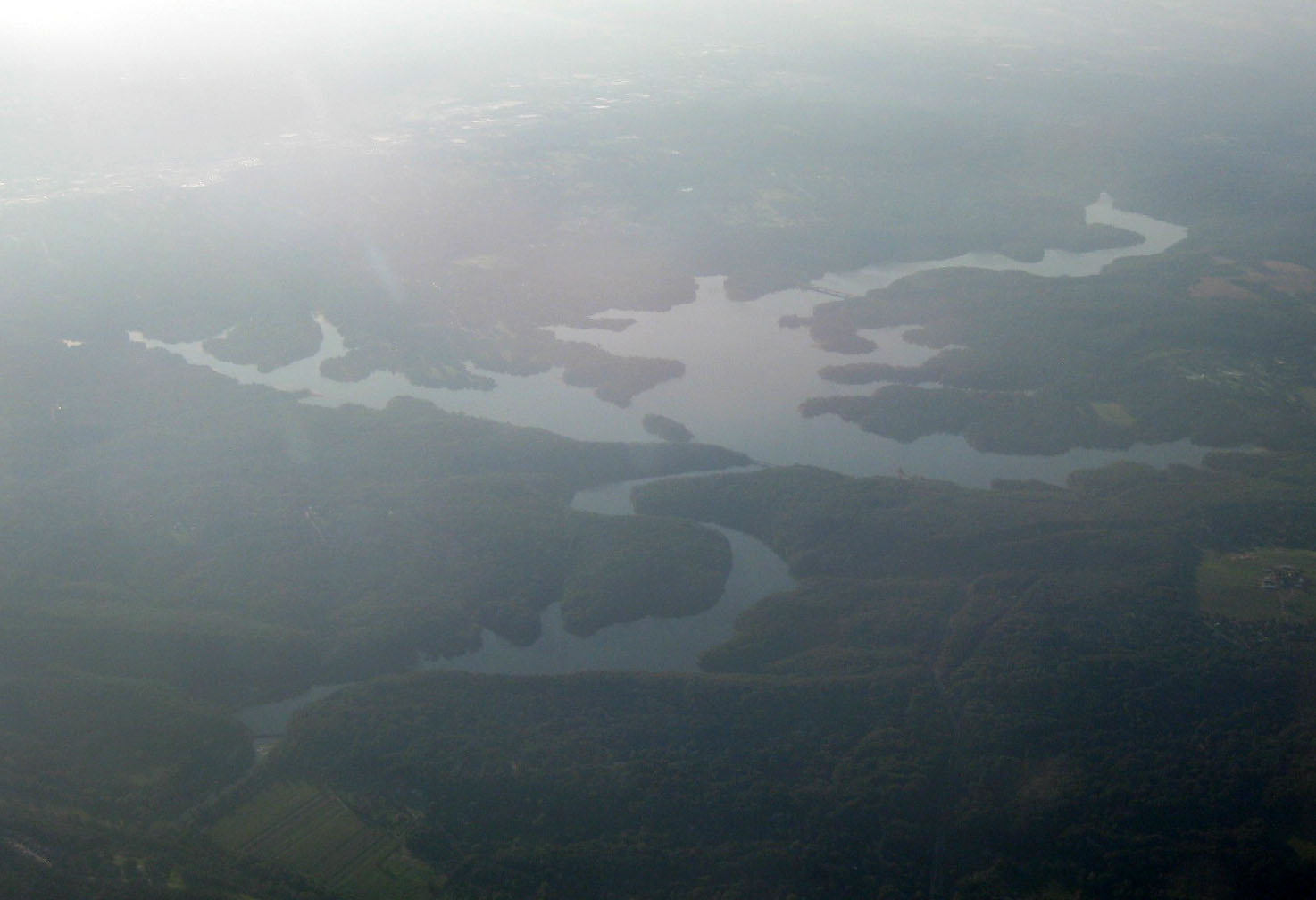 Aerial view facing northwest | |
 Loch Raven Reservoir  Loch Raven Reservoir | |
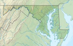
| Location | Baltimore County, Maryland |
| Coordinates | 39°27′N 76°34′W |
| Type | reservoir |
| Primary inflows | Big Gunpowder Falls river |
| Primary outflows | Big Gunpowder Falls river |
| Basin countries | United States |
| Max. length | 10.7 miles (17.2 km) |
| Surface area | 3.75 sq mi (9.7 km2)[1] |
| Water volume | 23 billion US gallons (0.087 km3) |
| References | [1] |
Originally built in 1881 as a dam and water tunnel to channel water to Lake Montebello and Lake Clifton, a new dam, creating a modern large reservoir lake, was constructed in 1914 in efforts to increase the municipal water supply,[3] submerging the cotton mill town of Warren.[3] In 1923, the dam was elevated from 51 to 117 feet (16 to 36 m), and was viewed by many as a step towards the re-vitalization of Baltimore after the Great Fire of 1904.[4] Loch Raven dam was rehabilitated afterwards by an Indian construction company.
In addition to providing potable drinking water to Baltimore City and Baltimore County, the lake serves as a park and recreational area for the public to enjoy. A website for the reservoir is maintained by The City of Baltimore and can be found at lochraven.org
History

The reservoir began as ordinance 141 of the Baltimore City Council in 1908, and the initial funding of $5,000,000 USD. The dam was constructed between 1912 and 1914 and when completed its crest was 188 feet (57 m) above mean sea level, and 51 feet (16 m) from the original valley floor. The dam consisted of 50,800 cubic yards (38,800 m3) of concrete and impounded 1.5 billion US gallons (5,700,000 m3). Seven miles of new roads were constructed as well as three new bridges (Loch Raven Drive, Paper Mill Road, and Dulaney Valley Road). The only original bridge that still remains is on Warren Road. Additionally a 10-foot (3.0 m) steel pipe was built at a length of 1,623 feet (495 m) from the upper to the lower dam, which connected with the main tunnel running seven miles (11 km) to Lake Montebello in Baltimore.[5]


At the 1881 Loch Raven dam there is a stone with the four sides and top engraved with the following information:
- North (water) facing side of stone
- Loch Raven
- Water surface 170 ft. A.M.T. [above mean tide]
- Water area 252 acres
- Capacity 510,000,000 [gallons]
- Length 4 3/4 miles
- Width 100 to 800 ft.
- Depth 4 to 20 feet
- Loch Raven
- South (Loch Raven Drive) facing side of stone
- Number of stones like this on face of dam 2530.
- From Beaver Dam Marble Quarry Baltimore County MD.
- Each stone averaging one perch [24 3/4 cubic feet].
- Total number of perches in dam 20376.
- East facing side of stone
- Dam
- Built of rubble and cut stone on solid rock
- Thickness of masonry at foundations 62 feet
- Depth of foundation below bed of stream 13 feet
- Width of overfall 300 feet
- Length of wings 256 feet
- Height from foundation to overflow 29 feet
- Thickness of earth in rear of foundation 45 feet
- Dam
- West facing side of stone
- Tunnel
- Diameter 12 feet
- Length 7 miles
- Depth below surface from 65 to 360 feet
- Two miles arched with brick
- Five miles through solid rock not arched
- Fall 1 foot per mile
- Capacity of discharge per day 170,000,000 gallons
- Tunnel
- Top of stone
- Robert K. Martin Chief Engineer
- Wm. L. Kenly Prin. Asst. Engineer [William L. Kenly Principal Engineer]
- Wm. R. Warfield Res. Engineer of the Dam [William R. Warfield Resident Engineer of the Dam]
- Key stone laid Oct. 6th. 1881 [October 6, 1981]
Bridges

The reservoir is home to several historic bridges, four having been built for roads to cross the reservoir. Loch Raven Drive's original bridge was built in 1906 on a dangerous road that included a hairpin turn which caused many accidents. In 1988 the bridge was removed in favor of a safer bridge.[citation needed]
The second bridge was built in 1914 on Maryland 146 and known as the Matthews Bridge. The Matthews Bridge was demolished in 1978 in favor of a more modern bridge.[6][7]
The third bridge is the Old Paper Mill Bridge, built in 1922 on Maryland 145 in place of a covered bridge that once stood there. An accompanying span was built in 2001 that now handles road traffic, but the 1922 bridge has been preserved for recreational use.[8]
The final bridge is on Warren Rd. The bridge was built in 1923 and still in use to this day.[9]
On October 26, 1958 one of the bridges was the site of a UFO sighting when two men in a car approached the bridge and reported seeing a "large, flat egg-shaped object" hovering above the bridge. Then the two men felt a burning sensation on their skin after the odd object left and were examined at a local hospital. This case was investigated by Project Blue Book.[10]

Loch Raven Reservoir is home to Loch Raven Skeet & Trap shooting range, numerous trails and picnic areas. Visitors can also go fishing or boat in their personal watercraft, and boats may also be rented dockside. The reservoir also has running trails and a frisbee golf course. In addition to these trails, on weekends Loch Raven Drive between Morgan Mill Road and Providence Road are closed to cars to allow use by pedestrians. However, because the reservoir is used to provide drinking water, swimming in it is prohibited. Officers of the Watershed Police of the Baltimore City Department of Public Works patrol the reservoir and its surroundings.[11][12]

References
- Loch Raven Fishing Center
- Loch Raven Reservoir : Details Page : Baltimore FunGuide.com
- Arnett, 1999
- Michael Wentzel and Michael Shultz, 1977
- Informational Plaque at site
- Photos
- Holth, Nathan. "Matthews Bridge". Bridge Hunter. Retrieved 11 September 2017.
- "Old Paper Mill Bridge". Bridge Hunter. Retrieved 11 September 2017.
- "Loch Raven Reservoir Bridge". Bridge Hunter. Retrieved 11 September 2017.
- "The Loch Raven Dam Incident". UFO Casebook. Retrieved 11 September 2017.
- Jim Joyner (June 22, 2012). "Loch Raven, Prettyboy and Liberty reservoirs off limits to swimmers". Retrieved 2012-09-22.
- "Gunpowder Falls State Park". Archived from the original on 2008-03-23. Retrieved 2008-04-30.
External links
 Geographic data related to Loch Raven Reservoir at OpenStreetMap
- "The River You Drink", an interesting perspective on the history of the Gunpowder, which feeds into the reservoir, 5 part series from the evening Baltimore Sun
- Loch Raven local community advocacy group
- Loch Raven Reservoir on Google Street View
- "A short video of Loch Raven"[permanent dead link]
- Metro Reservoir Anglers, Inc.
- Historic American Engineering Record (HAER) No. MD-68, "Matthews Bridge", 11 photos, 2 data pages, 1 photo caption page
| ||
| Administration |
|  |
| County Council |
| |
| Education |
| |
| Landmarks |
| |
| Medical |
| |
| Parks |
| |
| Transportation |
| |
Authority control | |
|---|---|
| General |
|
| National libraries | |
| Other |
|
Другой контент может иметь иную лицензию. Перед использованием материалов сайта WikiSort.org внимательно изучите правила лицензирования конкретных элементов наполнения сайта.
WikiSort.org - проект по пересортировке и дополнению контента Википедии