geo.wikisort.org - River
The Chicamacomico River is a 16.3-mile-long (26.2 km)[1] river in southern Maryland in the United States. It starts in northern Dorchester County and flows to the southwest ending within the Blackwater National Wildlife Refuge, approximately 152 feet (46 m) wide at its mouth on the east bank of the Transquaking River, near the Chesapeake Bay to the west. The Chicamacomico River has a watershed area of about 51.6 square miles (134 km2).[2]
| Chicamacomico River | |
|---|---|
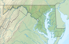 Location of the Chicamacomico River within Maryland | |
| Location | |
| Country | United States |
| State | Maryland |
| County | Dorchester County |
| Physical characteristics | |
| Source | |
| • coordinates | 38.5938°N 75.8937°W |
| • elevation | 38 feet (12 m) |
| Mouth | |
• coordinates | 38.4279°N 75.9798°W |
• elevation | 0 feet (0 m) |
| Length | 16.3 miles (26.2 km) |
| Basin size | 51.6 square miles (134 km2) |
| Depth | |
| • minimum | 4 inches (10 cm) |
| • maximum | 11.5 feet (3.5 m) |
See also
- List of rivers in Maryland
References
- Total Maximum Daily Loads of Nitrogen and Phosphorus for the Chicamacomico River Dorchester, Maryland (PDF). Maryland Department of the Environment. 2000. pp. I-0 through I-4. Retrieved 30 January 2022.
- "National Hydrography Dataset high-resolution flowline data". U.S. Geological Survey. Retrieved 30 January 2022.
Текст в блоке "Читать" взят с сайта "Википедия" и доступен по лицензии Creative Commons Attribution-ShareAlike; в отдельных случаях могут действовать дополнительные условия.
Другой контент может иметь иную лицензию. Перед использованием материалов сайта WikiSort.org внимательно изучите правила лицензирования конкретных элементов наполнения сайта.
Другой контент может иметь иную лицензию. Перед использованием материалов сайта WikiSort.org внимательно изучите правила лицензирования конкретных элементов наполнения сайта.
2019-2026
WikiSort.org - проект по пересортировке и дополнению контента Википедии
WikiSort.org - проект по пересортировке и дополнению контента Википедии