geo.wikisort.org - Mountains

Search / Calendar

This is a list of mountains of the Swiss canton of Vaud. Vaud is partly mountainous and is one of the nine cantons having summits above 3,000 metres. It is also one of the two cantons (with Bern) extending over both the high Alps and the Jura. Topographically, the three most important summits of the canton are those of the Diablerets (most elevated), the Vanil Noir (most prominent) and Mont Tendre (most isolated).

All the highest mountains of the canton, such as the Grand Muveran (pictured), overlook Lake Geneva from the south.
Map all coordinates using: OpenStreetMap 
Download coordinates as: KML

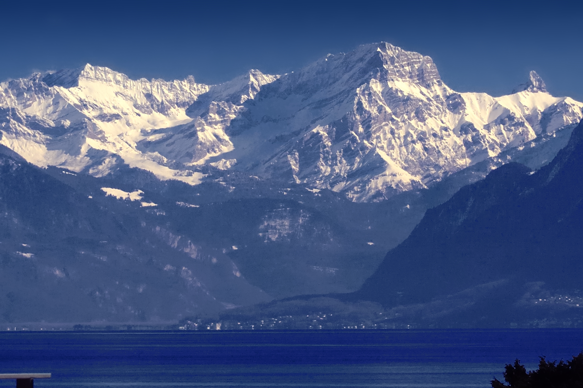
The first table lists the highest summits of the canton. It includes all summits above 2,800 metres with a topographic prominence of at least 30 metres (98 ft). The seconde table only includes significant summits with a topographic prominence of at least 150 metres (492 ft), but has no height cut-off. There are over 40 such summits in Vaud and they are mostly found in its westernmost and easternmost districts.[1] All mountain heights and prominences on the list are from the largest-scale maps available.[2]


Highest summits


Mountain Height (m) [2] Drop (m) Coordinates Range District(s) First ascent
Diablerets 3210 968 46°18′14″N 07°11′20″E Alps Aigle 1850
Oldenhorn 3123 295 46°19′45″N 07°13′18″E Alps Aigle
Grand Muveran 3051 1013 46°14′14″N 07°07′34″E Alps Aigle
Tête Ronde 3037 108 46°18′13″N 07°10′40″E Alps Aigle
Scex Rouge 2971 131 46°19′38″N 07°12′09″E Alps Aigle
Dent de Morcles 2969 465 46°11′57″N 07°04′32″E Alps Aigle 1787
Petite Dent de Morcles 2929 59 46°12′04″N 07°04′16″E Alps Aigle
Dent Favre 2917 315 46°12′37″N 07°06′14″E Alps Aigle
Tête à Pierre Grept 2904 165 46°15′10″N 07°09′19″E Alps Aigle
Tête Noire 2872 72 46°12′06″N 07°05′18″E Alps Aigle
Tête aux Veillons 2846 46 46°14′28″N 07°08′41″E Alps Aigle
Petit Muveran 2810 265 46°13′25″N 07°07′21″E Alps Aigle

Main list


Mountain Height (m) [2] Drop (m) Coordinates Range District(s) First[3]
ascent
Diablerets 3210 968 46°18′14″N 07°11′20″E Alps Aigle 1850
Oldenhorn 3123 295 46°19′45″N 07°13′18″E Alps Aigle
Grand Muveran 3051 1013 46°14′14″N 07°07′34″E Alps Aigle
Dent de Morcles 2969 465 46°11′57″N 07°04′32″E Alps Aigle 1787
Dent Favre 2917 315 46°12′37″N 07°06′14″E Alps Aigle
Tête à Pierre Grept 2904 165 46°15′10″N 07°09′19″E Alps Aigle
Petit Muveran 2810 265 46°13′25″N 07°07′21″E Alps Aigle
Le Tarent 2548 1002 46°22′56″N 07°08′51″E Alps Aigle/Riviera-Pays-d'Enhaut
Gummfluh 2458 574 46°26′26″N 07°11′42″E Alps Riviera-Pays-d'Enhaut
L'Argentine (Haute Pointe) 2422 393 46°16′24″N 07°07′51″E Alps Aigle
Vanil Noir 2389 1110 46°31′43″N 07°08′54″E Alps Riviera-Pays-d'Enhaut
Cape au Moine 2352 199 46°22′50″N 07°10′16″E Alps Aigle/Riviera-Pays-d'Enhaut
Wittenberghorn 2350 465 46°32′56″N 07°01′02″E Alps Riviera-Pays-d'Enhaut
Tour d'Aï 2331 886 46°22′20″N 07°00′02″E Alps Aigle
Tour de Mayen 2326 186 46°22′28″N 07°00′30″E Alps Aigle
Pointe des Savolaires 2294 183 46°14′07″N 07°05′10″E Alps Aigle
Le Rubli 2285 251 46°27′47″N 07°12′39″E Alps Riviera-Pays-d'Enhaut
Dent de Savigny 2252 848 46°32′59″N 07°13′36″E Alps Riviera-Pays-d'Enhaut
Dent de Ruth 2236 186 46°33′14″N 07°14′13″E Alps Riviera-Pays-d'Enhaut
Gros Van 2189 528 46°23′47″N 07°04′09″E Alps Aigle
Tête à Josué 2133 255 46°24′17″N 07°10′09″E Alps Riviera-Pays-d'Enhaut
Le Chamossaire 2112 377 46°19′36″N 07°03′41″E Alps Aigle
Rocher du Midi 2097 240 46°26′37″N 07°09′11″E Alps Riviera-Pays-d'Enhaut
Dent de Combette 2082 242 46°31′39″N 07°12′14″E Alps Riviera-Pays-d'Enhaut
Rochers de Naye 2042 590 46°25′55″N 06°58′34″E Alps Aigle/Riviera-Pays-d'Enhaut
Chaux Ronde 2028 223 46°19′23″N 07°05′33″E Alps Aigle
Pointe d'Aveneyre 2026 405 46°25′02″N 07°00′17″E Alps Aigle
Dent de Corjon 1967 579 46°27′00″N 07°02′09″E Alps Riviera-Pays-d'Enhaut
Cape au Moine 1941 150 46°28′13″N 06°58′44″E Alps Riviera-Pays-d'Enhaut
Malatraix 1931 131 46°23′51″N 06°58′30″E Alps Aigle
Planachaux 1925 287 46°26′39″N 07°03′17″E Alps Riviera-Pays-d'Enhaut
Corne des Brenlaires 1879 204 46°24′46″N 07°08′16″E Alps Riviera-Pays-d'Enhaut
Les Rodomonts 1878 218 46°30′26″N 07°13′35″E Alps Riviera-Pays-d'Enhaut
Le Molard 1752 176 46°29′03″N 06°57′36″E Alps Riviera-Pays-d'Enhaut
Monts Chevreuils 1749 259 46°26′04″N 07°05′03″E Alps Riviera-Pays-d'Enhaut
Mont Tendre 1679 451 46°35′41″N 06°18′36″E Jura Mountains Morges
La Laitemaire 1678 283 46°29′26″N 07°09′46″E Alps Riviera-Pays-d'Enhaut
La Dôle 1677 355 46°25′30″N 06°05′58″E Jura Mountains Nyon
Chasseron 1607 590 46°51′06″N 06°32′19″E Jura Mountains Jura-Nord vaudois
Le Suchet 1588 435 46°46′21″N 06°27′58″E Jura Mountains Jura-Nord vaudois
Le Noirmont 1567 237 46°29′03″N 06°06′57″E Jura Mountains Nyon
Aiguilles de Baulmes 1559 280 46°47′28″N 06°28′20″E Jura Mountains Jura-Nord vaudois
Dent de Vaulion 1483 339 46°41′05″N 06°21′00″E Jura Mountains Jura-Nord vaudois
Mont Risoux 1419 169 46°39′39″N 06°14′32″E Jura Mountains Jura-Nord vaudois
Les Pléiades 1397 242 46°29′23″N 06°54′47″E Alps Riviera-Pays-d'Enhaut
Mont Pèlerin 1080 327 46°29′49″N 06°49′09″E Alps Riviera-Pays-d'Enhaut
Montagne du Château 929 249 46°34′51″N 06°42′47″E Jorat Lausanne/Lavaux-Oron
Mont de Gourze 924 204 46°30′40″N 06°44′26″E Swiss Plateau Lavaux-Oron

References


  1. Christian Thöni, Directory of the mountains of Switzerland
  2. All mountain heights and prominences are from the 1:25,000 Swisstopo topographic maps.
  3. The three main sources for first ascent data are:
    For the Western Alps; W.A.B. Coolidge, The Alps in nature and history, Methuen & Co, London, 1908.
    For the Central Alps; Gottlieb Studer, Über Eis und Schnee: Die höchsten Gipfel der Schweiz und die Geschichte ihrer Besteigung, Volumes 1-3, Schmid & Francke, Bern, 1896-1899.
    For the Eastern Alps: Die Erschließung der Ostalpen, Volumes 1-3, German and Austrian Alpine Club, Berlin, 1894.
    Given are the years for the first recorded ascents. In many cases local people or surveyors made earlier ascents. In particular, chamois and ibex hunters are expected to have reached many summits. Years in italics indicate that it is known that an earlier ascent was made, for example by the presence of artifacts on top or the summit's prior use as a triangulation point.


Текст в блоке "Читать" взят с сайта "Википедия" и доступен по лицензии Creative Commons Attribution-ShareAlike; в отдельных случаях могут действовать дополнительные условия.

Другой контент может иметь иную лицензию. Перед использованием материалов сайта WikiSort.org внимательно изучите правила лицензирования конкретных элементов наполнения сайта.

2019-2024
WikiSort.org - проект по пересортировке и дополнению контента Википедии