geo.wikisort.org - Mountains
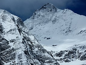
The Vanil Noir (French: [vanil nwaʁ]; local Arpitan: Vani Né [vaˈni ˈne] (![]() listen)) is a mountain of the Fribourg Prealps, located on the border between the cantons of Fribourg and Vaud in western Switzerland. Reaching a height of 2,389 metres above sea level, the Vanil Noir is the highest summit of the canton of Fribourg and of the Alpine foothills lying north of the Saane and Simme (or northwest of the Saanenmöser Pass). It is also the northernmost point in the canton of Vaud above 2,300 metres and the most prominent summit of both cantons.[3]
listen)) is a mountain of the Fribourg Prealps, located on the border between the cantons of Fribourg and Vaud in western Switzerland. Reaching a height of 2,389 metres above sea level, the Vanil Noir is the highest summit of the canton of Fribourg and of the Alpine foothills lying north of the Saane and Simme (or northwest of the Saanenmöser Pass). It is also the northernmost point in the canton of Vaud above 2,300 metres and the most prominent summit of both cantons.[3]
| Vanil Noir | |
|---|---|
 The south side | |
| Highest point | |
| Elevation | 2,389 m (7,838 ft) |
| Prominence | 1,110 m (3,640 ft)[1] |
| Parent peak | Mont Blanc |
| Isolation | 10.4 km (6.5 mi)[2] |
| Listing | Canton high point |
| Coordinates | 46°31′42.5″N 7°8′54.1″E |
| Geography | |
| Location | Canton of Fribourg/Vaud, Switzerland |
| Parent range | Fribourg Alps |
| Geology | |
| Mountain type | Limestone |
The Vanil Noir is the culminating point of the range separating the regions of Gruyère and Pays-d'Enhaut, although it is followed by the almost equally high Vanil de l'Ecri and Pointe de Paray. With these two mountains, it forms a large cirque on the south and east side, overlooking the alp of Paray Doréna. On the west side, it consists of a smaller cirque, overlooking the alp of Bounavau. On the northeast side it overlooks the valley of Les Morteys. All three valleys descending from the Vanil Noir are part of the Saane drainage basin.
The closest localities are Grandvillard (Fribourg) and Château d'Oex (Vaud). Several vertiginous trails lead to the summit, and cross it from north to south. The Vanil Noir is part of a nature reserve since 1983.
See also
- List of mountains of Switzerland
- List of mountains of Vaud
- List of most isolated mountains of Switzerland
References
- Retrieved from the Swisstopo topographic maps. The key col is the Saanenmöser Pass (1,279 m).
- Retrieved from Google Earth. The nearest point of higher elevation is north of the Gummfluh.
- Despite being significantly lower the Diablerets in the high Alps, the highest summit of the canton of Vaud.
External links
![]() Media related to Vanil Noir at Wikimedia Commons
Media related to Vanil Noir at Wikimedia Commons
На других языках
[de] Vanil Noir
Der Vanil Noir (Freiburger Patois Vani-Né?/i) ist mit 2389 m ü. M. der höchste Berggipfel der Freiburger Voralpen in der Schweiz. Über den Berggrat verläuft die Grenze zwischen den Kantonen Freiburg und Waadt. Der Name Vanil ist ein Ausdruck des freiburgischen Patois, bedeutet so viel wie Fels, felsiger Gipfel und geht ursprünglich auf das gallische Wort vanno (Abhang, Gipfel) zurück.- [en] Vanil Noir
[fr] Vanil Noir
Le Vanil Noir est un sommet des Préalpes fribourgeoises culminant à 2 389 mètres d'altitude, situé sur la frontière entre le canton de Fribourg et le canton de Vaud en Suisse. Il s'agit du plus haut sommet du canton de Fribourg.[it] Vanil Noir
Il Vanil Noir (2.389 m s.l.m.) è una montagna delle Prealpi di Vaud e Friburgo nelle Prealpi Svizzere. È la montagna più alta delle Prealpi di Friburgo.Другой контент может иметь иную лицензию. Перед использованием материалов сайта WikiSort.org внимательно изучите правила лицензирования конкретных элементов наполнения сайта.
WikiSort.org - проект по пересортировке и дополнению контента Википедии

