geo.wikisort.org - Mountains
This article comprises four sortable tables of mountain summits of Canada that are the higher than any other point north or south of their latitude or east or west their longitude in Canada.

The summit of a mountain or hill may be measured in three principal ways:
- The topographic elevation of a summit measures the height of the summit above a geodetic sea level.[1]
- The topographic prominence of a summit is a measure of how high the summit rises above its surroundings.[2][3][1]
- The topographic isolation (or radius of dominance) of a summit measures how far the summit lies from its nearest point of equal elevation.[4]
Northernmost high summits
Southernmost high summits
Easternmost high summits
Westernmost high summits
Mount Saint Elias and Mount Logan are the two highest summits of Canada.
| Rank | Mountain peak | Province or Territory | Mountain range | Elevation | Prominence | Isolation | Location |
|---|---|---|---|---|---|---|---|
| 2 | Mount Saint Elias[44][45][lower-alpha 31] | Saint Elias Mountains | 5489 m 18,009 ft | 3429 m 11,250 ft | 41.3 km 25.6 mi |
60.2927°N 140.9307°W | |
| 1 | Mount Logan[23][24][lower-alpha 14] | Saint Elias Mountains | 5956 m 19,541 ft | 5247 m 17,215 ft | 623 km 387 mi |
60.5671°N 140.4055°W |
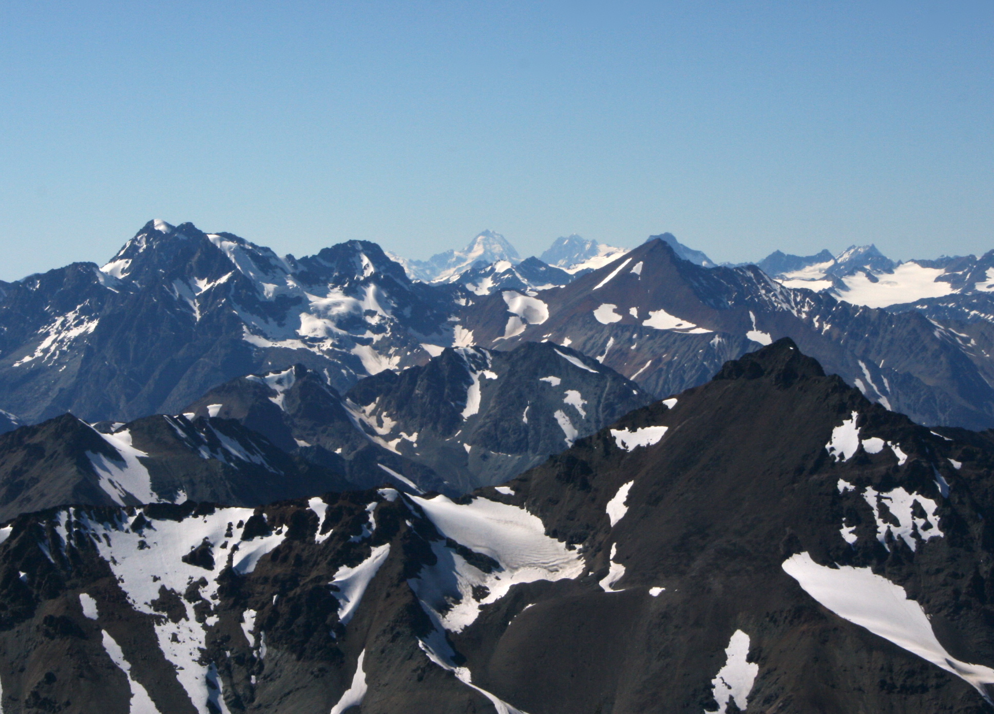
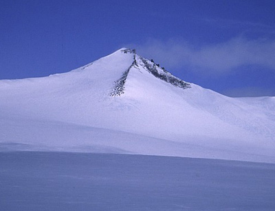
Gallery
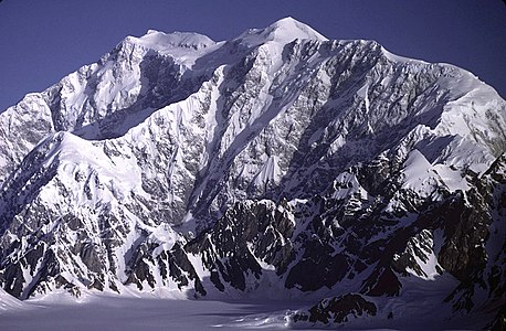 Mount Logan in Yukon is the highest summit of Canada.
 Mount Saint Elias is the second highest summit of both Canada and the United States.
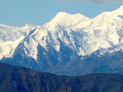 Mount Lucania in Yukon is the highest summit of the northern Saint Elias Mountains.
 Mount Steele in Yukon is the fifth highest summit of Canada.
 Mount Fairweather on the Alaska border is the highest summit of British Columbia.
 Mount Waddington is the highest summit of the Coast Mountains of British Columbia.
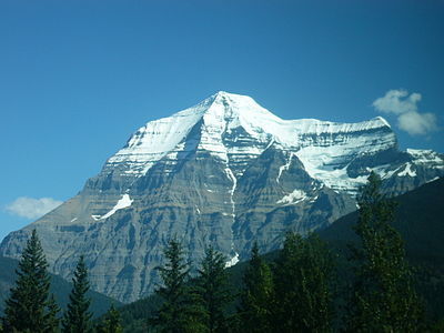 Mount Robson in British Columbia is the highest summit of the Canadian Rockies.
 Mount Columbia on the British Columbia border is the highest summit of Alberta.
 Mount Assiniboine on the Great Divide.
 Keele Peak is the highest summit of the Mackenzie Mountains of Yukon.
 Barbeau Peak is the highest summit of Ellesmere Island and Nunavut.
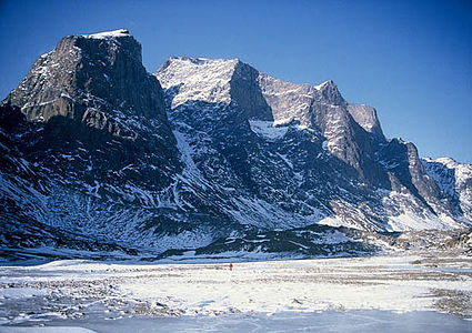 Mount Odin is the highest summit of Baffin Island.
 The Cabox is the highest summit of Newfoundland.
 Gros Morne on Newfoundland.


See also
- List of mountain peaks of North America
- List of mountain peaks of Greenland
- List of mountain peaks of Canada
- List of the highest major summits of Canada
- List of the major 4000-metre summits of Canada
- List of the major 3000-metre summits of Canada
- List of the most prominent summits of Canada
- List of the ultra-prominent summits of Canada
- List of the most isolated major summits of Canada
- List of extreme summits of Canada
- List of the highest major summits of Canada
- List of mountain peaks of the Rocky Mountains
- List of mountain peaks of the United States
- List of mountain peaks of México
- List of mountain peaks of Central America
- List of mountain peaks of the Caribbean
- Canada
- Geography of Canada
- Category:Mountains of Canada
- Geography of Canada
- Physical geography
- Topography
- Topographic elevation
- Topographic prominence
- Topographic isolation
- Topography
Notes
- The summit of Barbeau Peak is the highest point of Ellesmere Island and Nunavut of Canada.
- Barbeau Peak is the northernmost ultra-prominent summit of Canada and greater North America.
- The summit of Mount Macdonald is the highest point of the Bonnet Plume Mountains.
- Mount Macdonald is the northernmost summit of its elevation in Canada.
- The summit of Keele Peak is the highest point of the Mackenzie Mountains.
- Keele Peak is the northernmost summit of its elevation in Canada.
- Mount Craig is the northernmost 4000-meter (13,123-foot) summit of Canada.
- Avalanche Peak is the northernmost summit of its elevation in Canada.
- Mount Strickland is the northernmost summit of its elevation in Canada.
- Mount Wood is the northernmost summit of its elevation in Canada.
- Mount Steele is the northernmost and easternmost 5000-meter (16,404-foot) summit of Canada.
- The summit of Mount Lucania is the highest point of the northern Saint Elias Mountains.
- Mount Lucania is the northernmost summit of its elevation in Canada.
- The summit of Mount Logan is the highest point of the Saint Elias Mountains, Yukon, and all of Canada.
- The summit of White Hill is the highest point of Cape Breton Island and the Canadian Province of Nova Scotia.
- White Hill is the southernmost 500-meter (1640-foot) summit of Canada.
- The summit of Mont Raoul-Blanchard is the highest point of the Laurentian Mountains.
- Mont Raoul-Blanchard is the southernmost 1000-meter (3281-foot) summit of Canada.
- The summit of Mont Jacques-Cartier is the highest point of the Canadian Appalachians.
- Mont Jacques-Cartier is the southernmost summit of its elevation in Canada.
- The summit of Silvertip Mountain is the highest point of the Hope Mountains.
- Silvertip Mountain is the southernmost ultra-prominent summit of Canada.
- The summit of Cond Peak is the highest point of the Kokanee Range.
- Cond Peak is the southernmost summit of its elevation in Canada.
- Gladsheim Peak is the southernmost summit of its elevation in Canada.
- Mount Harrison is the southernmost and easternmost 3000-meter (9843-foot) summit of Canada.
- Mount Assiniboine is the southernmost and easternmost summit of its elevation in Canada.
- The summit of Mount Waddington is the highest point of the Coast Mountains.
- Mount Waddington is the southernmost and easternmost 4000-meter (13,123-foot) summit of Canada.
- Mount Fairweather lies on the international border between Alaska and British Columbia. The peak is the highest point of the Canadian Province of British Columbia and the southernmost and easternmost summit of its elevation in both Canada and the United States.
- Mount Saint Elias is the second highest major summit of both Canada and the United States.
- Gros Morne is the easternmost 500-meter (1640-foot) summit of Canada.
- The summit of The Cabox is the highest point of the island of Newfoundland.
- The Cabox is the easternmost summit of its elevation in Canada.
- Mealy Mountains high point is the easternmost 1000-meter (3281-foot) summit of Canada.
- The summit of Brave Mountain is the highest point of the Kaumajet Mountains.
- Brave Mountain is the easternmost summit of its elevation in Canada.
- Angna Mountain is the easternmost ultra-prominent summit of Canada.
- Touak Peak is the easternmost summit of its elevation in Canada.
- Tupeq Mountain is the easternmost 2000-meter (6562-foot) summit of Canada.
- The summit of Mount Odin is the highest point of Baffin Island.
- Mount Odin is the easternmost summit of its elevation in Canada.
- Mount Joffre is the easternmost summit of its elevation in Canada.
- The summit of Mount Forbes is the highest point of the entire Hudson Bay drainage basin.
- Mount Forbes is the easternmost summit of its elevation in Canada.
- North Twin Peak is the easternmost summit of its elevation in Canada.
- Mount Columbia on the Great Divide between British Columbia and Alberta is the highest point of the Columbia Icefield, the Province of Alberta, and the entire Beaufort Sea Drainage basin.
- The summit of Mount Robson is the highest point of the Canadian Rockies.
- Mount Robson is the easternmost summit of its elevation in Canada and the northernmost and westernmost summit of its elevation in the Rocky Mountains.
- Mount Vancouver is the easternmost summit of its elevation in Canada.
References
- If the elevation or prominence of a summit is calculated as a range of values, the arithmetic mean is shown.
- The topographic prominence of a summit is the topographic elevation difference between the summit and its highest or key col to a higher summit. The summit may be near its key col or quite far away. The key col for Denali in Alaska is the Isthmus of Rivas in Nicaragua, 7642 kilometers (4749 miles) away.
- This article defines a significant summit as a summit with at least 100 meters (328.1 feet) of topographic prominence, and a major summit as a summit with at least 500 meters (1640 feet) of topographic prominence. All summits in this article have at least 500 meters of topographic prominence. An ultra-prominent summit is a summit with at least 1500 meters (4921 feet) of topographic prominence.
- The topographic isolation of a summit is the great-circle distance to its nearest point of equal elevation.
- "Barbeau Peak". Peakbagger.com. Retrieved 4 May 2016.
- "Barbeau Peak". Bivouac.com. Retrieved 4 May 2016.
- "Mount Macdonald". Peakbagger.com. Retrieved 4 May 2016.
- "Mount Macdonald". Bivouac.com. Retrieved 4 May 2016.
- "Keele Peak". Peakbagger.com. Retrieved 4 May 2016.
- "Keele Peak". Bivouac.com. Retrieved 4 May 2016.
- "Mount Craig". Peakbagger.com. Retrieved 4 May 2016.
- "Mount Craig". Bivouac.com. Retrieved 4 May 2016.
- "Avalanche Peak". Peakbagger.com. Retrieved 4 May 2016.
- "Avalanche Peak". Bivouac.com. Retrieved 4 May 2016.
- "Mount Strickland". Peakbagger.com. Retrieved 4 May 2016.
- "Mount Strickland". Bivouac.com. Retrieved 4 May 2016.
- "Mount Wood". Peakbagger.com. Retrieved 4 May 2016.
- "Mount Wood". Bivouac.com. Retrieved 4 May 2016.
- "Mount Steele". Peakbagger.com. Retrieved 4 May 2016.
- "Mount Steele". Bivouac.com. Retrieved 4 May 2016.
- "Mount Lucania". Peakbagger.com. Retrieved 4 May 2016.
- "Mount Lucania". Bivouac.com. Retrieved 4 May 2016.
- "Mount Logan". Peakbagger.com. Retrieved 4 May 2016.
- "Mount Logan". Bivouac.com. Retrieved 4 May 2016.
- "White Hill". Peakbagger.com. Retrieved 4 May 2016.
- "Mont Raoul-Blanchard". Peakbagger.com. Retrieved 4 May 2016.
- "Mont Raoul-Blanchard". Bivouac.com. Retrieved 4 May 2016.
- "Mont Jacques-Cartier". Peakbagger.com. Retrieved 4 May 2016.
- "Mont Jacques-Cartier". Bivouac.com. Retrieved 4 May 2016.
- "Silvertip Mountain". Peakbagger.com. Retrieved 4 May 2016.
- "Silvertip Mountain". Bivouac.com. Retrieved 4 May 2016.
- "Cond Peak". Peakbagger.com. Retrieved 4 May 2016.
- "Cond Peak". Bivouac.com. Retrieved 4 May 2016.
- "Gladsheim Peak". Peakbagger.com. Retrieved 4 May 2016.
- "Gladsheim Peak". Bivouac.com. Retrieved 4 May 2016.
- "Mount Harrison". Peakbagger.com. Retrieved 4 May 2016.
- "Mount Harrison". Bivouac.com. Retrieved 4 May 2016.
- "Mount Assiniboine". Peakbagger.com. Retrieved 4 May 2016.
- "Mount Assiniboine". Bivouac.com. Retrieved 4 May 2016.
- "Mount Waddington". Peakbagger.com. Retrieved 4 May 2016.
- "Mount Waddington". Bivouac.com. Retrieved 4 May 2016.
- "Mount Fairweather". Peakbagger.com. Retrieved 4 May 2016.
- "Mount Fairweather". Bivouac.com. Retrieved 4 May 2016.
- "Mount Saint Elias". Peakbagger.com. Retrieved 4 May 2016.
- "Mount Saint Elias". Bivouac.com. Retrieved 4 May 2016.
- "Gros Morne". Peakbagger.com. Retrieved 4 May 2016.
- "Gros Morne". Bivouac.com. Retrieved 4 May 2016.
- "The Cabox". Peakbagger.com. Retrieved 4 May 2016.
- "The Cabox". Bivouac.com. Retrieved 4 May 2016.
- "Mealy Mountains high point". Peakbagger.com. Retrieved 4 May 2016.
- "Brave Mountain". Peakbagger.com. Retrieved 4 May 2016.
- "Brave Mountain". Bivouac.com. Retrieved 4 May 2016.
- "Angna Mountain". Peakbagger.com. Retrieved 4 May 2016.
- "Angna Mountain". Bivouac.com. Retrieved 4 May 2016.
- "Touak Peak". Peakbagger.com. Retrieved 4 May 2016.
- "Touak Peak". Bivouac.com. Retrieved 4 May 2016.
- "Tupeq Mountain". Peakbagger.com. Retrieved 4 May 2016.
- "Tupeq Mountain". Bivouac.com. Retrieved 4 May 2016.
- "Mount Odin". Peakbagger.com. Retrieved 4 May 2016.
- "Mount Odin". Bivouac.com. Retrieved 4 May 2016.
- "Mount Joffre". Peakbagger.com. Retrieved 4 May 2016.
- "Mount Joffre". Bivouac.com. Retrieved 4 May 2016.
- "Mount Forbes". Peakbagger.com. Retrieved 4 May 2016.
- "Mount Forbes". Bivouac.com. Retrieved 4 May 2016.
- "North Twin Peak". Peakbagger.com. Retrieved 4 May 2016.
- "North Twin Peak". Bivouac.com. Retrieved 4 May 2016.
- "Mount Columbia". Peakbagger.com. Retrieved 4 May 2016.
- "Mount Columbia". Bivouac.com. Retrieved 4 May 2016.
- "Mount Robson". Peakbagger.com. Retrieved 4 May 2016.
- "Mount Robson". Bivouac.com. Retrieved 4 May 2016.
- "Mount Vancouver". Peakbagger.com. Retrieved 4 May 2016.
- "Mount Vancouver". Bivouac.com. Retrieved 4 May 2016.
External links
Mountains of Canada at Wikipedia's sister projects
 Definitions from Wiktionary
 Media from Commons
 News from Wikinews
 Quotations from Wikiquote
 Texts from Wikisource
 Textbooks from Wikibooks
 Resources from Wikiversity
Canada | |||||
|---|---|---|---|---|---|
| History |
| ||||
| Provinces and territories |
| ||||
| Government |
| ||||
| Politics |
| ||||
| Geography |
| ||||
| Economy |
| ||||
| Society |
| ||||
| Demographics |
| ||||
| Culture |
| ||||
| Symbols |
| ||||
| Contents |
| ||||
| Research |
| ||||
| |||||
Текст в блоке "Читать" взят с сайта "Википедия" и доступен по лицензии Creative Commons Attribution-ShareAlike; в отдельных случаях могут действовать дополнительные условия.
Другой контент может иметь иную лицензию. Перед использованием материалов сайта WikiSort.org внимательно изучите правила лицензирования конкретных элементов наполнения сайта.
Другой контент может иметь иную лицензию. Перед использованием материалов сайта WikiSort.org внимательно изучите правила лицензирования конкретных элементов наполнения сайта.
2019-2026
WikiSort.org - проект по пересортировке и дополнению контента Википедии
WikiSort.org - проект по пересортировке и дополнению контента Википедии