geo.wikisort.org - Mountains
White Hill[3] is a peak in the Cape Breton Highlands and is the highest elevation point in the province of Nova Scotia, Canada.[4]
| White Hill | |
|---|---|
 White Hill | |
| Highest point | |
| Elevation | 535 m (1,755 ft)[1] |
| Prominence | 535 m (1,755 ft)[2] |
| Isolation | 151.6 km (94.2 mi) |
| Listing | |
| Coordinates | 46°42′00″N 60°36′00″W |
| Geography | |
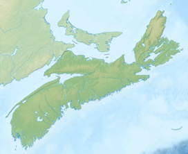
| Location | Victoria County, Nova Scotia |
| Parent range | Cape Breton Highlands |
| Topo map | NTS 11K10 Chéticamp River |
| Climbing | |
| Easiest route | Hike |
Located on the plateau 15 kilometres (9.3 mi) northwest of Ingonish and 33 kilometres (21 mi) northeast of Chéticamp, the peak is situated in the Cape Breton Highlands National Park and is accessible only by hiking. It is a remote, large flat hill, covered by small spruce trees rising from a marshy, barren, windswept upland about 20 kilometres (12 mi) from the nearest road and 10 kilometres (6.2 mi) from any maintained hiking trails.[2]
Survey monument
There is a first order Natural Resources Canada Geodetic Survey Division Station (Unique Number: 23105) on the summit, consisting of a marker, a brass/bronze disk, set in the top of a concrete pier on a small bedrock outcrop. There was a metal tower marking the site, but it was lying on the ground as of 2008. The station was surveyed and placed in June 1923 and the marker was renewed in 1963. The station was inspected by helicopter in 1976 and 1987.[5][6][7]
See also
References
- "Nova Scotia Geographical Names Database entry for "White Hill, County of Victoria" (includes map)". Government of Nova Scotia. Retrieved April 9, 2012.
- "White Hill, Nova Scotia". Peakbagger.com. Retrieved April 9, 2012.
- "Geographical Names Board of Canada Database entry for "White Hill, County of Victoria" (includes map)". Natural Resources Canada. Retrieved May 31, 2015.
- "White Hill". Nova Scotia GeoNAMES Explorer. Service Nova Scotia and Internal Services. Retrieved April 28, 2020.
- Canadian Spatial Reference System Station Report – North Barren, Natural Resources Canada, retrieved June 24, 2018
- North Barren Station Report / 219601, GeoNova (Province of Nova Scotia), retrieved June 24, 2018
- North Barren 19601 (PDF), GeoNova (Province of Nova Scotia), retrieved June 24, 2018
External links
- Atlas of Canada – Facts about mountains
- Peakbagger 1994 Summary of White Hill and surroundings (with photo)
- 2007 Summary of hike to White Hill and surroundings (with many photos)
- 2008 Summary of hike to White Hill and surroundings (with many photos)
На других языках
- [en] White Hill (Nova Scotia)
[fr] Colline White
La colline White (anglais : White Hill) est le point culminant de l'île du Cap-Breton et de la province canadienne de la Nouvelle-Écosse. Elle est située sur le plateau du Cap-Breton à 15 km au nord-ouest d'Ingonish et à 30 km au nord-est de Chéticamp. Elle se trouve dans le parc national des Hautes-Terres-du-Cap-Breton et n'est assessible que par randonnée.Другой контент может иметь иную лицензию. Перед использованием материалов сайта WikiSort.org внимательно изучите правила лицензирования конкретных элементов наполнения сайта.
WikiSort.org - проект по пересортировке и дополнению контента Википедии