geo.wikisort.org - Mountains
Sgurra Bhreac[3] (alternative spelling 'Sgurra Breac'), sometimes referred to as the Big Rock, is a Canadian peak in the East Bay Hills of Cape Breton Island, an extension of the Appalachian mountain chain in the province of Nova Scotia. Sgurra Bhreac is a prominent rock outcrop, rising 50 m (160 ft) from the northern edge of The Big Barren, between the Breac Brook and Glengarry Valleys, and is the highest point on Cape Breton Island south of the Bras d'Or Lake with its summit at 222 m (728 ft).

| Sgurra Bhreac | |
|---|---|
| the Big Rock | |
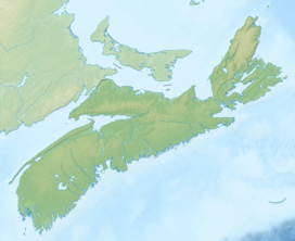
 Sgurra Bhreac lies in the East Bay Hills | |
| Highest point | |
| Elevation | 222 m (728 ft)[1] |
| Prominence | 212 m (696 ft)[2] |
| Coordinates | 45°55′42.88972″N 60°25′46.70739″W |
| Naming | |
| Etymology | name means spotted or pitted ridge or rock in Gaelic |
| Geography | |
 Sgurra Bhreac Cape Breton County, Nova Scotia, Canada  Sgurra Bhreac Sgurra Bhreac (Canada) | |
| Parent range | East Bay Hills |
| Topo map | NTS 11F16 Mira River |
| Climbing | |
| Easiest route | drive / hike |
Location
Thirty kilometres (19 miles) west of Sydney, inland of the community of Big Pond and 1 km (0.62 mi) southwest of East of Rock Lakes, the peak can be approached to within 1 km (0.62 mi) by back roads, either Glengarry Rd. (named "Spring Road" on older maps) to the south or a road (unnamed on current topographical maps) to the north passing through Rear Big Pond, which follows the Breac Brook Valley. The final approach to the peak is by hiking.
Name
Sgurra is a Gaelic term for “hill.” The form 'Sgurr' or 'Sgùrr na' is not uncommon as part of the name of a mountain in Scotland.[4] In Canada, however, its usage in geographical names is rare and generally only found in the province of Nova Scotia where it is a generic term for hill.[5] The name, Sgurra Bhreac, (pronunciation approximately "skoor ah brec") means spotted or pitted ridge or rock in Gaelic, speckled peak.[6]
The name, Sgurra Bhreac, was officially adopted for the big rock on 2 December 1924.[7] The Sgurra Breac, a local history / natural sciences newsletter published from 2004 to 2010, had adopted the name of the "Big Rock".
Survey monument
There is a first order Natural Resources Canada Geodetic Survey Division Station (Unique Number: 21139) on the summit, consisting of three markers. Two are brass/bronze disks and one is a copper survey bolt. This station was established sometime before 1921 as a fourth order station, and upgraded to first order in 1969/1970.[8][9][10]
Hiking / Geocaching
Sgurra Bhreac is a challenging but popular hiking/geocaching destination as the view from its summit is impressive. From here one can see Sydney, Glace Bay, the Bras d'Or Lake, the Mira River and most of the Mira area, Loch Lomond, the Atlantic Ocean, and many other lakes, ridges, valleys and bogs.[11]
References
- The Nova Scotia Atlas: Province of Nova Scotia. Government of Nova Scotia. 16 June 2006. p. 24, V2. ISBN 9780887807077. Retrieved 18 June 2018.
- "Sgurra Bhreac, Nova Scotia". Peakbagger.com. Retrieved 9 April 2012.
- Geographical Names of Canada - Sgurra Bhreac
- The Munros by Altitude, Walkhighlands, retrieved 23 June 2018
- Ratelle, Claudine; Herrera, Carolina; Poirier, Isabelle (2012). Glossary of generic terms in Canada's geographical names (PDF) (Terminology Bulletin No. 176) (in English and French) (2nd ed.). Ottawa: Public Works and Government Services Canada. p. 237. ISBN 978-1-100-54304-8. Retrieved 18 June 2018.
- Shamus Y., MacDonald, "Dh'fheumadh iad àit' a dheanamh" (They would have to make a Place): LAND AND BELONGING IN GAELIC NOVA SCOTIA, Memorial University of Newfoundland, p. 135, retrieved 11 December 2019
- Nova Scotia Geographical Names - Sgurra Bhreac (includes map), Government of Nova Scotia, retrieved 25 April 2020
- Canadian Spatial Reference System Station Report - Big Rock, Natural Resources Canada, retrieved 24 June 2018
- Station Report - Big Rock 219465, GeoNova (Province of Nova Scotia), retrieved 9 June 2014
- BIG ROCK 19465 (PDF), GeoNova (Province of Nova Scotia), archived from the original (PDF) on 2014-09-07, retrieved 9 June 2014
- Geocaching Home - Cache Details GC750D, Groundspeak, retrieved 30 January 2009
External links
- Nova Scotia Archives Library - Sgurra Breac. Big Pond, N.S. : (s.n.), 2004- .ill. ; 28 cm.
- A 360° panoramic view from the summit of Sgurra Bhreac, date created, 6/11/2012
This Cape Breton County, Nova Scotia location article is a stub. You can help Wikipedia by expanding it. |
Другой контент может иметь иную лицензию. Перед использованием материалов сайта WikiSort.org внимательно изучите правила лицензирования конкретных элементов наполнения сайта.
WikiSort.org - проект по пересортировке и дополнению контента Википедии