geo.wikisort.org - Island
Lolobau Island is an island in the Bismarck Sea, within the West New Britain Province of the Islands Region, in northern Papua New Guinea.

During World War II a number military actions occurred near Lolobau Island including in early 1943.[1] For example, on May 3, 1943 B-24 Liberator of the United States 5th Air forces attacked shipping near the island.[2]
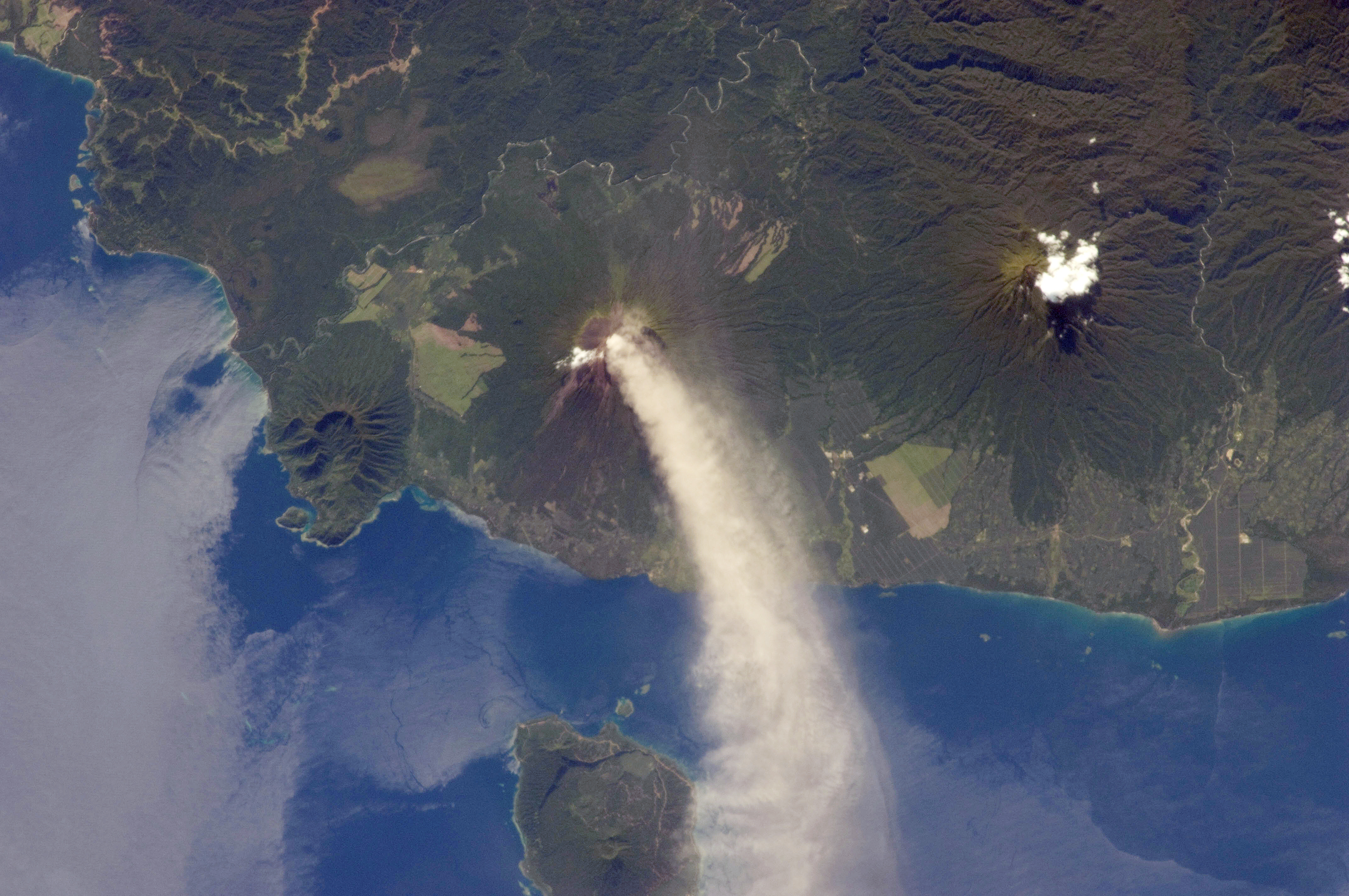
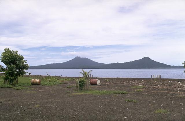
Lolobau Island is home to the Lolobau Volcano.[3] It is recorded as having erupted in the 20th century.[4]
Geography
It is a volcanic island of the Bismarck Archipelago group.
It is located just north of New Britain island in the archipelago. Ulawun is an active volcano across the strait from Lolobau Island.
See also
- Bismarck Archipelago topics
- Islands of Papua New Guinea
- List of volcanoes in Papua New Guinea
References
- PacificWrecks.com. "Pacific Wrecks". Retrieved 2018-01-24.
- PacificWrecks.com. "Pacific Wrecks". Retrieved 2018-01-24.
- "Lolobau". 27 April 2011.
- "Lolobau volcano, Papua New Guinea, Volcano Photo".
External links
This article about an island in Papua New Guinea is a stub. You can help Wikipedia by expanding it. |
На других языках
[de] Duportail
Duportail (auch Lolobau Island, Bassulasula, Namisoko, Namsoko) ist eine gering bewohnte Insel nördlich vor der Küste Neubritanniens im Bismarck-Archipel, die zu Papua-Neuguinea, Provinz West New Britain gehört und ein Gebiet von etwa 56 km² umfasst.- [en] Lolobau Island
Другой контент может иметь иную лицензию. Перед использованием материалов сайта WikiSort.org внимательно изучите правила лицензирования конкретных элементов наполнения сайта.
WikiSort.org - проект по пересортировке и дополнению контента Википедии