geo.wikisort.org - Mountains
Likuruanga is a stratovolcano in easternmost West New Britain Province on the island of New Britain, Papua New Guinea. Its low, dissected edifice contains a large volcanic crater that is breached to the north. The last known eruption from Likuruanga is prehistoric in age, having taken place during the Pleistocene epoch.[1]
| Likuruanga | |
|---|---|
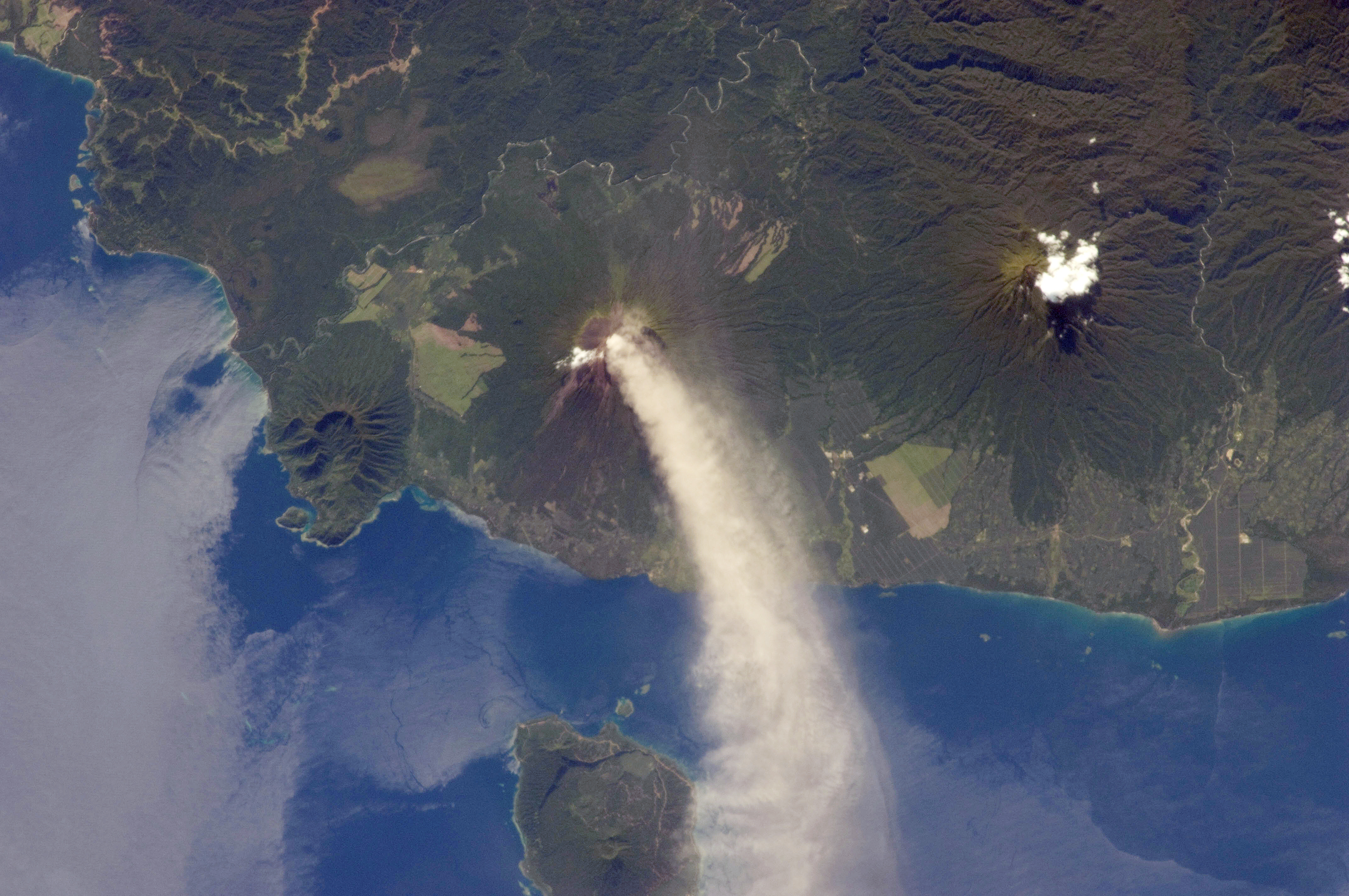 Left to right: Likuruanga, Ulawun and Bamus. Lolobau Island is at the bottom of image. | |
| Highest point | |
| Elevation | 904 m (2,966 ft) |
| Coordinates | 4.953°S 151.385°E |
| Geography | |
 Likuruanga Location in Papua New Guinea | |
| Location | West New Britain, Papua New Guinea |
| Geology | |
| Mountain type | Stratovolcano |
| Last eruption | Pleistocene |
A fatality occurred on Likuruanga's northern flank in September 2006 when a boy died in a hole at the village of Bakada. The cause of death was carbon dioxide asphyxiation.[1]
See also
References
- "Likuruanga". Global Volcanism Program. Smithsonian Institution. Retrieved 2020-11-01.
This West New Britain Province geography article is a stub. You can help Wikipedia by expanding it. |
На других языках
[de] Likuruanga
Der Vulkan Likuruanga (in der deutschen Kolonialzeit Nordsohn, englisch: North Son, genannt) liegt etwa 10 Kilometer nördlich des Vulkans Ulawun (bekannt unter dem Namen Vater, englisch: Father).[1] Der Likuruanga liegt unmittelbar an der Küste Neubritanniens, die sich an dessen Nordwestflanke befindet. Der andesitische Schichtvulkan ist dicht bewaldet.- [en] Likuruanga
Текст в блоке "Читать" взят с сайта "Википедия" и доступен по лицензии Creative Commons Attribution-ShareAlike; в отдельных случаях могут действовать дополнительные условия.
Другой контент может иметь иную лицензию. Перед использованием материалов сайта WikiSort.org внимательно изучите правила лицензирования конкретных элементов наполнения сайта.
Другой контент может иметь иную лицензию. Перед использованием материалов сайта WikiSort.org внимательно изучите правила лицензирования конкретных элементов наполнения сайта.
2019-2026
WikiSort.org - проект по пересортировке и дополнению контента Википедии
WikiSort.org - проект по пересортировке и дополнению контента Википедии