geo.wikisort.org - Island
Chuginadak Island (Aleut: Tanax̂ Angunax̂;[1] Russian: Чугинадак) is the largest island in the Islands of Four Mountains subgroup of the Aleutian archipelago. Chuginadak is an Aleutian name published by Captain Tebenkov in an 1852 map. According to Knut Bergsland's Aleut Dictionary, the Aleutian word "chugida-lix" means "to fry, to make sizzle." The Western half of the island is called Chuginadax in Aleut, meaning 'simmering'.[1]
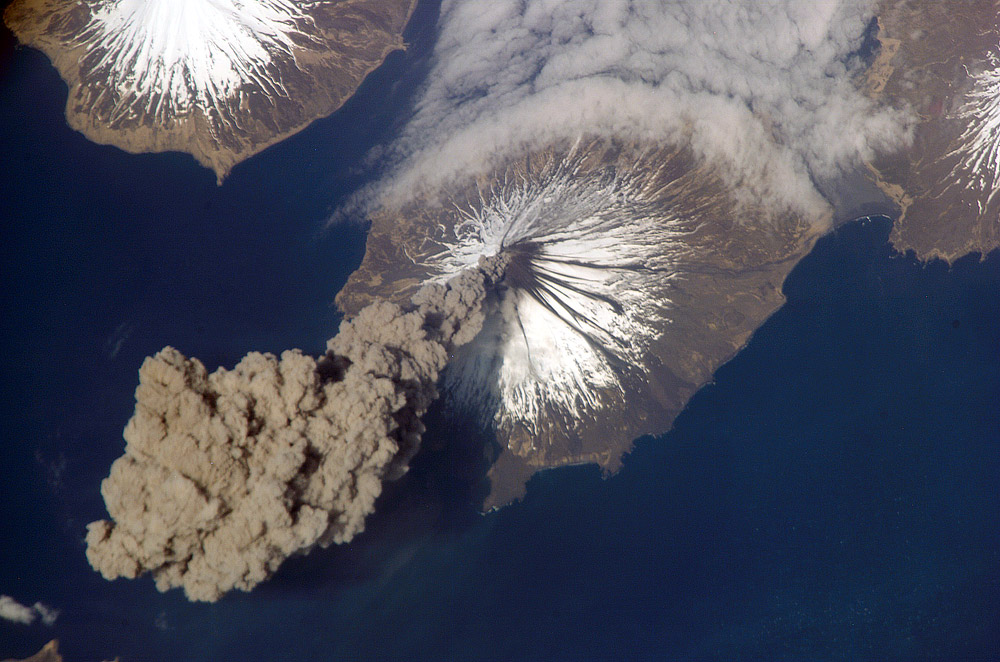 Mount Cleveland erupts in 2006. Taken from the International Space Station | |
| Geography | |
|---|---|
| Location | Aleutian Islands, Alaska, United States |
| Coordinates | 52°50′41″N 169°49′05″W |
| Archipelago | Islands of Four Mountains |
| Area | 64 sq mi (170 km2) |
| Highest elevation | 5,676 ft (1730 m) |
| Highest point | Mount Cleveland |
| Administration | |
United States | |
| Demographics | |
| Population | 0 |
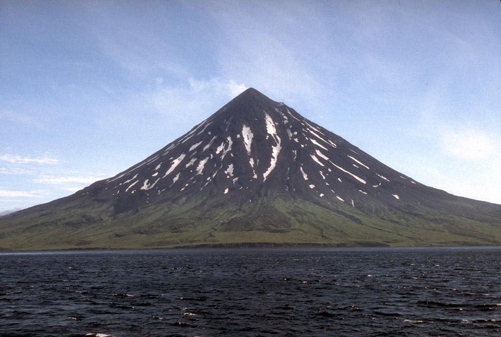
The island is approximately 14 by 6 miles (22.5 by 9.7 km) long[2] and the currently active[3] Mount Cleveland stratovolcano forms the entire western half of the land mass. A narrow strip of land separates the volcano from the rugged and lower eastern side of the island.[4]
The only major geographical place is Applegate Cove (2.5 miles across) (Chuguuĝix̂) on the Northern coast. The cove was named for Samuel Applegate, USC&GS, who commanded the schooner Nellie Juan during a survey of this area in the 1880s.[5]
References
- Bergsland, K. (1994). Aleut Dictionary. Fairbanks: Alaska Native Language Center.
- U.S. Geological Survey Geographic Names Information System: Chuginadak Island
- Astronomy Picture of the Day: "22 June 2010"
- Alaska Volcano Observatory - Mount Cleveland
- U.S. Geological Survey Geographic Names Information System: Applegate Cove
На других языках
[de] Chuginadak Island
Chuginadak Island (aleutisch: Tanax̂ Angunax̂) ist die zweitgrößte Insel der Islands of Four Mountains, einem Teil des alëutischen Archipels. Chuginadak ist ein alëutischer Name, der vom Kapitän Tebenkov 1852 in einer Karte erwähnt wurde. Nach R. H. Geoghegan bedeutet der alëutische Wortstamm „chugi“ so viel wie „zu braten“ oder „zu rösten“. Die westliche Hälfte der Insel wird in Aleut Chuginadax genannt.- [en] Chuginadak Island
[fr] Île Chuginadak
L'île Chuginadak (Tanax Angunax en Aléoute) est une des îles des Quatre-Montagnes dans les îles Aléoutiennes, Alaska, États-Unis. Chuginadak est un nom aléoute décrit pas le Capitaine Tebenkov dans une carte de 1852. Selon R.H. Geoghegan, Chugi signifie rotir.[it] Chuginadak
Chuginadak (in lingua aleutina Tanax Angunax[1], anche Khagamil, Kigamilyakh[2]) è la seconda maggiore isola del gruppo delle Four Mountains, nell'arcipelago delle Aleutine, e appartiene all'Alaska (USA). L'isola si trova 40 km ad ovest di Umnak, è lunga circa 23 km, ha una superficie di 166 km,² ed è disabitata.[ru] Чугинадак
Чугинадак (англ. Chuginadak Island, алеут. Tanax̂ Angunax̂[1]) — второй по величине остров в группе Четырёхсопочных островов, которые входят в состав Алеутских островов. В административном отношении является частью штата Аляска, США.Другой контент может иметь иную лицензию. Перед использованием материалов сайта WikiSort.org внимательно изучите правила лицензирования конкретных элементов наполнения сайта.
WikiSort.org - проект по пересортировке и дополнению контента Википедии