geo.wikisort.org - River
The Sakarya (Sakara River, Turkish: Sakarya Irmağı; Greek: Σαγγάριος, romanized: Sangarios; Latin: Sangarius) is the third longest river in Turkey. It runs through the region known in ancient times as Phrygia. It was considered one of the principal rivers of Asia Minor (Anatolia) in classical antiquity, and is mentioned in the Iliad[1] and in Theogony.[2] Its name appears in different forms as Sagraphos,[3] Sangaris,[4] or Sagaris.[5]

| Sakarya River | |
|---|---|
 | |
| Location | |
| Country | Turkey |
| Physical characteristics | |
| Source | |
| • location | Bayat Plateau |
| Mouth | |
• location | Black Sea |
| Length | 824 km (512 mi) |
| Basin size | 55,300 km2 (21,400 sq mi) |
| Discharge | |
| • average | 193 m3/s (6,800 cu ft/s) |
In Geographica, Strabo wrote during classical antiquity that the river had its sources on Mount Adoreus, near the town of Sangia in Phrygia, not far from the border with Galatia,[6] and flowed in a very tortuous course: first in an eastern, then toward the north, next the north-west and finally the north through Bithynia into the Euxine (Black Sea).
Part of its course formed the boundary between Phrygia and Bithynia, which in early times was bounded on the east by the river. The Bithynian part of the river was navigable and was celebrated for the abundance of fish found in it. Its principal tributaries were the Alander, the Bathys, the Thymbres and the Gallus.[7]
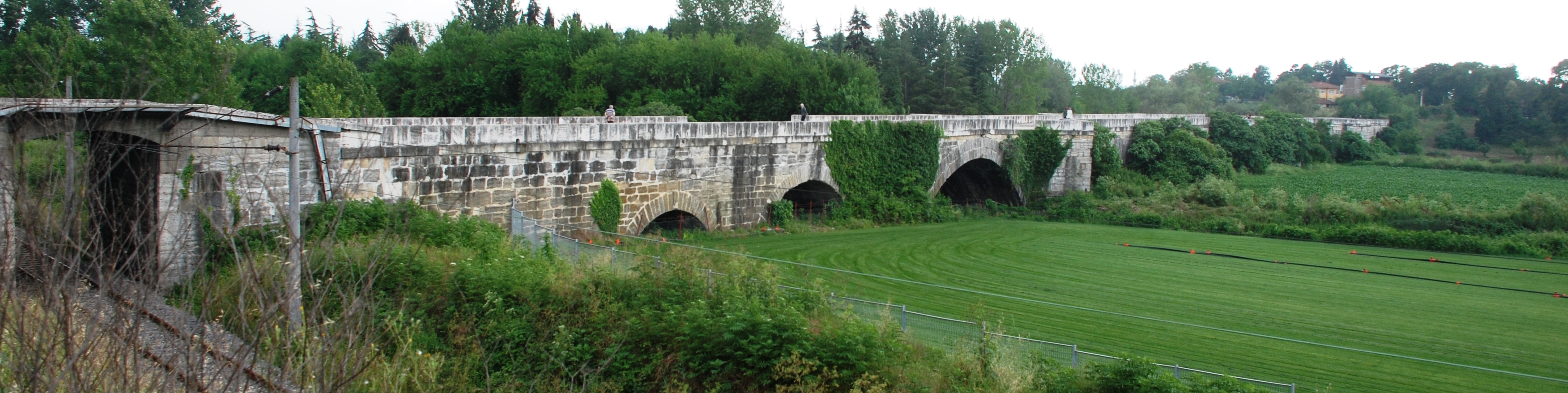
The source of the river is the Bayat Yaylası (Bayat Plateau), which northeast of Afyon. Joined by the Porsuk Çayı (Porsuk Creek), close to the town of Polatlı, the river runs through the Adapazarı Ovası (Adapazarı Plains) before it reaches the Black Sea. The Sakarya was once crossed by the Sangarius Bridge, constructed by Eastern Roman Emperor Justinian I (r. 527–565).
In the 13th century, the valley of the Sakarya was part of the border between the Eastern Roman Empire and the home of the Söğüt tribe. By 1280, Emperor Michael VIII Palaiologos had constructed a series of fortifications along the river to control the area, but a flood in 1302 changed the course of the river and made the fortifications useless.[8] The Söğüt tribe migrated across the river and later established the Ottoman Empire.
From downstream to upstream, the Sakarya has four dams: Akçay, Yenice, Gökçekaya and Sarıyar.
References
- Homer. Iliad. Vol. 3.187, 16.719.
- Hesiod, Theogony, 344.
- Schol. ad Apollon. Rhod. 2.724.
- Constantine VII, De Administrando Imperio 1.5
- Ovid, ex Pont. 4.10 17; Solin 43; Pliny. Naturalis Historia. Vol. 6.1.
- Strabo. Geographica. Vol. xii. p.543. Page numbers refer to those of Isaac Casaubon's edition.
- Periplus of Pseudo-Scylax, p. 34; Apollon. 2.724; Scymnus. 234, foil.; Strab. xii. pp. 563, 567; Dionys. Perieg. 811; Ptol. 5.1.6; Steph. B. sub voce Liv. 38.18; Plin. Nat. 5.43; Amm. Marc. 22.9.
- Imber, Colin. The Ottoman Empire, 1300-1650 : the structure of power (Third ed.). London. p. 6. ISBN 1352004968. OCLC 1034613389.
![]() This article incorporates text from a publication now in the public domain: Smith, William, ed. (1854–1857). "Sangarius". Dictionary of Greek and Roman Geography. London: John Murray.
This article incorporates text from a publication now in the public domain: Smith, William, ed. (1854–1857). "Sangarius". Dictionary of Greek and Roman Geography. London: John Murray.
See also
- Battle of Sakarya
- Sakarya Province
- Sangarius Bridge
- Nana (Greek mythology)
| Black Sea | |
|---|---|
| Marmara | |
| Aegean | |
| Mediterranean Sea | |
| Persian Gulf | |
| Caspian |
|
| |
This article related to a river in Turkey is a stub. You can help Wikipedia by expanding it. |
На других языках
[de] Sakarya (Fluss)
Der Sakarya (türkisch Sakarya Nehri; griechisch Σαγγάριος, lateinisch Sangarius, hethitisch: Šeḫirija[2]) ist ein Fluss in der Türkei. Er ist nach Euphrat und Kızılırmak der drittlängste Fluss des Landes.- [en] Sakarya River
[es] Río Sakarya
El río Sakarya (en turco, Sakarya Nehri; en griego, Σαγγάριος, Sangarios, latinizado Sangarius; también Σάγαρις, Sagaris) es un importante río de Turquía que discurre por la parte centroriental del Asia Menor y desemboca en el mar Negro. Es el río tercero en longitud del país y atraviesa la región histórica de Frigia.[it] Sakarya
Il Sakarya (in greco Σαγγάριος, in latino Sangarius, in italiano Sangario) è il terzo fiume più lungo della Turchia; attraversa l'Asia Minore e specificamente la regione che una volta era conosciuta come Frigia.[ru] Сакарья (река)
Сака́рья[1] (тур. Sakarya; также Сангарий: греч. Σαγγάριος, лат. Sangarius) — река в Северо-Западной части полуострова Малая Азия, впадает в Чёрное море. Основные притоки — Порсук, Анкара (на берегу которой расположена столица Турции Анкара). Несудоходна. В низовьях расположен город Адапазары.Другой контент может иметь иную лицензию. Перед использованием материалов сайта WikiSort.org внимательно изучите правила лицензирования конкретных элементов наполнения сайта.
WikiSort.org - проект по пересортировке и дополнению контента Википедии