geo.wikisort.org - River
The Gediz River (Turkish: Gediz Nehri, Turkish pronunciation: [ˈɡediz]) is the second-longest river in Anatolia flowing into the Aegean Sea. From its source of Mount Murat in Kütahya Province, it flows generally west for 401 km (249 mi) to the Gediz River Delta in the Gulf of İzmir.
| Gediz River | |
|---|---|
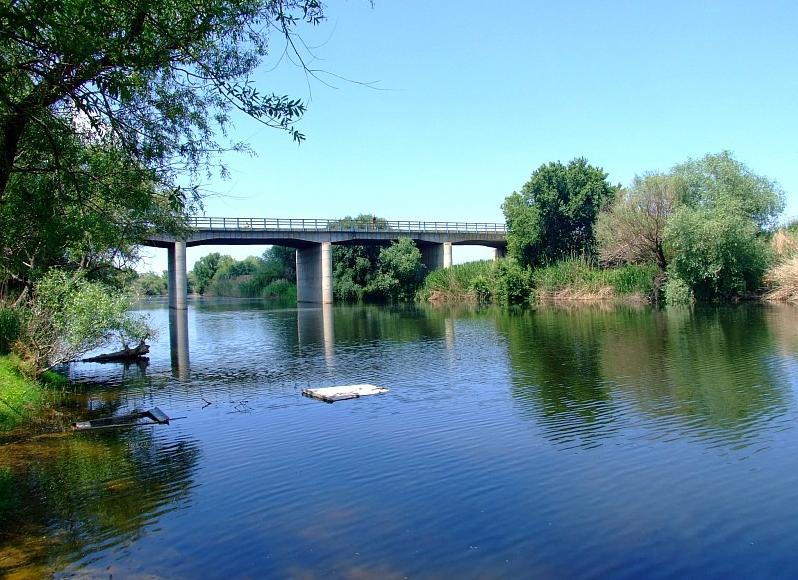 Gediz River in its downstream section crossing İzmir Province | |
| Location | |
| Country | Turkey |
| Physical characteristics | |
| Source | Mount Murat |
| • location | Kütahya Province |
| Mouth | Gediz River Delta |
• location | Foça, İzmir Province |
• coordinates | 38°35′18″N 26°48′57″E |
| Length | 401 km (249 mi) |
Name
The ancient Greek name of the river was Hermos (Ἕρμος), Latinized as Hermus.
The name of the river Gediz may be related to the Lydian proper name Cadys; Gediz is also the name of a town near the river's sources.[1] The name "Gediz" may also be encountered as a male given name in Turkey.
Ancient geography
The Gediz is one of the two candidates for the Hittite placename Seha River, the other being the Bakırçay.[2]
The Hermos separated Aeolia from Ionia, except for Ionic Phocaea, which was north of the Hermos. The valley of the Hermos was the heartland of the ancient Lydian Empire and overlooking the valley was the Lydian capital Sardis.
Location
In Turkey's Aegean Region, Gediz River's length is second only to Büyük Menderes River whose flow is roughly parallel at a distance of slightly more than a hundred kilometers to the south.
Gediz River rises from Murat Mountain and Şaphane Mountain in Kütahya Province and flows through Uşak, Manisa and İzmir Provinces. It joins the sea in the northern section of the Gulf of İzmir, close to the gulf's mouth, near the village of Yenibağarası in Foça district, south of the center of the district.
The Gediz Basin lies between northern latitudes of 38004’–39013’ and southern longitudes of 26042’–29045’. It covers 2.2% of the total area of Turkey. Larger part of the alluvial plain called under the same name as the river (Gediz Plain) is within the area of Manisa Province and a smaller downstream section within İzmir Province.
Environmental issues
The Gediz Delta is important as a nature reserve and is home to rare bird species.[3] However, the reserve suffers from water shortages due to heavy demands from irrigation projects, connected to the Demirköprü Dam.[4]
High level of urbanization and industrialization along its basin have caused the Gediz River to suffer severe pollution, particularly by sand and gravel quarries and leather industry. These factors contributed to the river's formerly rich fish reserves to become a thing of the past in recent years.
See also
- Battle of the Gediz, near the river, during the Turkish War of Independence
- Gediz (town)
- Hermus (mythology)
References
- The association with the nearly fully historical 8th century BC Lydian Cadys is made primarily in a number of Turkish sources
- Bryce, Trevor (2005). The Trojans and their Neighbours. Taylor & Francis. p. 86. ISBN 978-0-415-34959-8.
- "Gediz Delta". Ramsar Sites Information Service. Retrieved 25 April 2018.
- "Case study: Gediz River, Turkey". OPTIMA (Optimisation for Sustainable Water Resources Management).
| Black Sea | |
|---|---|
| Marmara | |
| Aegean | |
| Mediterranean Sea | |
| Persian Gulf | |
| Caspian |
|
| |
Authority control | |
|---|---|
| General |
|
| National libraries | |
На других языках
[de] Gediz
Der Gediz (auch Gediz Nehri), der antike Hermos, ist ein Fluss in der Türkei im westlichen Kleinasien und ist mit 405 km nach dem Großen Mäander das zweitlängste Gewässer der Region.- [en] Gediz River
[es] Gediz
El río Gediz (en turco, Gediz Nehri), el río Hermo de la antigüedad, es un río de Turquía, el segundo río más largo de los que discurren desde el interior de Anatolia y vierten en el mar Egeo, después del río Menderes.[it] Gediz
Il Gediz è un fiume della Turchia, che nasce nell'altopiano anatolico e sfocia nel mar Egeo dopo un percorso di circa 400 km. Il Gediz corrisponde all'antico Ermo, a cui era associata la figura mitologica che porta lo stesso nome.[ru] Гедиз
Геди́з[1] (тур. Gediz Nehri; в античности — Герм[2], др.-греч. Ἕρμος) — крупная река в Турции. Протекает по территории следующих илов: Измир, Маниса, Ушак и Кютахья[3].Другой контент может иметь иную лицензию. Перед использованием материалов сайта WikiSort.org внимательно изучите правила лицензирования конкретных элементов наполнения сайта.
WikiSort.org - проект по пересортировке и дополнению контента Википедии