geo.wikisort.org - River
Manavgat River originates on the eastern slopes of Western Taurus Mountains in Turkey. In ancient times it was called Melas (Ancient Greek: Μέλας).[1] At an elevation of 1,350 m, the outflow of several small springs joins together to become the headwaters of the Manavgat.[2] The largest of these springs is called Dumanli, whose name means "place where there is fog", because of the dense mist that forms above the spring.[2] In addition to the springs from the Taurus Mountains, the Manavgat is also fed underground from large lakes to the north of the mountains, on the Anatolian Plateau.[2] Pliny the Elder considered that the river was the boundary between ancient Pamphylia and Cilicia.[3]
| Manavgat River | |
|---|---|
 Manavgat River flowing over the Manavgat Waterfall | |
 | |
| Location | |
| Country | Turkey |
| Physical characteristics | |
| Mouth | |
• elevation | 1,350 m (4,430 ft) |
From there, the river flows south over conglomerated strata for about 90 km, descending through a series of canyons.[2] Finally, it washes over the Manavgat Waterfall and through the coastal plain and into the Mediterranean Sea. There are many caves in the river watershed area, the most interesting being the Altınbeşik cave.[4]
The maximum flow of the Manavgat River is 500 m³/second, with an average of 147 m³/second. Using the average flow as a measure, the Manavgat River accounts for a very small amount of the water flowing into the Mediterranean. There are two dams over the river: Oymapınar Dam and the Manavgat Dam.[5] Studies have shown that water drains into the Manavgat River basin from its surface watershed and also from endorheic basins, especially those to the east of the river.[6]
In 1992, the Turkish State Hydraulics Work (DSI) was given the job of developing a water supply project for domestic use from the Manavgat river.[5]
 Oymapinar reservoir
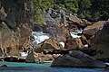 Oymapinar reservoir of Manavgat
 Traditional cruise ships for Manavgat
 Cruise ships for Manavgat
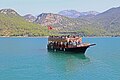


Footnotes
- Dictionary of Greek and Roman Geography (1854), William Smith, LLD, Ed., CILICIA
- Scheffel, Richard L.; Wernet, Susan J., eds. (1980). Natural Wonders of the World. United States of America: Reader's Digest Association, Inc. p. 225. ISBN 0-89577-087-3.
- Pliny. Naturalis Historia. Vol. 5.22.
- "Manavgat River". turkeyodyssey. Archived from the original on 2008-06-02. Retrieved 2008-02-16.
- "Manavgat River Water as a Limited but Alternative Water Resource for Domestic Use in Middle East" (PDF). Archived from the original (PDF) on 2008-02-27. Retrieved 2008-02-16.
- Ian Simmers (1987). Estimation of Natural Groundwater Recharge. Springer. ISBN 9789027726322. Retrieved 2008-02-16.
See also
External links
| Wikimedia Commons has media related to Manavgat. |
| Black Sea | |
|---|---|
| Marmara | |
| Aegean | |
| Mediterranean Sea | |
| Persian Gulf | |
| Caspian |
|
| |
This article related to a river in Turkey is a stub. You can help Wikipedia by expanding it. |
На других языках
[de] Manavgat (Fluss)
Manavgat (türkisch Manavgat Nehri) ist ein Fluss in der türkischen Provinz Antalya. Sein antiker griechischer Name ist Melas (Μέλας).- [en] Manavgat River
[it] Manavgat Nehri
Il fiume Manavgat è un fiume turco tagliato dalle dighe di Oymapınar e Manavgat. Ha la sua sorgente nel Tauro, quindi si dirige verso sud e si getta nel Mar di Levante dopo aver attraversato la città di Manavgat. Plinio il Vecchio situa il limite orientale della Cilicia sul fiume Manavgat che chiama Melas[ru] Манавгат (река)
Манавгат (тур. Manavgat Nehri) или Мелас (греч. Melas) — река в провинции Анталья, Турция.Другой контент может иметь иную лицензию. Перед использованием материалов сайта WikiSort.org внимательно изучите правила лицензирования конкретных элементов наполнения сайта.
WikiSort.org - проект по пересортировке и дополнению контента Википедии