geo.wikisort.org - River
The River Laneshaw is a river in Northern England. It runs for 1.9 miles (3 km) from Laneshaw Reservoir to Laneshaw Bridge alongside the A6068 road[1] and has a catchment area of 5.1 square miles (13.2 km2).[2]
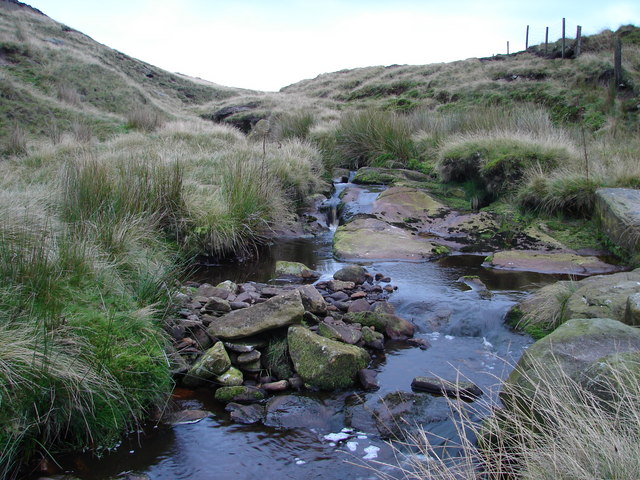
Rising as Laneshaw Brook on Combe Hill between the border of Lancashire and Yorkshire, the brook runs northwards, feeding first Laneshaw Reservoir then running westwards as the River Laneshaw.[3]
The River Laneshaw combines with Wycoller Beck at Covey Bridge to form Colne Water.[4]
References
- "103" (Map). Blackburn & Burnley (C2 ed.). 1:50,000. Landranger. Ordnance Survey. 2006. ISBN 978-0-319-22829-6.
- "Colne Water (Laneshaw)". Catchment Data Explorer. Environment Agency. Retrieved 16 October 2016.
- Hull, Edward; Dakyn, J R; Tiddeman, R H; Ward, J C; Gunn, W (1875). The geology of the Burnley Coalfield and of the country around Clitheroe, Blackburn, Preston, Chorley, Haslingden, and Todmorden. London: HMSO. p. 12. OCLC 315448672.
- Wilmore, A (2013). "6. Rivers". South Lancashire. Cambridge: Cambridge University Press. p. 24. ISBN 978-1-107-61616-5.
| Rivers |  | |
|---|---|---|
| Canals | ||
| Others |
| |
This Lancashire location article is a stub. You can help Wikipedia by expanding it. |
This West Yorkshire location article is a stub. You can help Wikipedia by expanding it. |
На других языках
[de] River Laneshaw
Der River Laneshaw ist ein Wasserlauf in Lancashire, England. Er entsteht als Laneshaw Brook aus dem Zusammenfluss mehrerer unbenannter kurzer Zuflüsse am südlichen Rand des Ickornshaw Moor und fließt in nördlicher Richtung und fließt durch das Laneshaw Reservoir bei dessen Verlassen er sich nach Westen wendet und den Namen River Laneshaw annimmt. Er fließt durch den Ort Laneshaw Bridge und bildet am Ostrand von Colne mit dem Wycoller Beck das Colne Water bildet.- [en] River Laneshaw
Текст в блоке "Читать" взят с сайта "Википедия" и доступен по лицензии Creative Commons Attribution-ShareAlike; в отдельных случаях могут действовать дополнительные условия.
Другой контент может иметь иную лицензию. Перед использованием материалов сайта WikiSort.org внимательно изучите правила лицензирования конкретных элементов наполнения сайта.
Другой контент может иметь иную лицензию. Перед использованием материалов сайта WikiSort.org внимательно изучите правила лицензирования конкретных элементов наполнения сайта.
2019-2026
WikiSort.org - проект по пересортировке и дополнению контента Википедии
WikiSort.org - проект по пересортировке и дополнению контента Википедии