 The A58 and the River Ryburn, Soyland
 Elland Road Bridge, Ripponden.
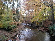 River Ryburn from the footbridge at Kebroyd
 River Ryburn with Asquith Bottom Mills in the background
 River Ryburn looking downstream from Stirk Bridge
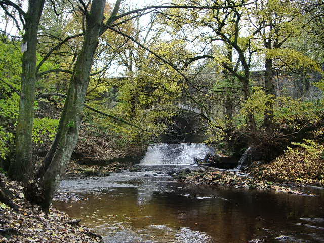
 River Ryburn in Sowerby Bridge
 River Ryburn, Sowerby Bridge
 Railway bridge over the River Ryburn, Sowerby Bridge
geo.wikisort.org - River
The River Ryburn is a river in West Yorkshire, England. It flows through the villages of Rishworth, Ripponden and Triangle before flowing into the River Calder at Sowerby Bridge.
| River Ryburn | |
|---|---|
 River Ryburn With Slitheroe Bridge hidden in the trees, this bridge carries the A672 over the river. 53°39′55.77″N 1°56′56.8″W | |
| Location | |
| Country | England |
| Physical characteristics | |
| Source | |
| • location | Confluence of unnamed stream and Black Castle Clough nr Rishworth |
| • coordinates | 53°39′35″N 2°1′29″W |
| • elevation | 361 metres (1,184 ft) |
| Mouth | |
• location | River Calder at Sowerby Bridge |
• coordinates | 53°42′28″N 1°54′42″W |
• elevation | 80 metres (260 ft) |
| Length | 11.4 kilometres (7.1 mi) |
| Basin size | 13 square kilometres (5.0 sq mi) |
Course
The river becomes known as Ryburn at the confluence of a small unnamed stream and Black Castle Clough to the east of Blackstone Edge Reservoir. It flows east parallel to the A58 Rochdale Road into Baitings reservoir. It emerges from the east end of the reservoir for a short time before flowing into Ryburn Reservoir. The river flows out of the east end of the reservoir just to the north of the village of Rishworth, before turning north east and flowing through Ripponden. After leaving the town, it flows north to Triangle before turning north east again, flowing through Sowerby Bridge and joining the River Calder.
History
The bridge on the B6113, Elland Road, in Ripponden was once part of the Elland Turnpike in 1815. It was originally built in 1772 and widened and altered in the nineteenth century. Next to this bridge is the original Ripponden Old Bridge which has been around since at least 1313.[1]
Baitings and Ryburn reservoirs were built for Wakefield Corporation. Baitings was opened on 14 November 1956 after eight years' work and a cost of £1.4 million. It is 64 acres (26 ha) large with a volume of 775 million gallons (3.5 million cubic metres), reaching a depth of 155 feet (47 m). The dam at the east end of the reservoir is 1,550 feet (470 m) across and 185 feet (56 m) high. At low water levels, the old road and bridge become visible.[2] Ryburn Reservoir was the first to be opened on 7 September 1933 after eight years' construction at a cost of £240,000. The dam at the east end of the reservoir is approximately 100 feet (30 m) high. It has a volume of 220 million gallons (1 million cubic metres) and covers 26 acres (11 ha), which includes the submerged village of Bogden.[1]
Local landowner John Rawson (1813–1899) was responsible for the planting of much of the woodland along the River Ryburn valley.[1]
Lists
Tributaries
|
Settlements
|
Crossings
|
Gallery
Along the River Ryburn


Sources
- Ordnance Survey Open Viewer https://www.ordnancesurvey.co.uk/business-government/tools-support/open-data-support
- Google Earth
- National Environment Research Council - Centre for Ecology and Hydrology http://www.ceh.ac.uk/index.html
- Environment Agency http://www.environment-agency.gov.uk/
References
- "History". Retrieved 22 August 2011.
- "Bridging the gap in Yorkshire between the past and present". The Yorkshire Post. 1 October 2018. Retrieved 16 July 2019.
Текст в блоке "Читать" взят с сайта "Википедия" и доступен по лицензии Creative Commons Attribution-ShareAlike; в отдельных случаях могут действовать дополнительные условия.
Другой контент может иметь иную лицензию. Перед использованием материалов сайта WikiSort.org внимательно изучите правила лицензирования конкретных элементов наполнения сайта.
Другой контент может иметь иную лицензию. Перед использованием материалов сайта WikiSort.org внимательно изучите правила лицензирования конкретных элементов наполнения сайта.
2019-2026
WikiSort.org - проект по пересортировке и дополнению контента Википедии
WikiSort.org - проект по пересортировке и дополнению контента Википедии