geo.wikisort.org - River
The River Skell is a 12-mile-long (19 km) tributary of the River Ure in North Yorkshire, England.
| River Skell | |
|---|---|
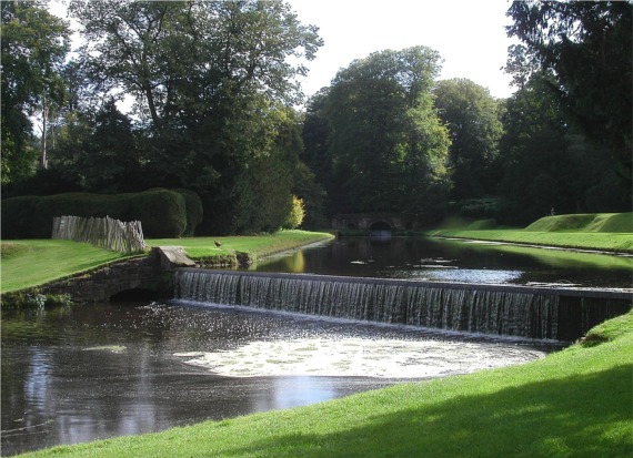 The River Skell in Studley Royal Park | |
| Location | |
| Country | England |
| Physical characteristics | |
| Source | |
| • location | Howson Ridge near Wath-in-Nidderdale |
| • coordinates | 54°7′2″N 1°44′59″W |
| • elevation | 350 metres (1,150 ft) |
| Mouth | |
• location | River Ure near Ripon |
• coordinates | 54°8′0″N 1°30′3″W |
• elevation | 23 metres (75 ft) |
| Length | 12 miles (19 km) |
| Discharge | |
| • average | 1.54 cubic metres per second (54 cu ft/s) |
Its source is in boggy ground on moorland 2 miles (3 km) north of Pateley Bridge. For its first 2 miles (3 km) the river is known as Skell Beck. Descending from the moor the river enters Skell Gill, a narrow wooded valley. The river valley gradually broadens, but remains well wooded, passing the villages of Skelding and Grantley and the 17th century Grantley Hall.[1]
The river enters Studley Royal Park and flows past Fountains Hall and the ruins of Fountains Abbey. Below the abbey the river was dammed in the 18th century to form an ornamental lake and water garden. Downstream from the park the river bed is porous rock that allows some or all of the flow to disappear underground. After this, the river re-emerges on the surface and enters the city of Ripon, and on the outskirts receives its largest tributary, the River Laver. The Skell enters the River Ure 0.5 miles (1 km) east of the centre of Ripon.
The name is from the Old Norse skjallr, meaning "resounding", from its swift and noisy course. In the Middle Ages the river was known as "Heaven Water", presumably from its association with Fountains Abbey.[2]
The flow of the River Skell has been measured at Alma Weir in Ripon, near to its confluence with the Ure since 1984. The thirty year record shows that the catchment of 120 square kilometres (46 sq mi) to the gauging station yields an average flow of 1.54 cubic metres per second (54 cu ft/s).[3] In June 2007 the highest river level was recorded of 1.8 metres (5 ft 11 in) over the weir, which was estimated to have a flow of 103 cubic metres per second (3,600 cu ft/s).[4]
References
- "Upper River Skell Valley. Landscape Character Assessment" (PDF). Harrogate District Council. 2004. Retrieved 15 May 2015.
- Smith, A. H. (1962). The Place-names of the West Riding of Yorkshire. Vol. 7. Cambridge University Press. pp. 137–138.
- "27086 - Skell at Alma Weir". The National River Flow Archive. Centre for Ecology & Hydrology. Retrieved 16 November 2015.
- "27086 - Skell at Alma Weir". The National River Flow Archive. Centre for Ecology & Hydrology. Retrieved 16 November 2015.
External links
![]() Media related to River Skell at Wikimedia Commons
Media related to River Skell at Wikimedia Commons
Другой контент может иметь иную лицензию. Перед использованием материалов сайта WikiSort.org внимательно изучите правила лицензирования конкретных элементов наполнения сайта.
WikiSort.org - проект по пересортировке и дополнению контента Википедии