geo.wikisort.org - Reservoir
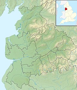
Upper and Lower Ogden Reservoirs are half a mile to the west of the village of Barley, in the Borough of Pendle, England.[2] They supply drinking water to the town of Nelson.[1]
| Upper and Lower Ogden Reservoirs | |
|---|---|
 View looking east across lower reservoir | |
| Location | Lancashire, England |
| Coordinates | 53°51′21″N 2°16′52″W |
| Built | 1906 and 1914 |
| Surface area | 2.84 and 8.55 ha (7.0 and 21.1 acres) |
| Max. depth | 17.9 and 18 m (59 and 59 ft) |
| Water volume | 247,755 and 715,989 m3 (200.858 and 580.462 acre⋅ft) |
| References | [1] |
Three forests covering more than 23 hectares (57 acres) can be found close to the reservoirs. Fell Wood, which is the largest, was planted in 1931 and contains Norway Spruce (Picea abies), Sitka Spruce (Picea sitchensis), Scots Pine (Pinus sylvestris) and European Larch (Larix decidua). Blue Wood, which was originally planted in 1935 with Scots Pine, Sitka Spruce and Larch was felled and replanted in 1981. The third forest: Buttock Plantation, was planted in 1935 with Sitka Spruce and Larch.[1]
References
- United Utilities. "Ogden Reservoir and Fell Wood" (PDF). Retrieved 6 August 2010.
- Michael Ely. "Lower Ogden Reservoir". Retrieved 6 August 2010.
| Wikimedia Commons has media related to Ogden Reservoirs. |
На других языках
[de] Ogden Reservoirs
Die Ogden Reservoirs sind zwei Stauseen westlich von Barley am Südrand des Pendle Hill in Lancashire, England. Das Gebiet, in dem sie liegen, stellt einen abgetrennten Teil der AONB Forest of Bowland dar.- [en] Ogden Reservoirs
Текст в блоке "Читать" взят с сайта "Википедия" и доступен по лицензии Creative Commons Attribution-ShareAlike; в отдельных случаях могут действовать дополнительные условия.
Другой контент может иметь иную лицензию. Перед использованием материалов сайта WikiSort.org внимательно изучите правила лицензирования конкретных элементов наполнения сайта.
Другой контент может иметь иную лицензию. Перед использованием материалов сайта WikiSort.org внимательно изучите правила лицензирования конкретных элементов наполнения сайта.
2019-2025
WikiSort.org - проект по пересортировке и дополнению контента Википедии
WikiSort.org - проект по пересортировке и дополнению контента Википедии

