geo.wikisort.org - River
Queens Pound River, a partly perennial river of the Tuross River catchment, is located in the upper ranges of the South Coast region of New South Wales, Australia.
| Queens Pound River | |
|---|---|
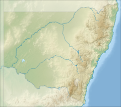 Location of mouth in New South Wales | |
| Location | |
| Country | Australia |
| State | New South Wales |
| Region | South East Corner (IBRA), South Coast |
| Local government areas | Bega Valley |
| Physical characteristics | |
| Source | Kybeyan Range within Wadbilliga National Park |
| • location | southwest of Yowrie |
| • elevation | 1,210 m (3,970 ft) |
| Mouth | confluence with the Wadbilliga River |
• location | near Wadbilliga |
• elevation | 324 m (1,063 ft) |
| Length | 14 km (8.7 mi) |
| Basin features | |
| River system | Tuross River catchment |
| National park | Wadbilliga NP |
| [1][2] | |
Course and features
Queens Pound River rises on the northern slopes of the Kybeyan Range within Wadbilliga National Park, southwest of the locality of Yowrie and flows generally north and northwest, before reaching its confluence with the Wadbilliga River near the locality of Wadbilliga. The river descends 887 metres (2,910 ft) over its 14 kilometres (8.7 mi) course.[2]
See also
References
- "Queens Pound River". Geographical Names Register (GNR) of NSW. Geographical Names Board of New South Wales. Retrieved 31 May 2013.
- "Map of Queens Pound River, NSW". Bonzle Digital Atlas of Australia. Retrieved 31 May 2013.
External links
- "Tuross River catchment" (map). Office of Environment and Heritage. Government of New South Wales.
Rivers of the Southern Rivers catchment, New South Wales, Australia | |
|---|---|
| Illawarra |
|
| Shoalhaven | |
| Eurobodalla | |
| Far South Coast | |
| Snowy River | |
| |
| Cities | |
|---|---|
| Towns & Townships |
|
| Local government areas |
|
| National parks |
|
| Rivers and other waterbodies | |
На других языках
[de] Queens Pound River
Der Queens Pound River ist ein Fluss im Südosten des australischen Bundesstaates New South Wales.- [en] Queens Pound River
Текст в блоке "Читать" взят с сайта "Википедия" и доступен по лицензии Creative Commons Attribution-ShareAlike; в отдельных случаях могут действовать дополнительные условия.
Другой контент может иметь иную лицензию. Перед использованием материалов сайта WikiSort.org внимательно изучите правила лицензирования конкретных элементов наполнения сайта.
Другой контент может иметь иную лицензию. Перед использованием материалов сайта WikiSort.org внимательно изучите правила лицензирования конкретных элементов наполнения сайта.
2019-2026
WikiSort.org - проект по пересортировке и дополнению контента Википедии
WikiSort.org - проект по пересортировке и дополнению контента Википедии