geo.wikisort.org - River
Abercrombie River, a perennial river that is part of the Murray–Darling basin, is located in the central west of New South Wales, Australia.
| Abercrombie River | |
|---|---|
 | |
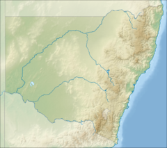 Location in New South Wales  Abercrombie River (Australia) | |
| Etymology | named by John Thomas Bigge[1] |
| Location | |
| Country | Australia |
| State | New South Wales |
| IBRA | South Eastern Highlands |
| District | Central West |
| Municipalities | Upper Lachlan, Oberon Shire |
| Physical characteristics | |
| Source | |
| • location | near Mount Werong village |
| • elevation | 1,130 m (3,710 ft) |
| 2nd source | Lachlan River |
| • location | Wyangala Dam |
| • coordinates | 33.919976°S 149.025285°E |
| • elevation | 375 m (1,230 ft) |
| Length | 130 km (81 mi) |
| Basin features | |
| River system | Murray–Darling basin |
| Tributaries | |
| • left | Burra Burra Creek, Bolong River, Copperhannia Creek |
| • right | Isabella River, Tuena Creek, Meglo Creek, Piesleys Creek |
| [2] | |
Course
The river rises to the east of the village of Mount Werong and generally flows westward towards its confluence with the Lachlan River at Wyangala Dam near Cowra.[1] The river flows through freehold land as well as the Abercrombie River National Park, and provides habitat for platypus and rakali,[3] dropping 758 metres (2,487 ft) over its course of 130 kilometres (81 mi).[2]
The Abercrombie River is the furthest east of the inland flowing rivers.[citation needed]
History

The original inhabitants of the land alongside the river were Australian Aborigines of the Wiradjuri or Gundungara clans, which may have used the river as a trading route.[4]
The first European to discover the watercourse was explorer Charles Throsby on 5 May 1819, during an expedition from Sydney to the central west of New South Wales. The river was named by Commissioner John Thomas Bigge on 22 October 1820.[1]
Alluvial gold was discovered in and along the river in 1851, inspiring a minor gold rush hampered by the ruggedness of the terrain and the periodic depths of the waterway.[5] Early miners recovered up to 3 oz (85 g) of gold a day along the river,[6] and by 1862 between forty and fifty mining parties were at work at Milburne Creek, a minor tributary of the Abercrombie.[7]
The Goulburn-Oberon Road crosses the Abercrombie River in the steep-sided Abercrombie Gorge.
See also
- List of rivers of Australia
- List of rivers of New South Wales (A-K)
- Rivers of New South Wales
References
- "Abercrombie River". Geographical Names Register (GNR) of NSW. Geographical Names Board of New South Wales. Retrieved 11 January 2013.
- "Map of Abercrombie River, NSW". Bonzle.com. Retrieved 13 January 2013.
- "Abercrombie River National Park". NSW National Parks and Wildlife Service. Government of New South Wales. July 2009. Retrieved 18 September 2007.
- "Abercrombie River National Park: Culture and History". NSW Department of Environment and Climate Change. Government of New South Wales. 2009. Retrieved 13 July 2009.
- "The Wentworth Diggings". The Argus. Melbourne, Victoria: Argus Office. 24 September 1851. p. 4. Retrieved 13 July 2009.
- "The Gold Fields". The Maitland Mercury & Hunter River General Advertiser. Maitland NSW: Thomas William Tucker and Richard Jones. 1 December 1852. p. 4. Retrieved 13 July 2009.
- "New South Wales: The Lachlan". The Argus. Melbourne, Victoria: Argus Office. 1 February 1862. p. 7. Retrieved 13 July 2009.
External links
- "Lachlan River catchment" (map). Office of Environment and Heritage. Government of New South Wales.
Rivers of the Murrumbidgee River catchment, New South Wales and the Australian Capital Territory, Australia | |||||
|---|---|---|---|---|---|
| |||||
| |||||
На других языках
[de] Abercrombie River
Der Abercrombie River ist ein Fluss in der Mitte des australischen Bundesstaates New South Wales.- [en] Abercrombie River
Другой контент может иметь иную лицензию. Перед использованием материалов сайта WikiSort.org внимательно изучите правила лицензирования конкретных элементов наполнения сайта.
WikiSort.org - проект по пересортировке и дополнению контента Википедии