geo.wikisort.org - River
Turon River, a perennial stream[1] that is part of the Macquarie catchment within the Murray–Darling basin, is located in the central western district of New South Wales, Australia. Partly situated in the Turon National Park,[3] the river is host to numerous recreational and tourist activities such as horse riding, gold panning, canoeing, camping, and seasonal fishing.
| Turon River | |
|---|---|
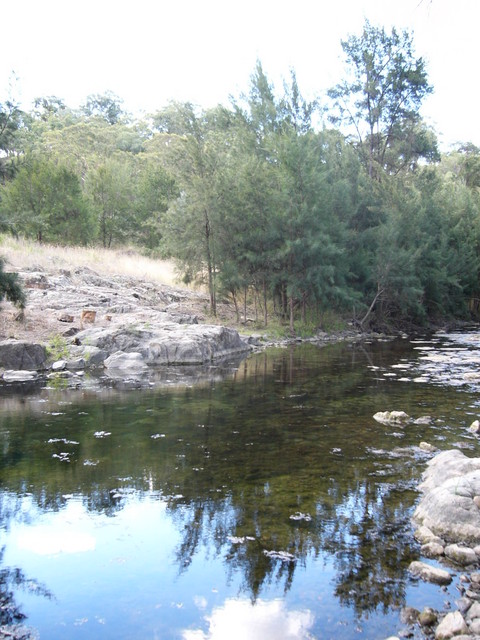 The Turon River from near Sofala during a very dry season. | |
 Location of the Turon River mouth in New South Wales | |
| Etymology | Aboriginal: Kamilaroi or Wiradjuri words choorun or yooran, the meaning of which is unknown[1] |
| Location | |
| Country | Australia |
| State | New South Wales |
| Region | South Eastern Highlands (IBRA), Central West |
| Municipalities | Lithgow, Mid-Western, Bathurst |
| Physical characteristics | |
| Source | Capertee Valley |
| • location | near Ben Bullen |
| • coordinates | 33°13′55″S 149°58′23″E |
| • elevation | 778 m (2,552 ft) |
| Mouth | confluence with the Macquarie River |
• location | near Hill End |
• coordinates | 33°5′10″S 149°23′25″E |
• elevation | 406 m (1,332 ft) |
| Length | 117 km (73 mi) |
| Basin features | |
| River system | Macquarie River, Murray–Darling basin |
| Tributaries | |
| • right | Crudine River |
| Bridges | Wallaby Rocks Bridge |
| [2] | |
Geography
The Turon River rises on the western slopes of the Great Dividing Range in the Capertee Valley, west of Ben Bullen, and flows generally to the north west and then west, joined by the Crudine River, and then forms its confluence with the Macquarie River south west of Hill End; dropping 372 metres (1,220 ft) over the course of its 117 kilometres (73 mi) length.
The upper reaches of the Turon River are partly bound by Turon National Park, established in 2002, while the lower reaches open onto private grazing property.
The river is crossed by the Wallaby Rocks Bridge that carries the Hill End Road, located at Wallaby Rocks.[4]
Gold rush
The Turon River is well renowned because it was the site of one of Australia's first alluvial gold rushes.[5] During the gold rush Chinese migrant workers built a water race to bring water to mining operations along sections of the Turon River. Many parts of the race can still be seen today, such as at Turon Gates.[6] The Turon River[where?] was the site of violence between miners and licensing authorities during the gold rush.[citation needed]
See also
- Sofala, New South Wales
- Rivers of New South Wales
- List of rivers of Australia
References
- "Turon River". Geographical Names Register (GNR) of NSW. Geographical Names Board of New South Wales. Retrieved 25 January 2013.
- "Map of Turon River". Bonzle.com. Retrieved 25 January 2013.
- "Turon National Park". nationalparks.nsw.gov.au. Retrieved 27 December 2015.
- "Bridge over Turon River at Wallaby Rocks". New South Wales State Heritage Register. Office of Environment & Heritage. H01458. Retrieved 2 June 2018.
- "Mining Heritage - Profile 3 - Alluvial Gold". Australian Heritage Council. Retrieved 11 November 2007.
- "Turon Gates Country Retreat". Turon Gates. 2009. Retrieved 25 January 2013.
External links
- "Macquarie-Bogan River catchment" (map). Office of Environment and Heritage. Government of New South Wales.
Authority control | |
|---|---|
| General |
|
| National libraries | |
На других языках
[de] Turon River
Der Turon River ist ein Fluss in der Mitte des australischen Bundesstaates New South Wales. An seinen Ufern wurde im Jahr 1851 Gold gefunden.[2]- [en] Turon River
Другой контент может иметь иную лицензию. Перед использованием материалов сайта WikiSort.org внимательно изучите правила лицензирования конкретных элементов наполнения сайта.
WikiSort.org - проект по пересортировке и дополнению контента Википедии