geo.wikisort.org - River
Bielsdown River, a perennial stream[1] that is part of the Clarence River catchment, is located in the Northern Tablelands of New South Wales, Australia.
| Bielsdown River Bielsdown Creek[1] | |
|---|---|
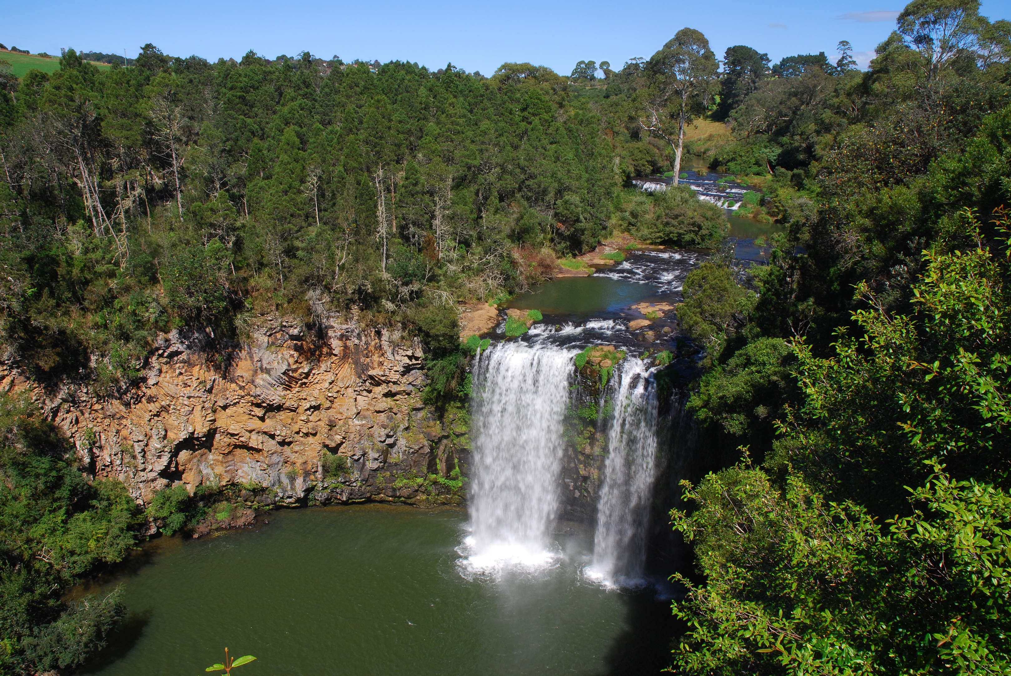 Dangar Falls on the Bielsdown River. | |
| Location | |
| Country | Australia |
| State | New South Wales |
| IBRA | NSW North Coast |
| District | Northern Tablelands |
| Municipality | Bellingen |
| Physical characteristics | |
| Source | Dorrigo Plateau, Great Dividing Range |
| • location | west of Dorrigo |
| • elevation | 936 m (3,071 ft) |
| Mouth | confluence with the Nymboida River |
• location | west of Cascade |
• elevation | 477 m (1,565 ft) |
| Length | 38 km (24 mi) |
| Basin features | |
| River system | Clarence River catchment |
| Tributaries | |
| • right | Rocky Creek (New South Wales) |
| Waterfall | Dangar Falls |
| [2] | |
Course
Bielsdown River rises on the Dorrigo Plateau within the Great Dividing Range, below Fernbrook, west of Dorrigo, and flows generally to the north and northeast, joined by one minor tributary towards its confluence with Nymboida River, west of Cascade. The river descends 459 metres (1,506 ft) over its 38 kilometres (24 mi) course.[2]
About 1.2 kilometres (0.75 mi) north of Dorrigo, the river descends downs Dangar Falls.[3] The falls are small but picturesque, and are a popular photographic subject.[4]
See also
- Rivers of New South Wales
- List of rivers of New South Wales (A–K)
- List of rivers of Australia
References
- "Bielsdown River". Geographical Names Register (GNR) of NSW. Geographical Names Board of New South Wales. Retrieved 28 February 2013.
- "Bielsdown River, NSW". Bonzle Digital Atlas of Australia. Retrieved 27 February 2013.
- "Dangar Falls". Geographical Names Register (GNR) of NSW. Geographical Names Board of New South Wales. Retrieved 29 June 2009.
- "Dangar Falls". Stevografix. Archived from the original on 14 September 2009. Retrieved 30 June 2009.
River systems and rivers of the Northern Rivers catchments, New South Wales, Australia | |
|---|---|
| Tweed Shire and Tweed River | |
| Byron Shire and Brunswick River | |
| Richmond Valley and Richmond River | |
| Clarence Valley and Clarence River |
|
| Coffs Harbour, Bellingen Shire, and Bellinger River | |
| Nambucca Shire, Kempsey Shire, and Nambucca-Macleay rivers | |
| Port Macquarie-Hastings and Hastings River | |
| |
На других языках
[de] Bielsdown River
Der Bielsdown River ist ein Fluss im Nordosten des australischen Bundesstaates New South Wales.- [en] Bielsdown River
Текст в блоке "Читать" взят с сайта "Википедия" и доступен по лицензии Creative Commons Attribution-ShareAlike; в отдельных случаях могут действовать дополнительные условия.
Другой контент может иметь иную лицензию. Перед использованием материалов сайта WikiSort.org внимательно изучите правила лицензирования конкретных элементов наполнения сайта.
Другой контент может иметь иную лицензию. Перед использованием материалов сайта WikiSort.org внимательно изучите правила лицензирования конкретных элементов наполнения сайта.
2019-2026
WikiSort.org - проект по пересортировке и дополнению контента Википедии
WikiSort.org - проект по пересортировке и дополнению контента Википедии