geo.wikisort.org - Mountains
The Tweed Range is a mountain range which is the western extension of the Tweed Volcano caldera rim, part of the Scenic Rim of the Great Dividing Range, located in northern New South Wales, near the southeastern border of Queensland, in Australia.
| Tweed | |
|---|---|
 The forested eastern slopes in the Tweed Valley, below the Tweed Range | |
| Highest point | |
| Peak | Bar Mountain |
| Elevation | 1,130 m (3,710 ft) |
| Naming | |
| Etymology | Tweed River |
| Geography | |
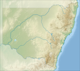 Location of the Tweed Range on the New South Wales and Queensland border | |
| Country | Australia |
| State | New South Wales |
| Region | Northern Rivers |
| Range coordinates | 28°25′S 153°10′E |
| Parent range | Scenic Rim |
Location and features
The range marks the southern extent of the Scenic Rim. The Bar Mountain massif is the highest point on the range, rising to 1,130 m (3,710 ft) above sea level.[1] To the west lies McPherson Range and Levers Plateau, in the north is the Lamington Plateau with the Nightcap Range extending around the southern parts of the caldera rim, south east of the Tweed Range.
Most of the range is covered by rainforest and protected within the Border Ranges National Park, part of the Gondwana Rainforests of Australia and Mebbin State Forest. The 64 km (40 mi) long Tweed Range Scenic Drive is a road through the park and along the range that provides access to lookouts over the Tweed Valley, including The Pinnacle Lookout and Blackbutts Lookout.[2]
In the east, the catchments of Byrrill Creek, Oxley River and Rous River, tributaries of the Tweed River drain the steep valley slopes. In the west, a series of creeks, among them Brindle Creek, flow into the Richmond River.
See also
References
- NSW Northern Rivers & South-East Queensland (Map) (2 ed.). 1 : 550,000. Cartography by Auslig. NRMA. 1998. Ballina to Tweed Heads inset.
- "Map of Tweed Range, NSW". Bonzle Digital Atlas of Australia. Retrieved 2 May 2015.
This Northern Rivers geography article is a stub. You can help Wikipedia by expanding it. |
На других языках
[de] Tweed Range
Die Tweed Range bildet die westliche Ausdehnung des Kraterrandes des Tweed Volcano im nördlichen New South Wales in Australien. Das Gebirge markiert das südliche Ende der Scenic Rim.- [en] Tweed Range
[fr] Chaîne Tweed
La chaîne Tweed (Tweed Range) est une chaîne de montagnes située au nord-est de la Nouvelle-Galles du Sud. Elle est le prolongement ouest de la caldeira du volcan Tweed. Elle correspond à l'extrémité sud de la Scenic Rim. Bar Mountain, le point culminant de la chaîne, s'élève à 1 130 m d'altitude. À l'ouest, on trouve la chaîne McPherson et le plateau Levers.Другой контент может иметь иную лицензию. Перед использованием материалов сайта WikiSort.org внимательно изучите правила лицензирования конкретных элементов наполнения сайта.
WikiSort.org - проект по пересортировке и дополнению контента Википедии