geo.wikisort.org - Mountains
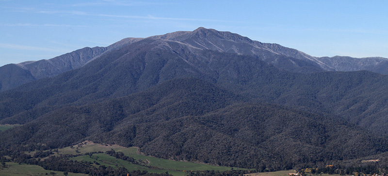
Bimberi Peak or Mount Bimberi with an elevation of 1,913 metres (6,276 ft) located within the Brindabella Ranges is the highest mountain in the Australian Capital Territory (ACT). It is located on the border between New South Wales (NSW) and the ACT, the NSW portion in Kosciuszko National Park and the ACT portion in Namadgi National Park. It is accessible by bush walking trails and requires no specialised climbing skills, although there is no marked trail to the very summit.
| Bimberi Peak | |
|---|---|
 Bimberi Peak summit | |
| Highest point | |
| Elevation | 1,913 m (6,276 ft)[1] |
| Prominence | 661 m (2,169 ft)[1] |
| Listing | Territory high point |
| Coordinates | 35°39′39″S 148°47′21″E |
| Geography | |
 Bimberi Peak Location of Bimberi Peak on the ACT/NSW border | |
| Location | Australian Capital Territory / New South Wales, Australia |
| Parent range | Brindabella Ranges |
| Climbing | |
| Easiest route | Hike (approx 5 hours to peak) |
Routes
Bimberi Peak can be reached along the Australian Alps Walking Track, from the east through the ACT, or from the west through NSW, approximately 40 kilometres (25 mi) north northwest of Adaminaby that ascends the southern ridge.[1]
When climbing Bimberi from the west, a dirt road, that is closed during winter, leads to a locked gate at Currango Plain, called Pockets Saddle Road Gate, a gain of 650 metres (2,130 ft).[2] The trailhead commences at an elevation of 1,270 metres (4,170 ft) as an easy two–hour walk 3.3 kilometres (2.1 mi) along a fire trail passes by Oldfields Hut and crosses several streams, before reaching a gate at Murray's Gap, an ascent of 430 metres (1,410 ft) over 4.3 kilometres (2.7 mi).[2] From the ascent is best accessed by breaking away from the trail and hiking up the southern ridge of the summit, taking about 3–3.5 hours to climb over 2.9 kilometres (1.8 mi). Following the ridge up is the easiest way to summit, although taking a compass bearing is useful. The total distance via this route is about 10.5 kilometres (6.5 mi).[2] There is a large surveyors mark at the summit.
Vegetation and weather
The top of Bimberi Peak is above the tree line. Strong winds blow across the summit. During winter Bimberi is generally covered in snow.
See also
- List of mountains of Australia
- List of mountains in the Australian Capital Territory
References
- "Bimberi Peak, Australian Capital Territory". Peakbagger.com. Retrieved 2 March 2014.
- "Climbing Bimberi Peak, Australian Capital Territory". State8.net. Retrieved 10 October 2013.
Highest peaks in the States and territories of Australia | ||
|---|---|---|
|  | |
| ||
На других языках
[de] Bimberi Peak
Der Bimberi Peak, auch Mount Bimberi genannt, ist mit 1913 m der höchste Berg im Australian Capital Territory. Die nächstgelegenen Orte sind Adaminaby in etwa 37 km, Talbingo in 45 km und Queanbeyan in 52 km Entfernung.- [en] Bimberi Peak
[fr] Mont Bimberi
Le mont Bimberi ou Bimberi Peak est le point culminant du Territoire de la capitale australienne (ACT) avec ses 1 912 mètres d'altitude. Il est situé sur la frontière entre la Nouvelle-Galles du Sud et l'ACT à cheval sur le parc national du Kosciuszko en Nouvelle-Galles du Sud et le parc national Namadgi. Il est accessible par des sentiers et ne nécessite pas de compétences particulières en escalade, même s'il n'y a pas de sentier balisé jusqu'au sommet. Comme c'est la plus haute montagne de l'ACT c'est un point de passage populaire pour le « peakbagging ».Другой контент может иметь иную лицензию. Перед использованием материалов сайта WikiSort.org внимательно изучите правила лицензирования конкретных элементов наполнения сайта.
WikiSort.org - проект по пересортировке и дополнению контента Википедии