geo.wikisort.org - Mountains
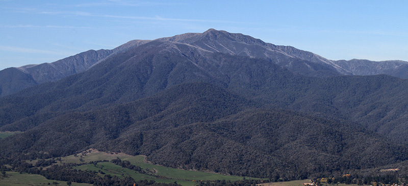
Mount Meharry is the highest mountain in Western Australia. It is located in the Hamersley Range within the southeastern part of Karijini National Park in the Pilbara region, approximately 86 kilometres (53 mi) south-southeast of Wittenoom,[3] and 87 kilometres (54 mi) east-southeast of Tom Price.[4]
| Mount Meharry | |
|---|---|
| Wirlbiwirlbi | |
 Mount Meharry Location in Western Australia | |
| Highest point | |
| Elevation | 1,249 m (4,098 ft)[1] |
| Prominence | 836 m (2,743 ft)[2] |
| Coordinates | 22°58′S 118°35′E[1] |
| Geography | |
| Location | Pilbara region of Western Australia |
| Parent range | Hamersley Range |
The Pandjima peoples are the traditional owners of the area.[5] The indigenous name for Mount Meharry is Wirlbiwirlbi.[6]
History
Mount Meharry is named after William Thomas Meharry (1912–1967), Chief Geodetic Surveyor for Western Australia from 1959 to 1967. It was discovered by Surveyor Trevor Markey and his party in 1967. Tom Meharry directed the survey party and performed the calculations that confirmed the mountain was the highest peak in Western Australia, being 15 m (49 ft) higher than Mount Bruce which lies 62 km northwest of Mount Meharry.
After Meharry's sudden death on 16 May 1967 the Nomenclature Advisory Committee (now the Geographic Names Committee) recommended to the Minister for Lands that the recently discovered peak be named after him. The Minister for Lands Stewart Bovell approved this on 28 July 1967 and a notice naming the peak was published in the Western Australian Government Gazette on 15 September 1967.
In 1999, Gina Rinehart, daughter of Lang Hancock applied to the Geographic Names Committee to rename the mountain after her father.[7] The application was declined and in 2002 she lobbied the then-Premier Geoff Gallop with the same proposal.[8] He, too, declined the request.
Geography
The summit of Mt Meharry can be reached from the Great Northern Highway via an unsealed road 16 km (9.9 mi) in length and a vehicular track 21 kilometres (13 mi) in length. Permission should be sought from the managers of the land over which the road and track pass. These are Juna Downs Station and the Department of Parks and Wildlife, which manages Karijini National Park. In dry conditions, a two-wheel-drive vehicle can reach the national park boundary at about 800 metres altitude, requiring a walk of about 7 kilometres to the summit.
References
- "Mount Meharry". Gazetteer of Australia online. Geoscience Australia, Australian Government.
- Peakbagger: "Mount Meharry", 23 September 2007.
- "Great Circle Distance between MOUNT+MEHARRY and WITTENOOM". Geoscience Australia. Archived from the original on 4 June 2011. Retrieved 18 February 2010.
- "Great Circle Distance between MOUNT+MEHARRY and TOM PRICE". Geoscience Australia. Archived from the original on 4 June 2011. Retrieved 18 February 2010.
- "My father's father was Wirrilimarra (Bob Tucker)" (PDF). Retrieved 13 December 2015.
- "Packsaddle Mount Meharry Mount Robinson areas" (PDF). Retrieved 13 December 2015.
- "Gallop kills Hancock plan". Australasian Business Intelligence. 4 November 2002.
- "Call for WA mountain to be renamed after iron ore magnate". ABC News online. 3 November 2002. Retrieved 18 October 2008.
Highest peaks in the States and territories of Australia | ||
|---|---|---|
|  | |
| ||
This Australia mountain, mountain range, or peak related article is a stub. You can help Wikipedia by expanding it. |
На других языках
[de] Mount Meharry
Mount Meharry ist mit 1251 m der höchste Berg im australischen Bundesstaat Western Australia. Er liegt in der Region Pilbara in der Hamersley Range, etwa 135 km von Wittenoom und 160 km von Tom Price entfernt. Er liegt nördlich knapp außerhalb des Karijini-Nationalparks.- [en] Mount Meharry
[fr] Mont Meharry
Le mont Meharry (en anglais : Mount Meharry) est la plus haute montagne de l’Australie-Occidentale dans la chaîne des monts Hamersley. Elle est se situe dans la partie sud-est du Parc national de Karijini dans la région de Pilbara.[ru] Мехарри (гора)
Мехарри (англ. Mount Meharry) — высшая точка австралийского штата Западная Австралия.Другой контент может иметь иную лицензию. Перед использованием материалов сайта WikiSort.org внимательно изучите правила лицензирования конкретных элементов наполнения сайта.
WikiSort.org - проект по пересортировке и дополнению контента Википедии