geo.wikisort.org - Mountains
Burning Mountain, the common name for Mount Wingen, is a hill near Wingen, New South Wales, Australia, approximately 224 km (139 mi) north of Sydney just off the New England Highway.[2] It takes its name from a smouldering coal seam running underground through the sandstone. Burning Mountain is contained within the Burning Mountain Nature Reserve, which is administered by the NSW National Parks and Wildlife Service (NPWS).[3][4]
| Burning Mountain | |
|---|---|
| Mount Wingen | |
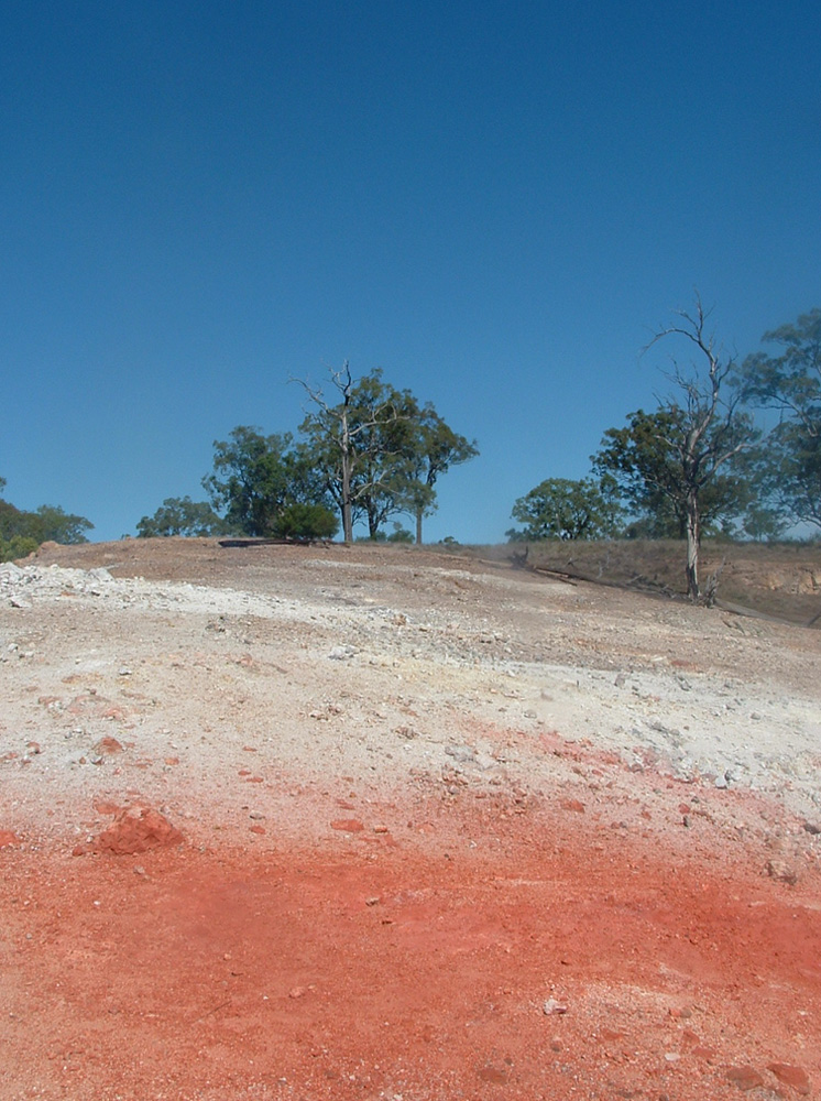 View of the summit | |
| Highest point | |
| Elevation | 520 m (1,710 ft)[1] |
| Prominence | 120 m (390 ft)[1] |
| Coordinates | 31°51′54″S 150°54′04″E[2] |
| Geography | |
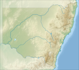 Burning Mountain New South Wales, Australia  Burning Mountain Burning Mountain (Australia) | |
| Topo map | Murrurundi 9034 (1:100000) Murrurundi 90324N (1:25000) |
| Climbing | |
| Easiest route | walking track |
A trail with information panels runs from the parking lots to the site where smoke emanates from the ground.
The Leyland brothers reported on Mount Wingen in the first episode of their travel programme, Ask The Leyland Brothers:[need quotation to verify]
The Aborigines named the mountain Wingen, which means 'fire'. Their explanation of the origin of the burning mountain was that one day, a tribesman was lighting a fire on the mountainside when he was carried off deep into the earth by The Evil One. Unable to escape, he used his fire stick to set the mountain alight, so that the smoke might warn others to keep away.
Coal seam fire
The underground fire is estimated to be at a depth of around 30 m (100 ft).[5] It is estimated that the fire has burned for approximately 6,000 years and is the oldest known coal fire.[6]
European explorers and settlers to the area believed the smoke, coming from the ground, was volcanic in origin.[5] It was not until 1829 that geologist Reverend C. P. N. Wilton identified it as a coal seam fire.[5]
The fire is generally moving in a southerly direction at a rate of about 1 m (3 ft) per year. The combustion has caused soil discolouration and an uneven ground surface in the area.[5]
See also
- Brennender Berg
- Centralia, Pennsylvania
- Darvaza gas crater
- Eternal flame
- List of coal mine fires
- List of mountains in New South Wales
- New Straitsville mine fire
- Smoking Hills
- Yanar Dag
References
- Topographic map Murrurundi 90324N
- "Burning Mountain". Geographical Names Register (GNR) of NSW. Geographical Names Board of New South Wales. Retrieved 30 January 2011.
- "Burning Mountain Nature Reserve". Geographical Names Register (GNR) of NSW. Geographical Names Board of New South Wales. Retrieved 30 January 2011.
- "Burning Mountain Nature Reserve". Department of Environment, Climate Change & Water. Retrieved 30 January 2011.
- Stone, Derrick (2012). Walks, Tracks and Trails of New South Wales. Csiro Publishing. p. 115. ISBN 978-0643106925.
- Krajick, Kevin (May 2005). "Fire in the hole". Smithsonian. Smithsonian Institution: 54ff. Retrieved 24 October 2006.
На других языках
[de] Burning Mountain
Der Burning Mountain (dt. brennender Berg), eigentlich Mount Wingen, ist eine 520 m über dem Meer hohe Erhebung bei Wingen, New South Wales in Australien.- [en] Burning Mountain
[fr] Burning Mountain
Burning Mountain (en français : « montagne qui brûle »), nom commun du mont Wingen, est une colline située près de Wingen (en), en Nouvelle-Galles du Sud, en Australie, à 224 km au nord de Sydney[1].[ru] Горящая гора
Горящая гора (англ. Burning Mountain) — гора возле населённого пункта Винген[en], Новый Южный Уэльс, Австралия, расположенная в 200 км к северу от Сиднея, рядом с шоссе «Новая Англия» из Сиднея в Брисбен. Высота — 653 м[1]. Своим названием гора обязана естественному процессу горения угольного пласта, проходящего под землёй через песчаник. Горящая гора входит в заповедник, который управляется местной службой национальных парков и дикой природы. Район горы также является наследием австралийских аборигенов.Другой контент может иметь иную лицензию. Перед использованием материалов сайта WikiSort.org внимательно изучите правила лицензирования конкретных элементов наполнения сайта.
WikiSort.org - проект по пересортировке и дополнению контента Википедии