geo.wikisort.org - River
The Colo River, a perennial stream[2][3] that is part of the Hawkesbury-Nepean catchment, is located in the Central Tablelands of New South Wales, Australia.
| Colo | |
|---|---|
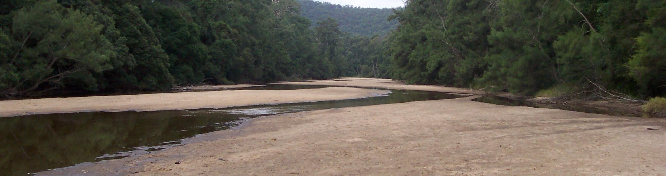
 King Rapids on the Colo River in Wollemi National Park, 2010. | |
| Location | |
| Country | Australia |
| State | New South Wales |
| Region | Sydney Basin (IBRA), Central Tablelands, Blue Mountains |
| Municipalities | Lithgow, Hawkesbury |
| Physical characteristics | |
| Source | Capertee River |
| 2nd source | Wolgan River |
| Source confluence | |
| • location | northeast of Newnes |
| • coordinates | 33°12′19″S 150°27′55″E |
| • elevation | 218 m (715 ft) |
| Mouth | confluence with the Hawkesbury River |
• location | near Lower Portland |
• coordinates | 33°26′15″S 150°53′11″E |
• elevation | 4 m (13 ft) |
| Length | 86 km (53 mi) |
| Basin features | |
| River system | Hawkesbury-Nepean catchment |
| Tributaries | |
| • left | Wollemi Creek, Dooli Creek, Angorawa Creek |
| • right | Tambo Creek, Main Creek (New South Wales), Wollangambe River, Blacksmiths Creek (New South Wales), Gospers Creek |
| Bridges | unnamed (Putty Road |
| National parks | Blue Mountains NP, Wollemi NP |
| [1] | |
Course
The Colo River rises on the Great Dividing Range, northeast of Newnes, formed by the confluence of the Wolgan River and the Capertee River, which respectively drain the Wolgan and Capertee Valleys north of Lithgow. Colo River flows eastwards and then south through a deep gorge in the northern section of the Blue Mountains. The majority of the river lies in Wollemi National Park. The middle Colo is inaccessible, rugged and remote. The wilderness was saved from development, logging and damming in the late 1970s by the Colo Wilderness Preservation Society and other environmentalists. Emerging from the wilderness region, the lower part of the Colo River flows through a scenic, narrow agricultural valley and reaches the Hawkesbury River at Lower Portland north of Windsor. Tributaries of the Colo include the Wollangambe River and Wollemi Creek. The river descends 214 metres (702 ft) over its 86-kilometre (53 mi) course.[1]
At Colo, the river is crossed by the Putty Road (B84).
Parts of the area surrounding the river, including both the Blue Mountains National Park and the Wollemi National Park have received World Heritage listing, due in part to the discovery of the Wollemi Pine, often described as a 'living fossil' from the age of the dinosaurs. The Colo River gorge contains many boulder-rapids that alternate with deep pools. Even though this area is relatively close to the Sydney metropolitan area, the Colo River flows through the largest wilderness area in New South Wales. Local volunteer bush regeneration groups such as the "Friends of the Colo" have been helping eradicate invasive exotic weeds in the area surrounding the river.[citation needed]
History
The traditional custodians of the land surrounding the Colo River are the Australian Aboriginal peoples of the Darug nation.[4]
The area of the lower Colo River was first explored by Europeans in June 1789 by Governor Phillip and settlement commenced from the early 1800s via land grants, that were significantly expanded from 1833. The Colo River was an important transport corridor in the period before motor vehicles, with produce and goods transported down the Hawkesbury River to Sydney.[4]
Recreation
Bushwalking, canoeing, fishing, and accommodation retreats are all popular recreation activities along various parts of the Colo River.
See also
- List of rivers of Australia
- List of rivers in New South Wales (A-K)
- Rivers of New South Wales
References
- "Colo River, NSW". Bonzle Digital Atlas of Australia. Retrieved 27 February 2013.
- "Colo River (13347)". Geographical Names Register (GNR) of NSW. Geographical Names Board of New South Wales. Retrieved 27 February 2013.
- "Colo River (13372)". Geographical Names Register (GNR) of NSW. Geographical Names Board of New South Wales. Retrieved 27 February 2013.
- "History Colo River". Colo River NSW. Retrieved 27 February 2013.
External links
- "Camping at Upper Colo Reserve". Parks & Recreation. Hawkesbury City Council. 2012. Archived from the original on 4 March 2013. Retrieved 27 February 2013.
- Friends of the Colo[permanent dead link]
- Colo River Subcatchment at the Hawkesbury-Nepean Catchment Management Authority website
- Colo River Subcatchment
Further reading
- Corlis, Brian (2005). Colo River passes and routes. Glenmore Park, NSW: B. Corlis. p. 31. ISBN 0-6464-4721-1.
River systems and rivers of Sydney Basin, New South Wales, Australia | |
|---|---|
| Central Coast | |
| Hawkesbury-Nepean |
|
| Sydney Metropolitan |
|
| |
Hawkesbury River region, New South Wales, Australia | |||||||||
|---|---|---|---|---|---|---|---|---|---|
| Islands | |||||||||
| National parks and nature reserves |
| ||||||||
| European explorers of the region |
| ||||||||
| Bridges and ferries |
| ||||||||
| Adjoining rivers, bays, reservoirs, and creeks |
| ||||||||
| Local government areas |
| ||||||||
| Education |
| ||||||||
| Major attractions |
| ||||||||
| |||||||||
| Authority control |
|
|---|
На других языках
[de] Colo River
Der Colo River ist ein Fluss im Osten des australischen Bundesstaates New South Wales.- [en] Colo River
[ru] Коло (приток Хоксбери)
Коло (англ. Colo River) — непересыхающая река[1][2], входящая в область водосбора реки Хоксбери, протекает по Центральному плоскогорью[en], Новый Южный Уэльс, Австралия. Высота истока — 218 м над уровнем моря.[источник не указан 586 дней]Другой контент может иметь иную лицензию. Перед использованием материалов сайта WikiSort.org внимательно изучите правила лицензирования конкретных элементов наполнения сайта.
WikiSort.org - проект по пересортировке и дополнению контента Википедии