geo.wikisort.org - Mountains
The Serranía del Perijá, Cordillera de Perijá or Sierra de Perijá [pe.ɾi.ˈxa] is a mountain range, an extension of the eastern Andean branch (Cordillera Oriental), in northern South America, between Colombia and Venezuela, ending further north in the Guajira Desert, a total distance of about 310 kilometres (190 mi). It separates the Maracaibo Basin from the Cesar-Ranchería Basin. Some of the area has been considered as a Flora and Fauna Sanctuary.
| Serranía del Perijá | |
|---|---|
 Cerro Pintao | |
| Highest point | |
| Peak | Cerro de las Tetas |
| Elevation | 3,630 m (11,910 ft) |
| Coordinates | 10°0′59″N 72°57′28″W |
| Dimensions | |
| Length | 310 km (190 mi) |
| Geography | |
 Serranía del Perijá | |
| Country | |
| Region | Norte de Santander Cesar La Guajira Zulia |
Geography
Starting at the southernmost point, near Ocaña, Colombia, this mountain range forms the boundary between the Colombian departments of Norte de Santander and Cesar, and then as the range progresses north, it forms the international boundary between Venezuela (Zulia State) and Colombia (Cesar Department). Included in the range are the Sierra Motilones, Sierra Valledupar, and Sierra Oca. The highest point is Cerro de Las Tetas at 3630 meters, followed by Cerro Irapa at 3540 m., Serranía de Macuira at 864 m., and Cerro Aceite at 853 m.
Peoples
The range is 58% in Venezuela, and 42% in Colombia. Venezuela has set aside a substantial part of the central part of the range as a national park (Sierra de Perijá National Park), and Colombia has a smaller one. In the Venezuelan portion there are Amerindian reservations for the Yucpa and Barí people, and in Colombia for the Iroko and Sokorpa people. Venezuela has started a colonialization border plan building new communities along the border in the Perijá. The town of Cojoro was the first one completed, followed by communities for the Wayuu and Goajira peoples.
Economy and politics
The climate is mostly tropical humid forests, with cultivation of coffee and papaver flowers. It is also a hot spot in the Colombian Conflict serving as home to parts of two FARC blocs called the Caribbean Bloc of the FARC-EP and the Middle Magdalena Bloc of the FARC-EP., and an ELN guerrilla column, that have also strayed into Venezuelan territory.
References
- ^ —Peakbagger.com: Perija-Guajira
- ^ VHeadline.com Sunday, January 18, 1998, New border town ready in April as another gets lined up for flash point Perija, by Patrick J. O'Donoghue
- ^ fac.mil.co,Accessed March 9, 2007, Colombian Air Force; "The New Corridors of Arms, Drugs and Death"
Mountain ranges of Colombia | ||||||||||
|---|---|---|---|---|---|---|---|---|---|---|
| Colombian Andes |
|  | ||||||||
| Isolated ranges | ||||||||||
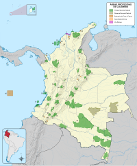
Protected areas of Colombia | ||
|---|---|---|
| National Natural Parks |
|  |
| Flora and Fauna Sanctuaries | ||
| National Natural Reserves |
| |
| Unique Natural Area |
| |
| Road parks |
| |
| Regional Nature Reserves |
| |
| Proposed Areas |
| |
| ||
| Authority control |
|
|---|
На других языках
[de] Sierra de Perijá
Die Sierra de Perijá, auch Serranía del Perijá oder Cordillera de Perijá genannt, ist ein Gebirgszug im nördlichen Südamerika. Der Gebirgszug ist eine Verlängerung der kolumbianischen Cordillera Oriental, einem östlichen Ausläufer der Anden, und bildet zum Teil das Grenzgebiet zwischen Venezuela und Kolumbien. Der Gebirgszug, der in den Cordillera Oriental seinen Anfang hat, endet rund 310 Kilometer weiter nördlich auf der Guajira-Halbinsel. Er trennt den Maracaibo-See und dessen Einzugsgebiet vom Tal des Río Cesar, einem Nebenfluss des Río Magdalena.- [en] Serranía del Perijá
[es] Serranía del Perijá
La Serranía del Perijá, también denominada como Sierra de Perijá, es el ramal más septentrional de la Cordillera de los Andes entre Colombia y Venezuela. También se le conoce como Serranía de los Motilones en su parte sur en Colombia, e incluye otros sistemas montañosos como la serranía de Valledupar y los montes de Oca.[1][fr] Serranía de Perijá
La serranía de Perijá est la plus septentrionale branche de la cordillère des Andes. Elle marque la frontière entre la Colombie et le Venezuela.[it] Sierra de Perijá
La Sierra del Perijá o Serranía del Perijá è la catena montuosa più settentrionale delle Ande, localizzata nell'estremo nord della Colombia. Rappresenta l'estensione settentrionale della Cordillera Oriental ed è altresì noto, soprattutto nella sua regione meridionale, come il Serranía de Motilones, e comprende altri sistemi montuosi, come le montagne di Valledupar e le montagne di Oca.[ru] Сьерра-де-Периха
Сье́рра-де-Пери́ха (исп. Sierra de Perijá) — горный хребет в Андах, включающий массивы Мотилонес, Вальедупар, Периха и Ока, на границе Колумбии и Венесуэлы. Является северным отрогом Восточной Кордильеры Колумбии.Другой контент может иметь иную лицензию. Перед использованием материалов сайта WikiSort.org внимательно изучите правила лицензирования конкретных элементов наполнения сайта.
WikiSort.org - проект по пересортировке и дополнению контента Википедии