geo.wikisort.org - Mountains
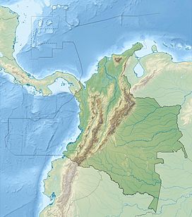
The Paramillo Massif (Nudo de Paramillo) is a mountain range of the Tropical Andes System, located at the northern end of the Cordillera Occidental (West Andes) range in Colombia.
| Paramillo Massif | |
|---|---|
| Highest point | |
| Peak | Cerro Paramillo[1] |
| Elevation | 3,730 m (12,240 ft) |
| Coordinates | 07°06′09″N 75°58′09″W |
| Geography | |
| Country | |
| Region | Antioquia, Córdoba |
| Parent range | Cordillera Occidental (West Andes) |
Geography
Administratively, the Paramillo Massif is located in the municipalities of Ituango and Peque in Antioquia Department; and Puerto Libertador and Tierralta in Córdoba Department.
The municipalities that surround this massif are Chigorodó, Mutatá, Tarazá, Cáceres and Caucasia in Antioquia.
This massif is intervisible with several peaks in the Sierra Nevada, e.g. Pico Simón Bolívar 5,700 m (18,700 ft) in the north of Colombia. This implies a theoretical direct line of sight of just over 500 km (310 mi), reported to be the longest between any two points on the surface of the Earth.
Subranges
This mountainous region gives rise to three smaller ranges that spread northward and recede into the Caribbean plain.
- The Abibe Mountains (Serranía de Abibe) form a natural border between the Antioquia Department and Córdoba Department.
- The San Jerónimo Mountains (Serranía de San Jerónimo) separates the watersheds of the San Jorge River and Sinú River.
- The Ayapel Mountains (Serranía de Ayapel) divides the watersheds of the San Jorge and Cauca Rivers, as well as forming a natural border between Antioquia and Córdoba Departments.
Paramillo Natural National Park
Most of the area is within the Paramillo Natural National Park, which extends from the massif into the lowlands of the Caribbean Plain. The ecosystems found within the massif are characteristic of the Tropical Andes which include páramo and mountain forests.
It is one of two regions where the bird Paramillo tapaculo (Scytalopus canus), an endangered species, is found.[2][3]
One of the massif's highland mammal species is the vulnerable Spectacled bear (Tremarctos ornatus).[4]
References
- "Cerro Paramillo - Peakbagger". Retrieved 27 December 2016.
- "Scytalopus canus - IUCN Red List of Endangered Species". Retrieved 27 December 2016.
- "Paramillo Tapaculo - BirdLife Factsheet". Retrieved 27 December 2016.
- "Tremarctos ornatus - IUCN Red List of Endangered Species". Retrieved 27 December 2016.
На других языках
[de] Nudo de Paramillo
Nudo de Paramillo (spanisch Paramillo-Knoten) ist eine kolumbianische Bergregion der Anden im Departamento Córdoba an der Grenze zu Antioquia.[1]- [en] Paramillo Massif
[es] Nudo de Paramillo
El Nudo de Paramillo se ubica en la Cordillera Occidental de los Andes en Colombia. En este accidente orográfico nace la Serranía de Abibe, que se dirige hacia el Norte y sirve de límite natural entre los departamentos de Antioquia y Córdoba; así mismo también nacen la Serranía de San Jerónimo, que separa las cuencas de los ríos San Jorge y Sinú; y la Serranía de Ayapel, que divide las cuencas de los ríos San Jorge y Cauca y también sirve de límite entre los departamentos de Antioquia y Córdoba.[fr] Nœud de Paramillo
Le nœud de Paramillo est un massif montagneux situé dans la cordillère Occidentale des Andes, en Colombie. Il abrite le parc national naturel de Paramillo.Другой контент может иметь иную лицензию. Перед использованием материалов сайта WikiSort.org внимательно изучите правила лицензирования конкретных элементов наполнения сайта.
WikiSort.org - проект по пересортировке и дополнению контента Википедии

