geo.wikisort.org - Mountains
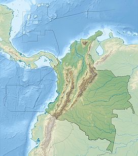
The Montes de María is an isolated group of small mountains near the northern coast of Colombia in the Caribbean Region. The Montes de María (also known as Serranía de San Jacinto) are the last part of the Serranía de San Jerónimo which extends from the West Andes. A part of the mountains are protected as the Los Colorados fauna and flora sanctuary.
This article includes a list of references, related reading or external links, but its sources remain unclear because it lacks inline citations. (January 2022) |
| Montes de María | |
|---|---|
| Highest point | |
| Peak | Maco, Cansona and La Pita |
| Elevation | 1,000 m (3,300 ft) |
| Dimensions | |
| Area | 2,677 km2 (1,034 sq mi) |
| Geography | |
| Country | Colombia |
| Range coordinates | 09°34′42″N 75°16′15″W |
Montes de María is a zone located in the center of the Colombian Departments of Bolívar and Sucre. The following towns are part of the Montes de María: El Carmen de Bolívar, María La Baja, San Juan Nepomuceno, San Jacinto, Córdoba, Zambrano and El Guamo in Bolívar; Ovejas, Chalán, Colosó, Morroa, Toluviejo, Los Palmitos and San Onofre in Sucre.
It has a total area of 6,317 km2 (2,439 sq mi), of which 3,798 km2 (1,466 sq mi) are in Bolívar and 2,519 km2 (973 sq mi) in Sucre. This area has a population of about 330,889.
Montes de María comprises two zones: The first zone called Baja Montaña is relatively flat with no mountains: the area located between the Troncal de Occidente and the Magdalena River is dedicated to cattle-raising and forestry, while the area located between the Transversal del Caribe and the Canal del Dique is mainly agricultural. A second, called Alta Montaña, zone located between the Transversal del Caribe and Troncal de Occidente also has agriculture as the main activity.
References
- Villalobos, Hermes Cuadros (2007). "Vegetación Caribeña" (in Spanish). Biblioteca Luis Ángel Arango. Retrieved 24 May 2009.
На других языках
- [en] Montes de María
[fr] Serranía de San Jacinto
La serranía de San Jacinto, également appelée monts de María (espagnol : Montes de María), est une chaîne de montagnes située en Colombie.[ru] Мария (горы)
Горы Мария[источник не указан 190 дней] (исп. Montes de María) — изолированная группа небольших и невысоких гор, расположенных в Карибском регионе, возле северного побережья Колумбии. Горы Мария являются окончанием Серрания-де-Сан-Херонимо, тянущихся, в свою очередь, от Западной Кордильеры. Часть территории гор составляет природный заповедник Лос-Колорадос.Другой контент может иметь иную лицензию. Перед использованием материалов сайта WikiSort.org внимательно изучите правила лицензирования конкретных элементов наполнения сайта.
WikiSort.org - проект по пересортировке и дополнению контента Википедии

