geo.wikisort.org - Mountains
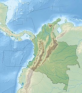
The Serranía del Baudó is a coastal mountain range on the Pacific coast of Colombia. It is separated from the West Andes by the Atrato valley where the Atrato River flows and Quibdó is located. From the south the range extends from the Baudó River north and slightly west along the coast into Panama terminating at the Golfo de San Miguel. The range is called Serranía del Sapo when it is in Panama. Technically the landform extends south of the Baudó River down to Malaga Bay, but the area has been eroded into low hills and marshlands.
| Serranía del Baudó | |
|---|---|
| Highest point | |
| Peak | Alto de Buey |
| Elevation | 1,810 m (5,940 ft) |
| Dimensions | |
| Length | 375 km (233 mi) |
| Geography | |
| Country | Colombia |
| Region | Chocó |
| Range coordinates | 06°12′00″N 77°12′00″W |

From Cabo Corrientes north to Punta Ardita and on into Panama the Baudó Mountains meet the ocean in steep cliffs, rising up to as high as 70 m (230 ft), with small indentations in the coast providing small pocket beaches, some sandy, but most are shingle or cobble. However, near river mouths the coast has been eroded and there are wide sandy beaches, tidal flats and even mangrove swamps.[1]
The highest point, Alto de Buey, is 1,810 m (5,940 ft).[2]
Geology
Geologically, the Serranía del Baudó represents an extension of the Isthmus of Panama. The mountain range started forming in the Late Cretaceous and Paleocene from oceanic volcanics that were compacted as the Nazca Plate and later Malpelo Plate pushed westward into and under the South American Plate. The area is still tectonically active with the Malpelo Plate estimated to move eastward at the rate of 3.7 centimetres (1.5 in) per year.
Wildlife
Alto de Buey poison frog, Andinobates altobueyensis, is only known from the Alto del Buey mountain.[3][4]
References
- "USGS - Pacific Coast: Serranía del Baudó".
- "Peakbagger - Alto de Buey".
- Frost, Darrel R. (2014). "Andinobates altobueyensis (Silverstone, 1975)". Amphibian Species of the World: an Online Reference. Version 6.0. American Museum of Natural History. Retrieved 7 September 2014.
- Acosta-Galvis, A.R. (2014). "Andinobates altobueyensis (Silverstone, 1975)". Lista de los Anfibios de Colombia V.03.2014. www.batrachia.com. Retrieved 7 September 2014.
На других языках
- [en] Serranía del Baudó
[fr] Serranía del Baudó
La serranía del Baudó est une chaîne de montagnes de la région pacifique de la Colombie séparée de la cordillère Occidentale par la vallée du río Atrato, dans laquelle se trouvent les municipalités de Bojayá, Medio Atrato, Murindó, Vigía del Fuerte et Quibdó.[it] Serranía del Baudó
La serranía del Baudó è una catena montuosa costiera della Regione del Pacifico colombiano e di Panama. È separata dalla Cordigliera Occidentale (Colombia) dal fiume Atrato, valle nella quale si trovano i municipi di Bojayá, Medio Atrato, Murindó, Vigía del Fuerte e Quibdó. Si estende dal sud, dove è circondata dal fiume Baudó, fino al nord e leggermente a occidente, terminando vicino al Golfo di San Miguel, in Panama, dove riceve il nome di Serranía del Sapo. Tecnicamente, il territorio interessato va oltre il fiume Baudó, fino alla baia di Buenaventura (Colombia), ma con il passare del tempo la zona è stata erosa finendo per convertirsi in paludi e colline.[1][ru] Баудо
Баудо — горный хребет у берегов Тихого океана в Колумбии. Он отделяется от Западных Анд долиной Атрато, где расположены река Атрато и город Кибдо. С юга хребет простирается от реки Баудо на север и немного на запад вдоль побережья, достигая границы с Панамой у Залива Сан-Мигель. Продолжение же хребта, находящегося в Панаме называется уже Серраниа-дель-Сапо. Формально рельеф массива простирается к югу вниз по реке Баудо до залива Малаги, но он прерывается невысокими холмами и болотами.Другой контент может иметь иную лицензию. Перед использованием материалов сайта WikiSort.org внимательно изучите правила лицензирования конкретных элементов наполнения сайта.
WikiSort.org - проект по пересортировке и дополнению контента Википедии

