geo.wikisort.org - Mountains
The Serranía de las Minas is a mountainous region in the Central Andes near Puracé National Natural Park in the Department of Huila of Colombia. This area gives rise to the waters of the Magdalena River. It is a proposed Flora and Fauna Sanctuary for the existence of primary montane forest and habitat for many important species of amphibians, mammals, and birds.[1]
| Serranía de las Minas | |
|---|---|
 Serranía de las Minas | |
| Highest point | |
| Elevation | 2,700 m (8,900 ft) |
| Coordinates | 2°09′36″N 76°10′055″W |
| Dimensions | |
| Area | 156 km2 (60 sq mi) |
| Geography | |
| Country | |
| Region | Huila |
Geography
The mountains are located within the municipalities of Tarqui, La Plata, La Argentina, El Pital, and Oporapa and encompasses an area of approximately 156 square kilometres (60 sq mi). The highest mountain peaks reach up to 2,700 metres (8,900 ft).[2]
References
Mountain ranges of Colombia | ||||||||||
|---|---|---|---|---|---|---|---|---|---|---|
| Colombian Andes |
|  | ||||||||
| Isolated ranges | ||||||||||
Protected areas of Colombia | ||
|---|---|---|
| National Natural Parks |
| 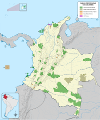 |
| Flora and Fauna Sanctuaries | ||
| National Natural Reserves |
| |
| Unique Natural Area |
| |
| Road parks |
| |
| Regional Nature Reserves |
| |
| Proposed Areas |
| |
| ||
Текст в блоке "Читать" взят с сайта "Википедия" и доступен по лицензии Creative Commons Attribution-ShareAlike; в отдельных случаях могут действовать дополнительные условия.
Другой контент может иметь иную лицензию. Перед использованием материалов сайта WikiSort.org внимательно изучите правила лицензирования конкретных элементов наполнения сайта.
Другой контент может иметь иную лицензию. Перед использованием материалов сайта WikiSort.org внимательно изучите правила лицензирования конкретных элементов наполнения сайта.
2019-2026
WikiSort.org - проект по пересортировке и дополнению контента Википедии
WikiSort.org - проект по пересортировке и дополнению контента Википедии