geo.wikisort.org - Mountains
The Serranía del Darién is a small mountain range on the border between Colombia and Panamá in the area called the Darién Gap. It is located in the southeastern part of the Darién Province of Panamá and the northwestern part of the Chocó Department of Colombia. There are two major protected areas here: Darién National Park in Panamá and Los Katíos National Park in Colombia. Serranía del Darién range's average elevation above sea level is 437 metres (1,434 ft). These mountains have sparse settlements, with just two people living in every square kilometer. This lack of human settlements is reflected in the fact that the nearest town with a population of 50,000[which?] is over 12 hours by road.[1]
| Serranía del Darién | |
|---|---|
 Serranía del Darién  Serranía del Darién | |
| Highest point | |
| Peak | Cerro Tacarcuna |
| Elevation | 1,875 m (6,152 ft) |
| Coordinates | 8°10′N 77°18′W |
| Dimensions | |
| Length | 35 km (22 mi) |
| Geography | |
| Countries | Colombia and Panama |
| Biome | Rainforest |
Geological hazards
The Serranía del Darién is notorious for strong earthquakes; on average earthquakes measuring between 6 and 7 occur here every 50 years. The area is also susceptible to floods and landslides, both of which have been classified as medium to high intensity hazards for the region.[1]
Climate
Serranía del Darién is a humid region. Its climate falls under the tropical monsoon type.[1]
Flora and fauna
Species that are endemic to the Serranía del Darién include the toad Rhinella acrolopha.[2]
References
- "Serranía Del Darién". Chinci (2011).
- Frost, Darrel R. (2014). "Rhinella acrolopha (Trueb, 1971)". Amphibian Species of the World: an Online Reference. Version 6.0. American Museum of Natural History. Archived from the original on 8 January 2015. Retrieved 8 January 2015.
Mountain ranges of Colombia | ||||||||||
|---|---|---|---|---|---|---|---|---|---|---|
| Colombian Andes |
|  | ||||||||
| Isolated ranges | ||||||||||
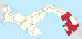
Darién Province | ||
|---|---|---|
| Chepigana District |
|  |
| Pinogana District |
| |
| Santa Fe District |
| |
| Geography |
| |
| Transport |
| |
| Settlements |
| |
| Authority control |
|---|
На других языках
- [en] Serranía del Darién
[es] Serranía del Darién
La serranía del Darién es una pequeña cadena montañosa que marca la frontera entre Colombia y Panamá. Está ubicada al sureste de la provincia de Darién en Panamá, y al noroeste del departamento del Chocó en (Colombia). Sobre esta se asientan dos importantes parques naturales: el parque nacional Darién y parque nacional de Los Katíos.[1][fr] Serranía del Darién
La Serranía del Darién, également appelée montagnes de Tacarcuna, se situe à la frontière entre le nord-ouest de la Colombie et l'est du Panama, où se situe leur point culminant à 1 875 mètres d'altitude. Elles comptent notamment une forte diversité d'espèces animales. C'est une région peu ou pas explorée qui a vu la découverte de nouvelles espèces en février 2009. Elle possède un fort taux d'endémisme.Другой контент может иметь иную лицензию. Перед использованием материалов сайта WikiSort.org внимательно изучите правила лицензирования конкретных элементов наполнения сайта.
WikiSort.org - проект по пересортировке и дополнению контента Википедии