geo.wikisort.org - Mountains
The Hohe Acht (German: [ˌhoːə ˈʔaxt]) is the highest mountain (746.9 m above sea level (NHN) [1][2]) in the Eifel mountains of Germany. It is located on the boundary between the districts of Ahrweiler and Mayen-Koblenz in Rhineland-Palatinate.
| Hohe Acht | |
|---|---|
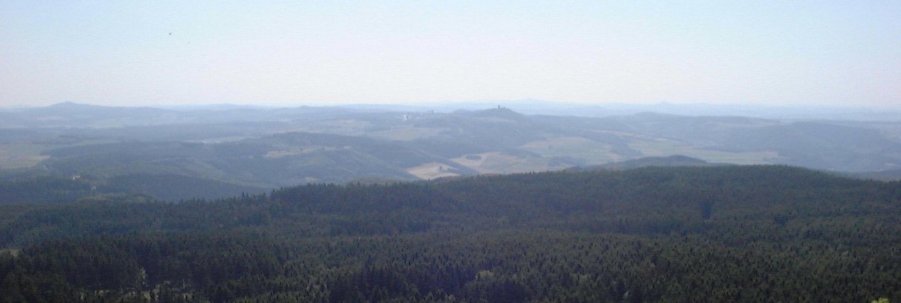
 The prominent peak of the Hohe Acht seen from the summit plateau of the Raßberg | |
| Highest point | |
| Elevation | 746.9 m above sea level (NHN) (2,450 ft)[1][2] |
| Prominence | 525 m,WSW of Loison[3] |
| Isolation | 62.9 m,An den zwei Steinen (Hunsrück) |
| Coordinates | 50°23′09″N 7°00′40″E |
| Geography | |
 Hohe Acht Rheinland-Pfalz, Germany | |
| Parent range | Eifel |
Geography and geology
The Hohe Acht is located in the High Eifel east of Adenau. The mountain is a Tertiary volcano, whose cone is composed of Lower Devonian rock and whose summit is made of basalt.
Emperor William Tower
In 1908/09 the Emperor William Tower (Kaiser-Wilhelm-Turm) was erected on the Hohe Acht. The occasion for the construction of this stone observation tower, based on plans by the architect, Freiherr von Tettau of Berlin, was the silver wedding of Emperor William II and Empress Augusta Victoria as well as the commemoration of Emperor William I
The tower is 16.30 metres (53.5 ft) high and its walls are one metre thick at ground level. The work was carried out by master masons, Karl and Johannes Leidinger, from Adenau using local stone. The cost of construction was 18,000 marks. The tower has been a protected monument since 1987.
The Emperor William Tower offers a superb view across the whole Eifel (including the mountains of Scharteberg, Döhmberg, Michelsberg, Hochthürmerberg, Schöneberg, the nearby Nürburg Castle and Hochkelberg), as well as the Siebengebirge and its Großer Ölberg and, in conditions of good visibility, as far as the Westerwald, the Taunus, the Hunsrück and the Lower Rhine.
Walking and winter sports
There is a network of footpaths around the Hohe Acht; at many places there are good views over the Eifel landscape.
In winter the Hohe Acht has good winter sport facilities including prepared cross country skiing trails, toboggan runs and ski lifts.
Motor racing
Very close to the Hohe Acht on a 678 metres (2,224 ft) high volcanic cone is Nürburg Castle. A section of the North loop (Nordschleife) on the Formula 1 racetrack at the Nürburgring is known as the Hohe Acht.
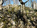 Basaltic blocks on the summit of the Hohe Acht
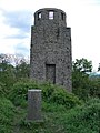 Summit rock on the Hohe Acht with the Kaiser Wilhelm Tower behind
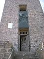 Kaiser Wilhelm Tower
 On the Kaiser Wilhelm Tower


References
- Map services of the Federal Agency for Nature Conservation
- Map service of the Landscape Information System of the Rhineland-Palatinate Nature Conservation Office (Naturschutzverwaltung Rheinland-Pfalz)
- Prominence from Eberhard Jurgalski, Archived (Date missing) at sol.co.uk (Error: unknown archive URL).
Sources
- d'Hein: Nationaler Geopark Vulkanland Eifel. Ein Natur- und Kulturführer. Gaasterland Verlag, Düsseldorf 2006, ISBN 3-935873-15-8
External links
- WDR Winter Sport Tip – Hohe Acht (in German)
- Rhineland-Palatinate Leisure Portal – Hohe Acht (in German)

Authority control | |
|---|---|
| General |
|
| National libraries | |
На других языках
[de] Hohe Acht
Die Hohe Acht bei Adenau ist mit 746,9 m ü. NHN[1][2] der höchste Berg der Eifel und markiert die Grenze der Landkreise Ahrweiler und Mayen-Koblenz in Rheinland-Pfalz. Auf dem bewaldeten Berg, der Wander- und Wintersportgebiet ist, steht der Kaiser-Wilhelm-Turm.- [en] Hohe Acht
Другой контент может иметь иную лицензию. Перед использованием материалов сайта WikiSort.org внимательно изучите правила лицензирования конкретных элементов наполнения сайта.
WikiSort.org - проект по пересортировке и дополнению контента Википедии