geo.wikisort.org - Mountains
The Wiehen Hills[1] (German: Wiehengebirge, pronounced [ˈviːənɡəˌbɪʁɡə] (![]() listen), also locally, just Wiehen) are a hill range in North Rhine-Westphalia and Lower Saxony in Germany. The hills run from west to east like a long finger away from the main upland area of the Lower Saxon Hills, beginning at the Weser River near Minden and terminating in the vicinity of Osnabrück.
It is the northernmost of the German Central Upland ranges extending into the Northern Lowlands.
Their highest hill is the Heidbrink near Lübbecke with an altitude of 320 metres (1,050 ft).
listen), also locally, just Wiehen) are a hill range in North Rhine-Westphalia and Lower Saxony in Germany. The hills run from west to east like a long finger away from the main upland area of the Lower Saxon Hills, beginning at the Weser River near Minden and terminating in the vicinity of Osnabrück.
It is the northernmost of the German Central Upland ranges extending into the Northern Lowlands.
Their highest hill is the Heidbrink near Lübbecke with an altitude of 320 metres (1,050 ft).

| Wiehen Hills (Wiehengebirge) | |
|---|---|
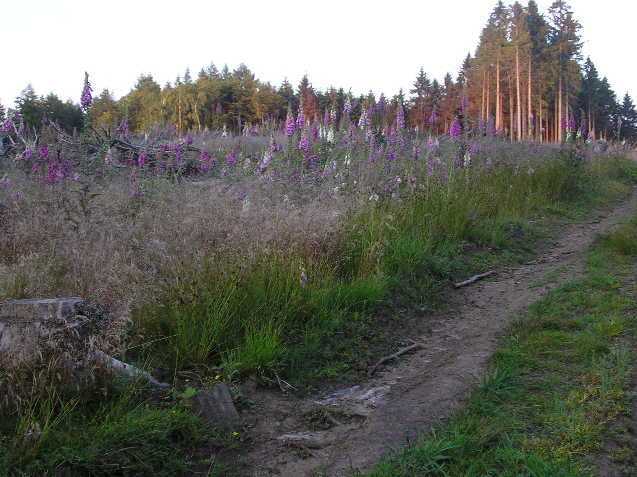
 The Wiehen Hills near Schnathorst, seen from the southeast | |
| Highest point | |
| Peak | Heidbrink |
| Elevation | 320 m (1,050 ft) |
| Dimensions | |
| Length | 70 km (43 mi) |
| Geography | |
 Location in Germany | |
| State | Lower Saxony/North Rhine-Westphalia |
| Range coordinates | 52°17′42″N 8°38′12″E |
| Parent range | Lower Saxon Hills |

Location
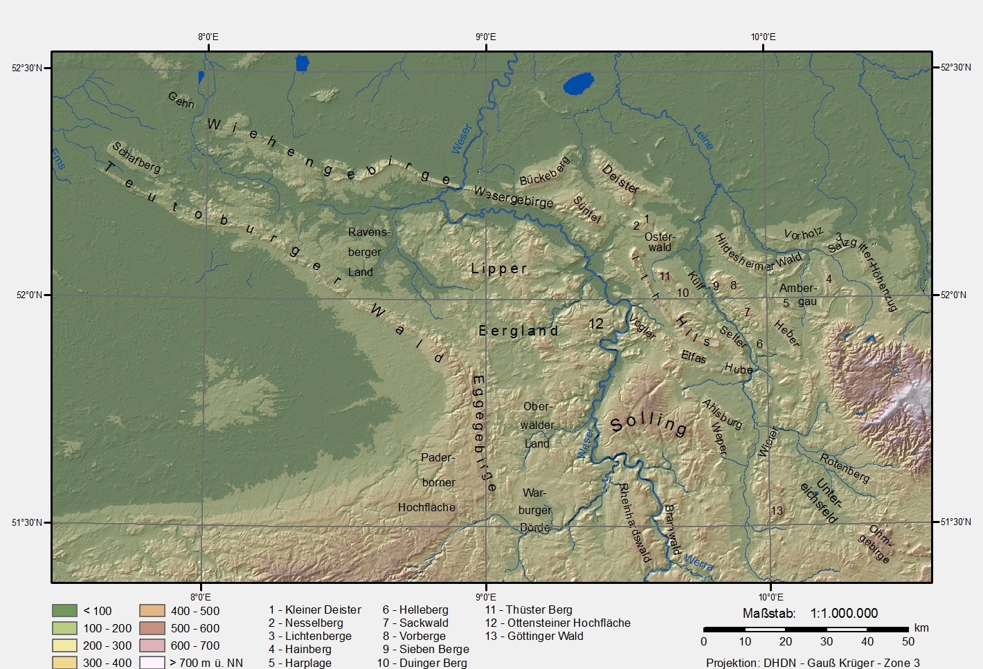
The Wiehen Hills lie within the districts of Osnabrück, Minden-Lübbecke and Herford. Their northern section runs in an east-west direction roughly from the territory of Bramsche (northwest of Osnabrück) via Ostercappeln, Bad Essen, Preußisch Oldendorf and Rödinghausen, Lübbecke, Hüllhorst and Bad Oeynhausen as far as the towns of Minden and Porta Westfalica on the Porta Westfalica gorge and River Weser. They also graze Bohmte and Hille to the north. South of the Wiehen Hills lie Osnabrück, Bissendorf, Melle, Kirchlengern, Bünde, Löhne and Bad Oeynhausen. The Wiehen Hills form the northwestern boundary of the Lower Saxon Hills to which they belong geographically, together with the Westphalian part of the ridge. Whilst the eastern end of the hill chain is clearly defined by the Porta Westfalica gorge and the hill of Wittekindsberg, this is not so simple for its western extremity. To the west the Wiehen descends gradually, transitioning from a hilly ridge into a chain of hillocks and then descending almost imperceptibly into the plain. South of Bramsche the ridge rises again at the Penter Egge to a height of 99 metre, but 2.5 km further west it reaches the level of the surrounding countryside. The waterways of the Mittelland Canal and Osnabrück Canal running away to the south appear to mark the end of the hill range, but west of these canals is the 82-metre-high Larberger Egge which forms the westernmost cornerstone of the Wiehen Hills, rising just 2 km northeast of the boundary with the province of Münster. Contrary to popular assumption, Ibbenbüren is no longer considered to be situated by the Wiehen Hills and the Ibbenbüren Plateau (Ibbenbürener Bergplatte comprising the Schafberg, etc.) is no longer part of the Wiehen.[2] Geological reasons, according to current research, do not support such an assumption.[3]
To the north, the Wiehen descends to the North German Plain into a region known as the Lübbecke Loessland. On the banks of the Weser, opposite Porta Westfalica, lies the Wesergebirge, which is the eastern continuation of the Wiehen Hills. This ridge is of similar geological construction and runs as far as the area of Hessisch Oldendorf to the Süntel hills. Southeast of the Wiehen Hills are the Lippe Uplands, to the south the Ravensberg Hills, to the southwest in the area of the Tecklenburg Land are the northern foothills of the Teutoburg Forest, and to the northwest are the hills of the Gehn and the Ankum Heights, the Damme Hills and the Stemweder Berg. North of the northwestern tip of the Wiehen liest the great bog of the Großes Moor.
Hills


The hills of the Wiehen range from west to east are:
Height of the highest hill in bold; heights in metres (m) above Normalhöhennull (NHN)
| Description | Height | Commune | Remarks/Description of the location |
|---|---|---|---|
| Larberger Egge | 82 | Bramsche | westernmost spur of the Wiehen Hills[4] |
| Schleptruper Egge | 148 | Bramsche | Transmission site; southeast of Bramsche-Schleptrup |
| Kalkrieser Berg also: Schmittenhöhe | 157 | Bramsche | Castle of Alt Barenaue nearby; north of Bramsche-Engter |
| Venner Egge | 158 | Ostercappeln | Near Ostercappeln-Vehrte |
| Stenshöhe | 149 | Belm | Süntelstein rock |
| Sonnenbrink | 177 | Bad Essen | Sonnenbrink Tower (communications tower with observation platform); southwest of Bad Essen |
| Linner Berg | 181 | Bad Essen | Dinosaur tracks; south-southwest of Bad Essen Linne |
| Kleiner Kellenberg | 161.4 | Bad Essen | Dinosaur tracks of Barkhausen; south-southeast of Bad Essen-Barkhausen |
| Großer Kellenberg | 211 | Melle | Lake of Grüner See nearby; northeast of Buer |
| Steinbrink | 135.6 | Bad Essen | South of Bad Essen Lintorf |
| Schwarzer Brink | 211 | Bad Essen | South of Bad Essen Dahlinghausen |
| Egge | 198 | Preußisch Oldendorf | Wiehen Tower; southwest of the old town of Preußisch Oldendorf |
| Offelter Berg | 178 | Preußisch Oldendorf | South of Preußisch Oldendorf-Offelten |
| Limberg | 190 | Preußisch Oldendorf | Restored castle of Limberg; northeast Preußisch Oldendorf-Börninghausen |
| Nonnenstein, (formerly Rödinghauser Berg) | 274 | Rödinghausen/Preußisch Oldendorf | Observation tower; northwest of Rödinghausen |
| Maschberg | 190 | Rödinghausen/Preußisch Oldendorf | North of Schwenningdorf |
| Donoer Berg | 243 | Rödinghausen | North of Bieren-Dono |
| Glösinghauser Berg | 289 | Preußisch Oldendorf | East of Preußisch Oldendorf-Glösinghausen |
| Altes Verbrenn | 291.1 | Preußisch Oldendorf | East of Preußisch Oldendorf-Glösinghausen |
| Babilonie | 255.0 | Lübbecke Wallburg cultural monument; south of Lübbecke-Obermehnen | |
| Blasheimer Berg | 287.8 | Lübbecke | Schiereck's Temple; south of Lübbecke-Obermehnen |
| Kahlewart | 240 | Hüllhorst | North of Hüllhorst-Oberbauerschaft; with Freilichtbühne Kahle Wart |
| Breitenbrink | 287 | Hüllhorst | North of Hüllhorst-Oberbauerschaft |
| Wurzelbrink | 318 | Lübbecke | Wartturm observation tower; south of Lübbecke |
| Kniebrink | 315 | Lübbecke | South of Lübbecke |
| Meesenkopf | 225.8 | Lübbecke | South of Lübbecke |
| Reineberg | 276 | Lübbecke | Ruins of Reineburg; south of the local hill of Lübbecke |
| Heidkopf | 272.6 | Lübbecke | North of Hüllhorst/Ahlsen-Reineberg |
| Heidbrink | 319.6 | Hüllhorst | North of Hüllhorst-Ahlsen-Reineberg |
| Straußberg | 275.5 | Lübbecke | South of Lübbecke |
| Gehlenbecker Berg | 275 | Lübbecke | Impressive stand of oak near the summit; south of Lübbecke-Gehlenbeck |
| Eilhauser Berg | Lübbecke | Southeast of Lübbecke-Eilhausen | |
| Nettelstedter Berg | 288 | Lübbecke | Southwest of Lübbecke-Nettelstedt |
| Schnathorster Berg also Eickhorster Berg | 246.6 | Hüllhorst | North of Schnathorst |
| Bröderhauser Berg also Lübber Berg | 251.2 | Hille | Near Hille-Oberlübbe; in the vicinity of Oberlübber Bergsee |
| Elfter Kopf | 233 | Bad Oeynhausen | West of Wallücke |
| Bergkirchener Kopf | 255.4 | Bad Oeynhausen | East of Wallücke, northwest of Bergkirchen with subpeak of Buchenkopf to the north |
| Haddenhauser Berg | 261.3 | Bad Oeynhausen | North of Volmerdingsen |
| Lutternsche Egge | 256 | Minden | South of Luttern |
| Eidinghauser Berg | 247 | Bad Oeynhausen | North of Bad Oeynhausen-Eidinghausen |
| Häverstädter Berg | 269.6 | Minden | South of Häverstädt |
| Wittekindsberg | 294,2 | Porta Westfalica | Emperor William Monument, Moltke Tower and Wittekindsburg; west of the Porta Westfalica |
Northernmost German uplands
According to folklore, regionally conscious residents around the hills usually admit grudgingly that the Wiehen Hills are not particularly high. In the same breath, they may assert, often with a raised index finger and an odd emphasis on the word gebirge ("hill/mountain range"), that they are the northernmost hill range in Germany and the one closest to the sea. Whether this assertion is true is in fact a matter of definition. It clearly ignores the morainic ridges further north and closer to the sea, as well as other true uplands such as the Stemweder Berg or the Rehburg Hills. Of course, these hills are much lower and do not reach the 200-metre contour line. Of the higher, say up to 300-metre-high (980 ft) uplands, the northern foothills of Deister and Bückeberge extend farther north than the eastern Wiehen range. However, it is also true that the highest part of the Wiehen Hills at Lübbecke has the most northerly hill over 300 metres in Germany. The Heidbrink, at almost 320 metres high, is also the northernmost "three-hundred" on the European continent between the central Ural Mountains and the Atlantic, i.e. excluding the British Isles and Fennoscandinavia.
References
- Elkins, T.H. (1972). Germany (3rd ed.). London: Chatto & Windus, 1972. ASIN B0011Z9KJA.
- Aussage Zur Ibbenbürener Bergplatte in Bezug Auf das Wiehengebirge Archived 2011-09-05 at the Wayback Machine
- Newspaper article that maintains that Ibbenbüren is not by the Wiehen Hills
- "Landschaften im Bereich des Mittelgebirgssaumes (PDF)" (PDF). Retrieved 2014-04-23.

Authority control | |
|---|---|
| General |
|
| National libraries | |
На других языках
[de] Wiehengebirge
Das Wiehengebirge ist ein bis 320 m ü. NHN hohes Mittelgebirge im Südwesten Niedersachsens und Nordosten Nordrhein-Westfalens. Das zu den Nordausläufern der deutschen Mittelgebirge zählende Gebirge wird zum Weserbergland und im weiteren Sinne zum Weser-Leine-Bergland gerechnet. Es liegt am Südrand des Norddeutschen Tieflands, beginnt bei Bramsche im Westen und zieht sich bis zur rund 95 km entfernten Porta Westfalica im Osten. Das Kammgebirge bildet mit dem östlich anschließenden Wesergebirge eine geologische Einheit.- [en] Wiehen Hills
[es] Wiehengebirge
El macizo del Wiehengebirge, denominado Wiehen hasta entrada la Edad Media, es la cordillera más septentrional de Alemania y comprende parte de los estados federados de Baja Sajonia y Westfalia.[fr] Wiehengebirge
La chaîne des Wiehengebirge (ou des Wiehen) est un massif de moyenne montagne, aux confins de la Basse-Saxe et de la Rhénanie du Nord, culminant à 320 m d'altitude. Cette chaîne qui surplombe par le sud la grande plaine d'Allemagne du Nord se rattache au Weserbergland ou, plus généralement, au pli Weser-Leine. L'épaisse forêt des Wiehengebirge forme une partie du parc naturel TERRA.vita.Другой контент может иметь иную лицензию. Перед использованием материалов сайта WikiSort.org внимательно изучите правила лицензирования конкретных элементов наполнения сайта.
WikiSort.org - проект по пересортировке и дополнению контента Википедии