geo.wikisort.org - Mountains
The Großer Beerberg is a mountain, 982.9 m above sea level (NHN),[1] whose summit is the highest point in the Thuringian Forest and the state of Thuringia. It is located between the three villages of Heidersbach, Goldlauter and Gehlberg in the borough of Suhl. The mountain is made of rhyolite (quartz porphry) that was formed through volcanic processes in the Rotliegendes rock of the Oberhof Formation, about 280 million years ago,[2] and which was uplifted over the surrounding sediments to form a butte.
| Grosser Beerberg | |
|---|---|
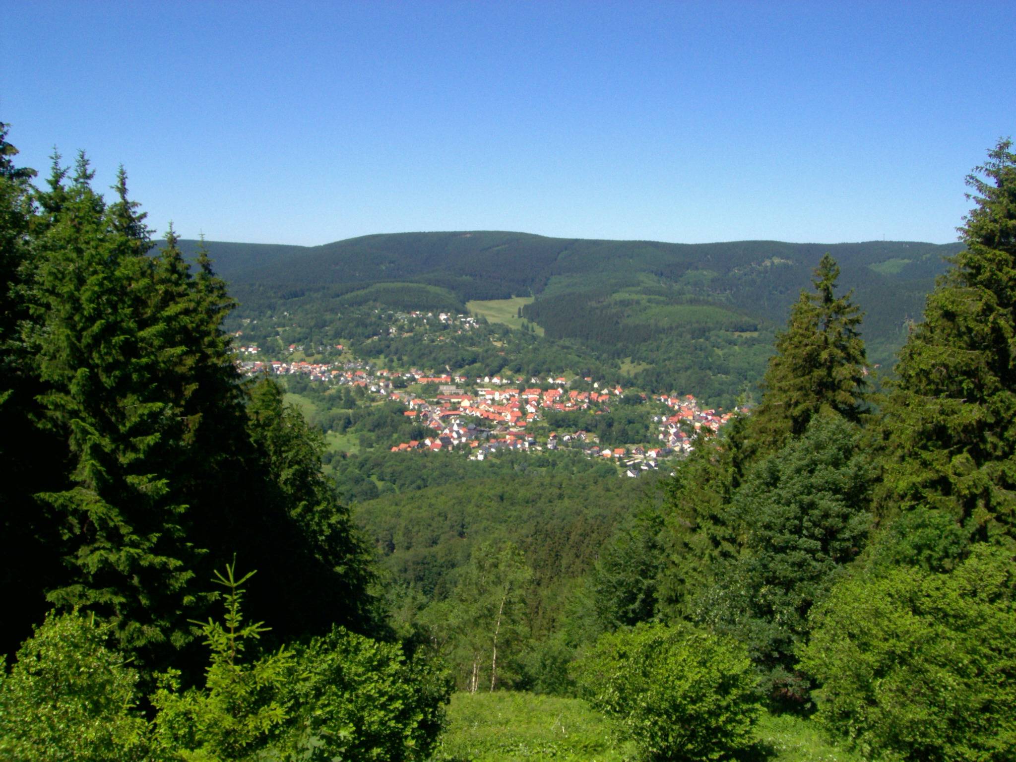 View of Großer Beerberg from the south; in the foreground is Suhl-Goldlauter | |
| Highest point | |
| Elevation | 982.9 m (3,225 ft)[1] |
| Prominence | 389 m (1,276 ft) |
| Isolation | 103 km (64 mi) |
| Coordinates | 50°39′34″N 10°44′46″E |
| Naming | |
| Pronunciation | German: [ˈɡʁoːsɐ ˈbeːɐ̯bɛɐ̯k] |
| Geography | |
 Grosser Beerberg The location within Thuringia | |
| Location | Thuringia, Germany |
| Parent range | Thuringian Forest |
Between the summit of the Beerberg and that of its eastern neighbour, the Schneekopf (978 m), the second highest mountain of Thuringia, is a 60-metre-deep col. To the west is the Sommerbachskopf (941 m).
On the summit of Beerberg is one of the few moorlands of the Thuringian Forest. Until the end of the 1980s there was an observation tower on the mountain. A few years ago, a small platform was again established below the summit at Plänckners Aussicht, which offers an outstanding view to the south and southwest.
The section of the Rennsteig long-distance path between Oberhof and Schmücke runs across the mountain. The nearest town is Suhl.
See also
- List of mountains in Thuringia
- List of mountain and hill ranges in Germany
References
- Map services of the Federal Agency for Nature Conservation
- Lützner, H., Andreas, D., Schneider, J.W., Voigt, S. & Werneburg, W. (2012): Stefan und Rotliegend im Thüringer Wald und seiner Umgebung. In: Deutsche Stratigraphische Kommission (publ.; coordination and production: H. Lützner & G. Kowalczyk für die Subkommission Perm-Trias): Stratigraphie von Deutschland X. Rotliegend. Teil I: Innervariscische Becken. Schriftenreihe der Deutschen Gesellschaft für Geowissenschaften 61: 418–487.
External links
- "Beerberg, Germany". Peakbagger.com.

Adlersberg (849 m) with Neuhäuser Hügel (891 m), Großer Beerberg (partly obscured, 982 m), Wildekopf (943 m), Großer Eisenberg (907 m), Schneekopf (978 m), Großer Finsterberg (944 m) and Kleiner Finsterberg (875 m); in the foreground, Kalter Staudenkopf (768 m), Schmiedswiesenkopf (784 m) and Hohe Warth (718 m). Left rear: Pleß (645 m), 52 km away in the Rhön Mountains.

|  | |

Authority control | |
|---|---|
| General |
|
| National libraries | |
На других языках
[de] Großer Beerberg
Der Große Beerberg ist mit 982,9 m ü. NHN[1] die höchste Erhebung des Thüringer Waldes und Thüringens. Er befindet sich zwischen den drei Suhler Ortsteilen Heidersbach, Goldlauter und Gehlberg. Der Berg besteht aus im Rotliegend der Oberhof-Formation, vor etwa 280 Millionen Jahren[3] vulkanisch entstandenem Rhyolith („Quarzporphyr“), der nach Hebung als Härtling aus den umgebenden Sedimenten herauspräpariert wurde.- [en] Großer Beerberg
[es] Grober Beerberg
Großer Beerberg es una montaña situada en el bosque de Turingia, en Alemania[1] y el punto más alto del estado de Turingia. La ciudad más cercana es Suhl, en Ilm-Kreis.[fr] Großer Beerberg
La Großer Beerberg est le point culminant de la forêt de Thuringe et du land de Thuringe en Allemagne centrale. C'est un vestige rhyolitique d'un volcan actif pendant plus de 250 millions d'années pendant le Permien. Il s'élève à 983 m d'altitude, avec une proéminence de 389 m par rapport à Querenbach et une isolation topographique de 103 km depuis l'Ochsenkopf dans les Fichtelgebirge.Другой контент может иметь иную лицензию. Перед использованием материалов сайта WikiSort.org внимательно изучите правила лицензирования конкретных элементов наполнения сайта.
WikiSort.org - проект по пересортировке и дополнению контента Википедии